Kafr Bara
Kafr Bara or Kfar Bara (Arabic: كفر برا; Hebrew: כַּפְר בַּרָא) is an Israeli-Arab local council in Israel's Central District. It is a small town located near the Green Line. The town is a part of the Little Triangle with Kafr Qasim and Jaljulia. In 2017, 3,489 people lived there.[1]
Kafr Bara
| |
|---|---|
Local council | |
| Hebrew transcription(s) | |
| • ISO 259 | Káper Báraˀ |
| • Also spelled | Kafar Bara (official) Kfar Bara (unofficial) |
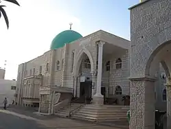 Mosque in Kafr Bara, 2010 | |
 Kafr Bara | |
| Coordinates: 32°7′50″N 34°58′19″E | |
| Grid position | 147/170 PAL |
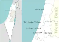
| District | Central |
| Area | |
| • Total | 9,387 dunams (9.387 km2 or 3.624 sq mi) |
| Population (2017)[1] | |
| • Total | 3,489 |
| • Density | 370/km2 (960/sq mi) |
| Name meaning | Khirbet Kafr Bara, "The ruin of the village of Bara"[2] |
Population
According to the latest statistics, the population of Kafr bara is Arab Muslims.
Institutions
The town has a community center and retirement center. It also has three mosques, a public library, a post office, two clinics and a football playground. There is 2 schools in Kafr Bara; Omar Bin Khattab primary school and , the Comprehensive Secondary School of Kafr Bara.
References
- "List of localities, in Alphabetical order" (PDF). Israel Central Bureau of Statistics. Retrieved August 26, 2018.
- Palmer, 1881, p. 234
This article is issued from Wikipedia. The text is licensed under Creative Commons - Attribution - Sharealike. Additional terms may apply for the media files.