Ittenthal
Ittenthal was a municipality, in the municipality of Kaisten and district of Laufenburg in the canton of Aargau in Switzerland.

Ittenthal
Ittenthal | |
|---|---|
 Coat of arms | |
Location of Ittenthal | |
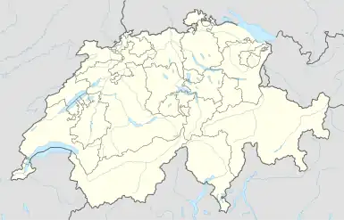 Ittenthal 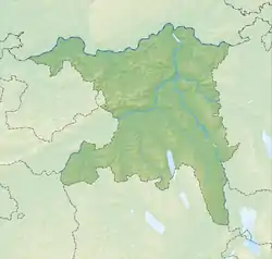 Ittenthal | |
| Coordinates: 47°31′N 8°04′E | |
| Country | Switzerland |
| Canton | Aargau |
| District | Laufenburg |
| Area | |
| • Total | 3.89 km2 (1.50 sq mi) |
| Elevation | 404 m (1,325 ft) |
| Population (2007) | |
| • Total | 208 |
| • Density | 53/km2 (140/sq mi) |
| Time zone | UTC+01:00 (Central European Time) |
| • Summer (DST) | UTC+02:00 (Central European Summer Time) |
| Postal code(s) | 5083 |
| SFOS number | 4168 |
| Surrounded by | Frick, Hornussen, Kaisten, Sulz |
| Website | www SFSO statistics |
This article is issued from Wikipedia. The text is licensed under Creative Commons - Attribution - Sharealike. Additional terms may apply for the media files.