Horry County, South Carolina
Horry County (/ˈɒriː/ ORR-ee) is a county in the U.S. state of South Carolina. As of the 2020 census, the population was 351,029,[2] making it the fourth-most populous county in South Carolina. The county seat is Conway.[3]
Horry County | |
|---|---|
.jpg.webp) Horry County Government and Justice Center | |
 Flag | |
| Nickname: The Independent Republic | |
| Motto: "Committed to Excellence" | |
 Location within the U.S. state of South Carolina | |
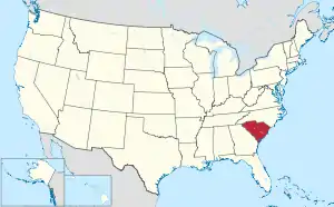 South Carolina's location within the U.S. | |
| Coordinates: 33°54′33″N 78°58′36″W | |
| Country | |
| State | |
| Founded | 1801 |
| Named for | Peter Horry |
| Seat | Conway |
| Largest community | Myrtle Beach |
| Area | |
| • Total | 1,254.73 sq mi (3,249.7 km2) |
| • Land | 1,133.31 sq mi (2,935.3 km2) |
| • Water | 121.42 sq mi (314.5 km2) 9.68% |
| Population (2020) | |
| • Total | 351,029 |
| • Density | 309.74/sq mi (119.59/km2) |
| Time zone | UTC−5 (Eastern) |
| • Summer (DST) | UTC−4 (EDT) |
| ZIP Codes | 29511, 29526, 29527, 29527, 29528, 29544, 29545, 29566, 29567, 29568, 29569, 29572, 29575, 29576. 29577, 29578, 29579, 29581, 29582, 29587, 29588, 29597, 29598[1] |
| Area code | 843 |
| Congressional district | 7th |
| Website | www |
The county is in the Pee Dee region of South Carolina, about 90 miles north of Charleston, South Carolina and about 130 miles east of the state capital, Columbia.
References
- "Zip Code List - 295 in South Carolina". Capital Impact Government Gateway. Retrieved February 20, 2018.
- "QuickFacts: Horry County, South Carolina". United States Census Bureau. Retrieved January 20, 2024.
- National Association of Counties. "NACo County Explorer". Retrieved January 20, 2024.
This article is issued from Wikipedia. The text is licensed under Creative Commons - Attribution - Sharealike. Additional terms may apply for the media files.