Garden State Parkway
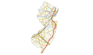
The Garden State Parkway (or Garden State Pkwy) is a toll highway (which means that people must pay to drive on it) that goes through New Jersey from the south end of the state at Cape May to the north end of the state at Montvale, New Jersey. It is 172.4 miles long,[1] and in 2008, was reported to be the busiest toll highway in the United States.[2]
Garden State Parkway | ||||
|---|---|---|---|---|
 | ||||
| Route information | ||||
| Maintained by New Jersey Turnpike Authority | ||||
| Length | 172.40 mi[1] (277.45 km) | |||
| Existed | 1944–present | |||
| Major junctions | ||||
| South end | ||||
| North end | G.S. Pkwy. Connector to | |||
| Location | ||||
| Country | United States | |||
| State | New Jersey | |||
| Highway system | ||||
| New Jersey Turnpike Authority | ||||
| ||||

References
- "Garden State Parkway straight line diagram" (PDF). New Jersey Department of Transportation. Retrieved December 8, 2009.
- "USA Today reports dramatically more expensive tolls - lousy data (ANALYSIS) | Toll Roads News". Archived from the original on 2008-09-05. Retrieved 2011-04-22.
This article is issued from Wikipedia. The text is licensed under Creative Commons - Attribution - Sharealike. Additional terms may apply for the media files.