Faizabad district
Ayodhya district, is one of the 75 districts of Indian state of Uttar Pradesh. The administrative headquarters of the district is the city of Ayodhya. The district is believed to be the birth place of Hindu deity Rama. The district occupies an area of 2,522 km2 (974 sq mi). In the 2011 census, it had a population of 2,470,996 people. Awadhi is the commonly used language of the people of the Ayodhya district.
Ayodhya district | |
|---|---|
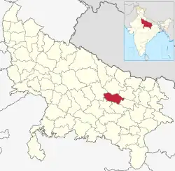 Location of Ayodhya district in Uttar Pradesh | |
| Country | India |
| State | Uttar Pradesh |
| Division | Ayodhya |
| Headquarters | Ayodhya |
| Tehsils | 5 |
| Government | |
| • Lok Sabha constituencies |
|
| • Vidhan Sabha constituencies |
|
| Area | |
| • Total | 2,522 km2 (974 sq mi) |
| Population | |
| • Total | 2,470,996 |
| • Density | 980/km2 (2,500/sq mi) |
| • Urban | 689,354 |
| Demographics | |
| • Literacy | 69.57% |
| • Sex ratio | 961 |
| Time zone | UTC+05:30 (IST) |
| Vehicle registration | UP-42 |
| Website | http://ayodhya.nic.in |
References
- "About district". District Ayodhya, Government of Uttar Pradesh. Retrieved 27 July 2021.
- "Census of India: Search Details – Faizabad District". www.censusindia.gov.in. Retrieved 6 November 2019.
This article is issued from Wikipedia. The text is licensed under Creative Commons - Attribution - Sharealike. Additional terms may apply for the media files.