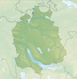
Dietikon
Dietikon is the fifth largest city of the canton of Zurich in Switzerland, after Zürich, Winterthur, Uster and Dübendorf. It is the capital of the same-named district of Dietikon.
Dietikon | |
|---|---|
 Coat of arms | |
Location of Dietikon | |
 Dietikon  Dietikon | |
| Coordinates: 47°24′N 8°24′E | |
| Country | Switzerland |
| Canton | Zurich |
| District | Dietikon |
| Government | |
| • Executive | Stadtrat with 7 members |
| • Mayor | Stadtpräsident Otto Müller (as of March 2014) |
| • Parliament | Gemeinderat with 36 members |
| Area | |
| • Total | 9.33 km2 (3.60 sq mi) |
| Elevation | 388 m (1,273 ft) |
| Population (31 December 2018)[2] | |
| • Total | 27,236 |
| • Density | 2,900/km2 (7,600/sq mi) |
| Demonym | Dietiker |
| Time zone | UTC+01:00 (Central European Time) |
| • Summer (DST) | UTC+02:00 (Central European Summer Time) |
| Postal code(s) | 8953 |
| SFOS number | 0243 |
| Surrounded by | Bergdietikon (AG), Geroldswil, Oetwil an der Limmat, Schlieren, Spreitenbach (AG), Unterengstringen, Urdorf, Weiningen |
| Twin towns | Kolín (Czech Republic), Braggio (Switzerland), Renens (Switzerland) |
| Website | www SFSO statistics |
Gallery
 Bremgartenstrasse in Dietikon and St. Agatha Kirche in the background
 Dietikon as seen from Grunschen and Limmattal in the background
 Dietikon train station
 S17 line provided by the Bremgarten-Dietikon-Bahn
 St. Agatha Kirche
References
- "Arealstatistik Standard - Gemeinden nach 4 Hauptbereichen". Federal Statistical Office. Retrieved 13 January 2019.
- "Ständige Wohnbevölkerung nach Staatsangehörigkeitskategorie Geschlecht und Gemeinde; Provisorische Jahresergebnisse; 2018". Federal Statistical Office. 9 April 2019. Retrieved 11 April 2019.
Other websites
![]() Media related to Dietikon at Wikimedia Commons
Media related to Dietikon at Wikimedia Commons
- Official Website of the city of Dietikon (in German)
- Dietikon in German, French and Italian in the online Historical Dictionary of Switzerland.
This article is issued from Wikipedia. The text is licensed under Creative Commons - Attribution - Sharealike. Additional terms may apply for the media files.