Chaguanas
Chaguanas is the largest city of Trinidad and Tobago. About 84,000 people live here. In 1990, it was made a borough.
Chaguanas | |
|---|---|
| Borough of Chaguanas | |
 Chaguanas Main Road and Price Plaza | |
 Chaguanas Location of Chaguanas, Trinidad and Tobago. 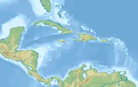 Chaguanas Chaguanas (Caribbean) 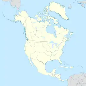 Chaguanas Chaguanas (North America) | |
| Coordinates: 10°31′N 61°24′W | |
| Country | |
| Jurisdiction | Borough of Chaguanas |
| Settled | 1797 |
| Borough | 13 September 1990 |
| Named for | Chaguanes indigenous tribe |
| Government | |
| • Governing body | Chaguanas Borough Corporation |
| • Mayor | Faaiq Mohammed (UNC) |
| • Deputy Mayor | Vacant |
| Borough Corporation seats | 8 electoral districts |
| House seats | 2/41 |
| Area | |
| • Borough | 59 km2 (23 sq mi) |
| Elevation | 48 m (157 ft) |
| Population (2011) | |
| • Borough | 83,489 |
| • Rank | 1st |
| • Density | 1,416/km2 (3,670/sq mi) |
| • Urban | 101,297 |
| Demonym | Chaguanans |
| Time zone | UTC-4 (AST) |
| Postal Code | 50xxxx, 52xxxx[2] |
| Area code | (868)[3] |
| ISO 3166 code | TT-CHA |
| Telephone Exchanges | 665, 671, 672, 829 |
| Website | www.chaguanasborough.com |
| HDI The HDI for Trinidad and Tobago is 0.814, which gives the country a rank of 19th out of 177 countries with data (2007/2008) – high | |
References
- "Elevation of Chaguanas,Trinidad and Tobago Elevation Map, Topo, Contour". floodmap.net. Retrieved 5 April 2016.
- "List of Postal Districts". TTPOST. 29 July 2018. Retrieved 29 July 2018.
- "Trinidad & Tobago Telephone Exchange". www.tntisland.com.
This article is issued from Wikipedia. The text is licensed under Creative Commons - Attribution - Sharealike. Additional terms may apply for the media files.