Barbourville, Kentucky
Barbourville is a city of Kentucky in the United States.
Barbourville, Kentucky | |
|---|---|
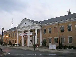 Knox County Courthouse in Barbourville | |
 Location in Knox County, Kentucky | |
| Coordinates: 36°52′00″N 83°53′05″W | |
| Country | United States |
| State | Kentucky |
| County | Knox |
| Area | |
| • Total | 2.72 sq mi (7.04 km2) |
| • Land | 2.65 sq mi (6.88 km2) |
| • Water | 0.06 sq mi (0.16 km2) |
| Elevation | 971 ft (296 m) |
| Population | |
| • Total | 3,222 |
| • Density | 1,213.56/sq mi (468.47/km2) |
| Time zone | UTC-5 (Eastern (EST)) |
| • Summer (DST) | UTC-4 (EDT) |
| ZIP code | 40906 |
| Area code | 606 |
| FIPS code | 21-03574 |
| GNIS feature ID | 2403155[2] |
| Website | www |
References
- "2020 U.S. Gazetteer Files". United States Census Bureau. Retrieved March 18, 2022.
- U.S. Geological Survey Geographic Names Information System: Barbourville, Kentucky
- "Barbourville city, Kentucky". United States Census Bureau. Retrieved November 10, 2023.
This article is issued from Wikipedia. The text is licensed under Creative Commons - Attribution - Sharealike. Additional terms may apply for the media files.