Appomattox County, Virginia
Appomattox County is a United States county near the center of the U.S. state of Virginia. The county is part of the Lynchburg, VA Metropolitan Statistical Area. Its county seat is the town of Appomattox.[1]
Appomattox County | |
|---|---|
 The Appomattox County Courthouse in October 2007 | |
 Flag | |
 Location within the U.S. state of Virginia | |
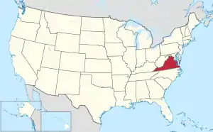 Virginia's location within the U.S. | |
| Coordinates: 37°21′32″N 78°49′35″W | |
| Country | |
| State | |
| Founded | 1845 |
| Named for | Appomattox River |
| Seat | Appomattox |
| Largest town | Appomattox |
| Area | |
| • Total | 335 sq mi (870 km2) |
| • Land | 333 sq mi (860 km2) |
| • Water | 1.2 sq mi (3 km2) 0.4% |
| Population (2020) | |
| • Total | 16,119 |
| • Density | 48/sq mi (19/km2) |
| Time zone | UTC−5 (Eastern) |
| • Summer (DST) | UTC−4 (EDT) |
| Congressional district | 5th |
| Website | www |
This article is issued from Wikipedia. The text is licensed under Creative Commons - Attribution - Sharealike. Additional terms may apply for the media files.