Aiguilles
Aiguilles is a commune in the Hautes-Alpes department and Provence-Alpes-Côte d'Azur region in southeastern France.
Aiguilles | |
|---|---|
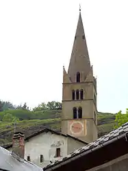 The bell tower of the church of Saint-Jean-Baptiste | |
 Coat of arms | |
Location of Aiguilles | |
 Aiguilles 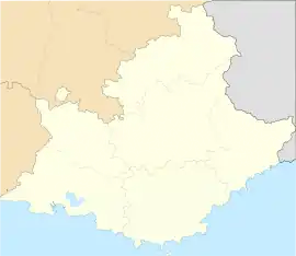 Aiguilles | |
| Coordinates: 44°46′57″N 6°52′11″E | |
| Country | France |
| Region | Provence-Alpes-Côte d'Azur |
| Department | Hautes-Alpes |
| Arrondissement | Briançon |
| Canton | Guillestre |
| Intercommunality | Guillestrois et Queyras |
| Government | |
| • Mayor (2014-2020) | Serge Laurens |
| Area 1 | 40.16 km2 (15.51 sq mi) |
| Population | 397 |
| • Density | 9.9/km2 (26/sq mi) |
| Time zone | UTC+01:00 (CET) |
| • Summer (DST) | UTC+02:00 (CEST) |
| INSEE/Postal code | 05003 /05470 |
| Elevation | 1,400–3,078 m (4,593–10,098 ft) (avg. 1,471 m or 4,826 ft) |
| 1 French Land Register data, which excludes lakes, ponds, glaciers > 1 km2 (0.386 sq mi or 247 acres) and river estuaries. | |
Geography
The village of Aiguilles is in the middle of the commune. The Guil river goes through the commune.
Transport
Road
The D947 road passes through the commune.
Population
| Year | Pop. | ±% |
|---|---|---|
| 2005 | 412 | — |
| 2006 | 412 | +0.0% |
| 2007 | 412 | +0.0% |
| 2008 | 419 | +1.7% |
| 2009 | 426 | +1.7% |
| 2010 | 433 | +1.6% |
| 2011 | 394 | −9.0% |
| 2012 | 449 | +14.0% |
| 2013 | 444 | −1.1% |
| 2014 | 434 | −2.3% |
| 2015 | 425 | −2.1% |
| 2016 | 428 | +0.7% |
References
- "Populations légales 2019". The National Institute of Statistics and Economic Studies. 29 December 2021.
This article is issued from Wikipedia. The text is licensed under Creative Commons - Attribution - Sharealike. Additional terms may apply for the media files.