| Wrigley Brook | |
|---|---|
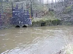 Confluence with River Roch | |
| Location | |
| Country | England |
| Physical characteristics | |
| Source | |
| • location | Hareshill |
| Mouth | |
• location | River Roch, Heywood |
• coordinates | 53°35′54.27″N 2°13′54.51″W / 53.5984083°N 2.2318083°W |
Wrigley Brook is a culverted watercourse in Greater Manchester which flows through Heywood and is a tributary of the River Roch. Originating in the Hareshill area to the South of Heywood, it flows northwards and joins the River Roch at Bottom O' th' Brow.
References
https://www.researchgate.net/figure/Wrigley-Brook-and-Millers-Brook-Heywood-and-the-locations-of-floods-in-2004-and-2006_fig6_229504526
Old Ordnance Survey Maps Lancashire sheet 88.11 by Alan Godfrey and Paul Hindle (ISBN 1-84151-923-5).
http://randd.defra.gov.uk/Document.aspx?Document=FD2603_7222_PR.pdf
This article is issued from Wikipedia. The text is licensed under Creative Commons - Attribution - Sharealike. Additional terms may apply for the media files.