| Voronya | |
|---|---|
 | |
| Location | |
| Country | Russia |
| Physical characteristics | |
| Mouth | Barents Sea |
• coordinates | 69°10′57″N 35°47′57″E / 69.18250°N 35.79917°E |
| Length | 137 km (85 mi) |
| Basin size | 1,600 km2 (620 sq mi) |
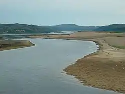
The Voronya (Russian: Воро́нья) is a river on the Kola Peninsula in Murmansk Oblast, Russia. It is 155 km in length. The area of its drainage basin is 9,940 km².[1] The Voronya flows out of Lake Lovozero and into the Barents Sea.
There are two hydroelectric power stations on the river, with a total capacity of 351 MW and an annual production of 1069 GWh.
References
- ↑ "Река Воронья in the State Water Register of Russia". textual.ru (in Russian).
This article is issued from Wikipedia. The text is licensed under Creative Commons - Attribution - Sharealike. Additional terms may apply for the media files.