Rural Municipality of Victoria | |
|---|---|
 Grain elevator at Holland | |
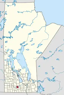
 Location of the RM of Victoria in Manitoba | |
| Coordinates: 49°39′52″N 98°54′55″W / 49.66444°N 98.91528°W | |
| Country | Canada |
| Province | Manitoba |
| Area | |
| • Land | 703.54 km2 (271.64 sq mi) |
| Population | |
| • Total | 1,188 |
| Time zone | UTC-6 (CST) |
| • Summer (DST) | UTC-5 (CDT) |
| Area codes | 204 and 431 |
The Rural Municipality of Victoria is a rural municipality (RM) located in south-central Manitoba, north-east of Glenboro. The RM was established in 1902 and named for Queen Victoria. In its westernmost part, the RM contains parts of Manitoba's Spruce Woods Provincial Forest and Spruce Woods Provincial Park.
Communities
- Cypress River
- Holland
- Landseer
Demographics
In the 2021 Census of Population conducted by Statistics Canada, Victoria had a population of 1,188 living in 464 of its 518 total private dwellings, a change of 4.9% from its 2016 population of 1,132. With a land area of 703.54 km2 (271.64 sq mi), it had a population density of 1.7/km2 (4.4/sq mi) in 2021.[1]
See also
References
- 1 2 "Population and dwelling counts: Canada, provinces and territories, and census subdivisions (municipalities), Manitoba". Statistics Canada. February 9, 2022. Retrieved February 20, 2022.
- Geographic Names of Manitoba (pg. 281–282) - the Millennium Bureau of Canada
External links
Wikimedia Commons has media related to Rural Municipality of Victoria.
This article is issued from Wikipedia. The text is licensed under Creative Commons - Attribution - Sharealike. Additional terms may apply for the media files.
