Val-d'Épy | |
|---|---|
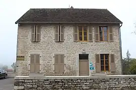 The town hall in Val-d'Épy | |
Location of Val-d'Épy | |
 Val-d'Épy 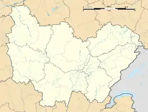 Val-d'Épy | |
| Coordinates: 46°23′01″N 5°23′56″E / 46.3836°N 5.3989°E | |
| Country | France |
| Region | Bourgogne-Franche-Comté |
| Department | Jura |
| Arrondissement | Lons-le-Saunier |
| Canton | Saint-Amour |
| Government | |
| • Mayor (2020–2026) | Michel Ganneval[1] |
| Area 1 | 25.35 km2 (9.79 sq mi) |
| Population | 310 |
| • Density | 12/km2 (32/sq mi) |
| Time zone | UTC+01:00 (CET) |
| • Summer (DST) | UTC+02:00 (CEST) |
| INSEE/Postal code | 39209 /39160 |
| Elevation | 285–555 m (935–1,821 ft) |
| 1 French Land Register data, which excludes lakes, ponds, glaciers > 1 km2 (0.386 sq mi or 247 acres) and river estuaries. | |
Val-d'Épy (French pronunciation: [val depi]) is a commune in the Jura department in the Bourgogne-Franche-Comté region in eastern France.[3] On 1 January 2016, the former communes of Florentia, Nantey and Senaud were merged into Val-d'Épy.[4] On 1 January 2018, the former commune of La Balme-d'Épy was merged into Val-d'Épy.[5]
Population
| Year | Pop. | ±% p.a. |
|---|---|---|
| 1968 | 364 | — |
| 1975 | 299 | −2.77% |
| 1982 | 291 | −0.39% |
| 1990 | 269 | −0.98% |
| 1999 | 297 | +1.11% |
| 2009 | 359 | +1.91% |
| 2014 | 360 | +0.06% |
| 2020 | 318 | −2.05% |
| Source: INSEE[6] | ||
Population data refer to the commune in its geography as of January 2023.
See also
References
- ↑ "Répertoire national des élus: les maires". data.gouv.fr, Plateforme ouverte des données publiques françaises (in French). 2 December 2020.
- ↑ "Populations légales 2021". The National Institute of Statistics and Economic Studies. 28 December 2023.
- ↑ INSEE commune file
- ↑ Arrêté préfectoral 30 November 2015
- ↑ Arrêté préfectoral 27 July 2017 (in French)
- ↑ Population en historique depuis 1968, INSEE
Wikimedia Commons has media related to Val-d'Épy.
This article is issued from Wikipedia. The text is licensed under Creative Commons - Attribution - Sharealike. Additional terms may apply for the media files.