West Sumbawa Regency
Kabupaten Sumbawa Barat | |
|---|---|
 Coat of arms | |
| Motto: Pariri Lema Bariri | |
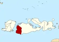 Location within West Nusa Tenggara | |
 West Sumbawa Regency Location in Lesser Sunda Islands and Indonesia 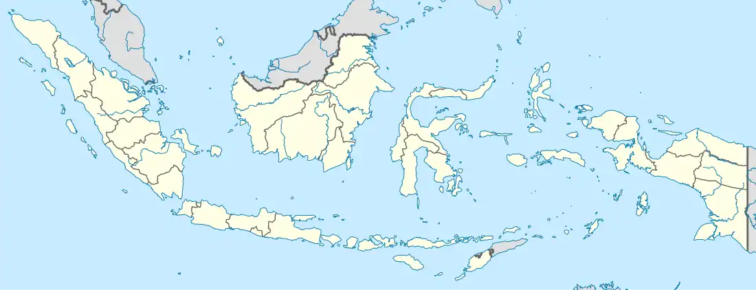 West Sumbawa Regency West Sumbawa Regency (Indonesia) | |
| Coordinates: 8°47′14.52″S 116°55′33.2″E / 8.7873667°S 116.925889°E | |
| Country | |
| Province | |
| Capital | Taliwang |
| Government | |
| • Regent | H. W. Musyafirin, M.M |
| • Vice Regent | Fud Syaifuddin |
| Area | |
| • Total | 1,743.58 km2 (673.20 sq mi) |
| Population (mid 2022 estimate) | |
| • Total | 148,458 |
| • Density | 85/km2 (220/sq mi) |
| [1] | |
| Time zone | UTC+8 (ICST) |
| Area code | (+62) 372 |
| Website | sumbawabaratkab.go.id |
West Sumbawa Regency (Indonesian: Kabupaten Sumbawa Barat) is a Regency (Kabupaten) of the Indonesian Province of West Nusa Tenggara. It is located on the island of Sumbawa and has an area of 1,743.58 km2. The regency was created on 18 December 2003 from what were at that time the westernmost five districts (kecamatan) of Sumbawa Regency. The population at the 2010 Census was 114,754,[2] and at the 2020 Census was 145,798;[3] the official estimate as at mid 2022 was 151,775 - comprising 76,959 males and 74,816 females.[1] The capital is the town of Taliwang.


Poto Tano, the most important harbour of West Sumbawa, is easily accessible by ferry from Lombok.
Administrative Districts
West Sumbawa Regency originally comprised five districts (kecamatan) formerly part of Sumbawa Regency, but now consists of eight districts, tabulated below with their areas and their populations at the 2010 Census[2] and the 2020 Census,[3] together with the official estimates as at mid 2021.[1] The table also includes the locations of the district administrative centres, the number of administrative villages in each district (totaling 57 rural desa and 7 urban kelurahan), and its postal codes. - the latter all in Taliwang District)
| Kode Wilayah | Name of District (kecamatan) | Area in km2 | Pop'n 2010 Census | Pop'n 2020 Census | Pop'n mid 2022 Estimate | Admin centre | No. of villages | Post code(s) |
|---|---|---|---|---|---|---|---|---|
| 52.07.04 | Sekongkang (a) | 273.65 | 8,179 | 14,483 | 15,080 | Sekongkang Bawah | 7 | 84457 |
| 52.07.01 | Jereweh | 527.63 | 8,370 | 9,764 | 10,160 | Beru | 4 | 84456 |
| 52.07.08 | Maluk | 38.83 | 11,929 | 11,649 | 12,130 | Benete | 5 | 84459 |
| 52.07.02 | Taliwang (b) | 153.71 | 44,136 | 57,610 | 56,350 | Kuang | 15 (c) | 84452 |
| 52.07.07 | Brang Ene | 252.62 | 5,088 | 6,589 | 6,860 | Manemeng | 6 | 84455 |
| 52.07.05 | Brang Rea | 258.23 | 12,498 | 16,044 | 16,700 | Tepas | 9 | 84455- 84458 |
| 52.07.03 | Seteluk | 107.37 | 15,424 | 19,413 | 20,210 | Seteluk Tengah | 10 | 84457 |
| 52.07.06 | Poto Tano (d) | 130.23 | 9,327 | 12,513 | 13,0340 | Senayan | 8 | 84454 |
| Totals | 1,743.58 | 114,754 | 145,798 | 151,775 | Taliwang | 64 |
Notes: (a) including the small islands of Pulau Baban and Pulau Rantung off the southwest coast of Sumbawa.
(b) including the small islands of Pulau Dua Ode, Pulau Dua Rea, Pulau Gera, Pulau Puyen, Pulau Sarang and Pulau Sesai off the west coast of Sumbawa.
(c) comprises 7 urban kelurahan and 8 desa.
(d) including the islands of Pulau Belang, Pulau Kambing, Pulau Kenawa, Pulau Mandik1, Pulau Namo, Pulau Paserang and Pulau Ular off the northwest coast of Sumbawa.
References
Regencies and cities of West Nusa Tenggara | ||
|---|---|---|
Capital: Mataram | ||
| Regencies | ||
| Cities | ||
8°47′14.52″S 116°55′33.2″E / 8.7873667°S 116.925889°E