St. Joseph's Cove-St. Veronica's | |
|---|---|
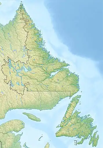 St. Joseph's Cove-St. Veronica's Location of St. Joseph's Cove-St. Veronica's  St. Joseph's Cove-St. Veronica's St. Joseph's Cove-St. Veronica's (Canada) | |
| Coordinates: 47°55′55″N 55°48′29″W / 47.932°N 55.808°W | |
| Country | Canada |
| Province | Newfoundland and Labrador |
| Region | Newfoundland |
| Census division | 3 |
| Census subdivision | D |
| Government | |
| • Type | Unincorporated |
| Area | |
| • Land | 25.71 km2 (9.93 sq mi) |
| Population (2021)[1] | |
| • Total | 85 |
| Time zone | UTC−03:30 (NST) |
| • Summer (DST) | UTC−02:30 (NDT) |
| Area code | 709 |
| Highways | |
St. Joseph's Cove-St. Veronica's is a local service district and designated place in the Canadian province of Newfoundland and Labrador.
Geography
St. Joseph's Cove-St. Veronica's is in the Bay d'Espoir region of Newfoundland within Subdivision D of Division No. 3.[2]
Demographics
As a designated place in the 2021 Census of Population conducted by Statistics Canada, St. Joseph's Cove-St. Veronica's recorded a population of 85 living in 41 of its 52 total private dwellings, a change of -27.4% from its 2016 population of 117.[1] With a land area of 25.71 km2 (9.93 sq mi), it had a population density of 4.6/km2 (11.8/sq mi) in 2016.[3]
Government
St. Joseph's Cove-St. Veronica's is a local service district (LSD)[4] that is governed by a committee responsible for the provision of certain services to the community.[5] The chair of the LSD committee is Pat Organ.[4]
See also
References
- 1 2 3 "Census Profile, 2021 Census". Statistics Canada. Retrieved February 9, 2022.
- ↑ "Population and dwelling counts, for Canada, provinces and territories, census divisions, census subdivisions (municipalities) and designated places, 2016 and 2011 censuses – 100% data (Newfoundland and Labrador)". Statistics Canada. February 7, 2018. Retrieved December 23, 2021.
- ↑ "Population and dwelling counts, for Canada, provinces and territories, and designated places, 2016 and 2011 censuses – 100% data (Newfoundland and Labrador)". Statistics Canada. February 7, 2018. Retrieved December 22, 2021.
- 1 2 "Directory of Local Service Districts" (PDF). Government of Newfoundland and Labrador. October 2021. Retrieved January 1, 2022.
- ↑ "Local Service Districts – Frequently Asked Questions". Government of Newfoundland and Labrador. Retrieved January 1, 2022.