South St. Paul Municipal Airport Richard E. Fleming Field | |||||||||||
|---|---|---|---|---|---|---|---|---|---|---|---|
 | |||||||||||
 | |||||||||||
| Summary | |||||||||||
| Airport type | Public | ||||||||||
| Owner | City of South St. Paul | ||||||||||
| Serves | South St. Paul, Minnesota | ||||||||||
| Elevation AMSL | 820 ft / 250 m | ||||||||||
| Website | www.flemingfield.com | ||||||||||
| Map | |||||||||||
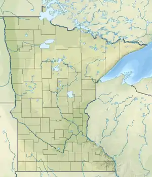
 SGS Location of airport in Minnesota / United States  SGS SGS (the United States) | |||||||||||
| Runways | |||||||||||
| |||||||||||
| Statistics | |||||||||||
| |||||||||||
South St. Paul Municipal Airport (ICAO: KSGS, FAA LID: SGS), also known as Richard E. Fleming Field or simply Fleming Field, is a city-owned public-use airport located two miles (3 km) south of the central business district of South St. Paul, a city in Dakota County, Minnesota, United States.[1] It is named for Richard E. Fleming, a United States Marine Corps Naval Aviator during World War II who was posthumously awarded a Medal of Honor. It is the only reliever airport for Minneapolis–St. Paul International Airport that is not operated by the Metropolitan Airports Commission.
Although most U.S. airports use the same three-letter location identifier for the FAA and IATA, South St. Paul Municipal Airport is assigned SGS by the FAA but has no designation from the IATA.[2]
Over the decade of 1950 and 1960 the airport was the main launch center for Winzen Research Inc. One of the most important companies devoted to the construction and operation of stratospheric balloons. The proximity to their headquarters in Minneapolis, made the ideal place for testing of new balloon models, as well as for technological flights and a number of scientific experiments.
In 1957, Fleming Field was the site chosen to launch the first manned flight of the MANHIGH program of the Air Force, commanded by Lieutenant Joseph Kittinger. According to our records the latest balloons flights from there dating from the mid 60's.
Currently, inside the installations of the airport, there is an important museum with a very prominent collection of WWII aircraft.[3]
Facilities and aircraft
South St. Paul Municipal-Richard E. Fleming Field covers an area of 270 acres (110 ha) and contains one asphalt paved runway designated 16/34 which measures 4,002 x 100 ft (1,220 x 30 m). For the 12-month period ending May 31, 2016, the airport had 51,000 general aviation aircraft operations, an average of 140 per day. In January 2017, there were 401 aircraft based at this airport: 375 single-engine, 20 multi-engine and 6 helicopter.[1]
See also
References
- 1 2 3 FAA Airport Form 5010 for SGS PDF, effective Jan 5, 2017.
- ↑ KSGS - South St. Paul Municipal Airport - South St. Paul, Minnesota at Great Circle Mapper
- ↑ http://stratocat.com.ar/bases/23e.htm
External links
- South Saint Paul Fleming Field, official web site
- "Minnesota Airport Directory: South St. Paul Municipal Airport" (PDF). Archived from the original (PDF) on 2006-09-24. (324 KiB)
- Resources for this airport:
- FAA airport information for SGS
- AirNav airport information for KSGS
- FlightAware airport information and live flight tracker
- NOAA/NWS weather observations: current, past three days
- SkyVector aeronautical chart, Terminal Procedures