Sirsa | |
|---|---|
 | |
 Sirsa 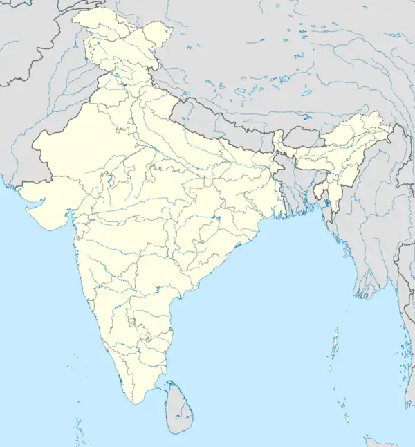 Sirsa | |
| Coordinates: 29°32′N 75°01′E / 29.533°N 75.017°E | |
| Country | |
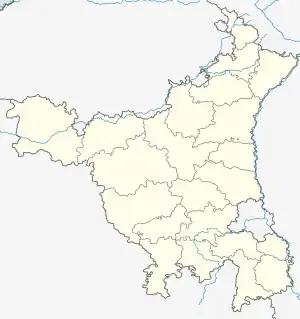
| State | Haryana |
| Division | Hisar |
| District | Sirsa |
| Government | |
| • Deputy Commissioner | Parth Gupta, IAS [1] |
| Elevation | 200.55 m (657.97 ft) |
| Population (2011) | |
| • Total | 200,034[2] |
| Languages[3][4] | |
| • Official | Hindi, Haryanvi |
| • Additional official | Bagri |
| Time zone | UTC+5:30 (IST) |
| PIN | 125055 |
| UNLOCODE | IN HSS |
| Telephone code | 91-1666 xxx xxx |
| Vehicle registration | HR-24, HR-57 |
| Sex ratio | 897 ♂/♀[5] |
| Literacy | 72.1[5] |
| Planning agency | HUDA |
| Website | sirsa mcsirsa |
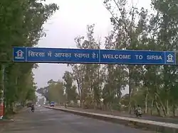
Sirsa is a city and a municipal council in Sirsa district in the westernmost region of the Indian state of Haryana, bordering Punjab and Rajasthan. It is located near to Thar desert. It is located 250 kilometres north-west of New Delhi and 260 kilometers south-west of state capital Chandigarh. Sirsa's nearest cities include Hisar, Fatehabad, Ellenabad, Bhadra, Nohar, Mandi Dabwali and Hanumangarh. Its history dates back to the time of the Mahabharata. At one time, the Sarasvati River flowed in this area. [6]
History
Sirsa is listed in the Ain-i-Akbari as a pargana under the sarkar of Hisar, producing a revenue of 4,361,368 dams for the imperial treasury and supplying a force of 5000 infantry and 500 cavalry.[7][6]
Geography
Sirsa is located at 29°32′N 75°01′E / 29.53°N 75.02°E.[8] It has an average elevation of 205 metres (672 feet).
Demographics
As of 2011 Indian Census, Sirsa had a total population of 200,034, of which 105,378 were males and 94,656 were females. Population within the age group of 0 to 6 years was 22,804. The total number of literates in Sirsa was 144,225, which constituted 72.1% of the population with male literacy of 76.0% and female literacy of 67.7%. The effective literacy rate of 7+ population of Sirsa was 81.4%, of which male literacy rate was 86.2% and female literacy rate was 76.0%. The Scheduled Castes population was 42,967. Sirsa had 39,689 households in 2011.[2]
Religion
City
| Religion | Population (1911)[9] | Percentage (1911) | Population (1941)[10]: 30 | Percentage (1941) |
|---|---|---|---|---|
| Hinduism |
9,323 | 63.73% | 13,083 | 63.15% |
| Islam |
4,614 | 31.54% | 6,368 | 30.74% |
| Sikhism |
392 | 2.68% | 831 | 4.01% |
| Christianity |
123 | 0.84% | 72 | 0.35% |
| Others [lower-alpha 1] | 177 | 1.21% | 364 | 1.76% |
| Total Population | 14,629 | 100% | 20,718 | 100% |
Tehsil
| Religion | Population (1941)[10]: 58 | Percentage (1941) |
|---|---|---|
| Hinduism |
98,161 | 45.78% |
| Islam |
78,048 | 36.4% |
| Sikhism |
36,657 | 17.1% |
| Christianity |
420 | 0.2% |
| Others [lower-alpha 2] | 1,118 | 0.52% |
| Total Population | 214,404 | 100% |
Point of interest
Air Force station
Sirsa has an air base of Indian Air Force named Sirsa Air Force Station and this is one of the most important Air Force Station of India near Pakistan border.
Dera Sacha Sauda
The non-governmental organization Dera Sacha Sauda, established in 1948 by ascetic Mastana Balochistani, has its headquarters in Sirsa.[11][12]
Shri Tara Baba Kutiya (Tarakeswar Dham)
Shri Tara Baba Kutiya, also known as Tarakeswar Dham, was constructed in the year 2003 with help from Sirsa MLA Gopal Goyal Kanda.[13] It is near Ramnagarian village on Haryana State Highway 23 (Sirsa-Ellenabad Road). It has a statue of Shiva and an idol of Nandi.[14]
Abubshaher: Abubshaher Wildlife Sanctuary is located in Sirsa district, which is the largest wildlife sanctuary of Haryana. Abubshaher Wildlife Sanctuary is also the birthplace of the black pheasant.[15]
References
- ↑ "Deputy Commissioner Sirsa". sirsa.gov.in. Retrieved 8 May 2022.
- 1 2 "Census of India: Sirsa". censusindia.gov.in. Retrieved 20 December 2019.
- ↑ "Report of the Commissioner for linguistic minorities: 52nd report (July 2014 to June 2015)" (PDF). Commissioner for Linguistic Minorities, Ministry of Minority Affairs, Government of India. p. 24. Archived from the original (PDF) on 15 November 2016. Retrieved 7 March 2019.
- ↑ IANS (28 January 2010). "Haryana grants second language status to Punjabi". Hindustan Times. Retrieved 2 January 2019.
- 1 2
- 1 2 "इतिहास | Sirsa | India".
- ↑ Abu'l-Fazl ibn Mubarak; Jarrett, Henry Sullivan (translator) (1891). The Ain-i-Akbari. Calcutta: Asiatic Society of Bengal. p. 294. Retrieved 21 January 2021.
{{cite book}}:|first2=has generic name (help) - ↑ "Maps, Weather, and Airports for Sirsa, India". Fallingrain.com. Retrieved 31 August 2017.
- ↑ "Census of India 1911. Vol. 14, Punjab. Pt. 1, Report". Retrieved 21 July 2022.
- 1 2 "CENSUS OF INDIA, 1941 VOLUME VI PUNJAB PROVINCE". Retrieved 20 July 2022.
- ↑ Rajalakshmi, T. K. (26 January 2013). "Godman under a cloud". Frontline. Archived from the original on 26 January 2013. Retrieved 4 February 2021.
- ↑ "The Baba on song". The Indian Express. 1 July 2020. Retrieved 4 February 2021.
- ↑ "सिरसा की पहचान बन चुकी है श्री बाबा तारा जी की कुटिया, बड़ा रोचक है इसका इतिहास". Jagran. Retrieved 9 August 2021.
- ↑ "तारा बाबा कुटिया है आस्था का केंद्र, मीलों दूर से दिखती है भगवान शिव की प्रतिमा, रोचक है कहानी". Jagran. Jagran. Retrieved 9 August 2021.
- ↑ Abubshaher Wildlife Sanctuary is located in Sirsa district mysirsa. Retrieved 16 September 2023
- ↑ Including Jainism, Buddhism, Zoroastrianism, Judaism, Ad-Dharmis, or not stated
- ↑ Including Jainism, Buddhism, Zoroastrianism, Judaism, Ad-Dharmis, or not stated
External links
Sirsa district topics | ||
|---|---|---|
| Cities and towns |  | |
| Education | ||
| Transport | ||
| Villages |
| |
| Lok Sabha constituencies | ||