Queensburgh | |
|---|---|
 Queensburgh  Queensburgh | |
| Coordinates: 29°52′S 30°56′E / 29.867°S 30.933°E | |
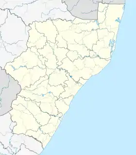
| Country | South Africa |
| Province | KwaZulu-Natal |
| Municipality | eThekwini |
| Area | |
| • Total | 22.88 km2 (8.83 sq mi) |
| Population (2011)[1] | |
| • Total | 54,846 |
| • Density | 2,400/km2 (6,200/sq mi) |
| Racial makeup (2011) | |
| • Black African | 23.8% |
| • Coloured | 1.6% |
| • Indian/Asian | 53.8% |
| • White | 20.2% |
| • Other | 0.6% |
| First languages (2011) | |
| • English | 70.0% |
| • Zulu | 14.3% |
| • Afrikaans | 7.5% |
| • Xhosa | 4.3% |
| • Other | 4.0% |
| Time zone | UTC+2 (SAST) |
| Postal code (street) | 4093 |
| PO box | 4070 |
Queensburgh (/ˈkwiːnsbərə/) is a town in KwaZulu-Natal, South Africa that is situated inland (southwest) from Durban and now forms part of eThekwini, the Greater Durban metropolitan area.
History
The hilly area was settled by people working in Durban who wanted to escape the humidity of the coastal city. In 1924, four residential townships in the area, Malvern, Escombe, Northdene and Moseley (now forms part of Pinetown) combined to form the town of Malvern. In 1952, to celebrate Queen Elizabeth II's accession to the throne, Malvern received municipality status and changed its name to Queensburgh.
Geography
Queensburgh is situated approximately 9 kilometres (6 mi) south-west of the Durban CBD, with much of the town situated between the uMbilo River to the north and the uMhlatuzana River to the south. Its neighbouring towns/cities are Pinetown to the west, Westville to the north-east, Durban to the east and Chatsworth to the south.[2]
Suburban areas
Queensburgh is the collective name of a few smaller suburbs situated on the undulating hills south-west of Durban, mainly encompassing the suburbs of Northdene, Malvern and Escombe.
The 2011 census divided the urban area of Queensburgh into eight “sub places” including:[3]
- Buffels Bosch
- Burlington Greenfields
- Escombe
- Malvern
- Northdene
- Queensmead Industrial
- Shallcross
- Shallcross Ext 2
Transport
Rail network
The old main railway line between Durban and Pinetown, known as Old Main Line, passes through the centre of Queensburgh. Metrorail operates commuter railway services on this line from the Northdene, Escombe, Malvern and Poet’s Corner railway stations in Queensburgh.
The newer main railway line between Durban and Cato Ridge, known as New Main Line, passes through the south of Queensburgh. Metrorail operates commuter railway services on this line from the Shallcross, Burlington and Cavendish railway stations in Queensburgh.
Road network
The M7, also known as Solomon Mahlangu Drive is the main freeway through Queensburgh, leading north-west to Pinetown and eastwards to the Bluff in Durban with access at the Bellville Road (exit 7) and Main Road (exit 12) interchanges. In passing Queensburgh it gives access to the N3 and N2 freeways.
Main Road, designated as the M5, is the main local arterial through Queensburgh leading north towards Pinetown and east towards Bellair in Durban. Stella Road, designated as the M10, is a local arterial leading east towards Bellair too.
Demographics
Queensburgh has a diverse population. The suburb has a significant Indian population who moved to the area from neighbouring townships after apartheid had ended.
English is the dominant language followed by Zulu, Afrikaans and Xhosa.
References
- 1 2 3 4 "Main Place Queensburgh". Census 2011.
- ↑ "Distance Queensburgh, EThekwini, Kwazulu-Natal, ZAF > Durban, EThekwini, Kwazulu-Natal, ZAF - Air line, driving route, midpoint". www.distance.to. Retrieved 4 November 2022.
- ↑ "Census 2011: Main Place: Queensburgh". census2011.adrianfrith.com. Retrieved 2 March 2023.
.svg.png.webp)