The Texas Portal
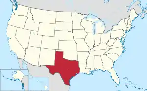
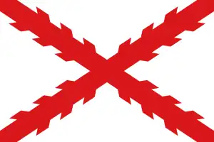
Texas (/ˈtɛksəs/ TEK-səs, locally also /ˈtɛksɪz/ TEK-siz; Spanish: Texas or Tejas, pronounced [ˈtexas]) is a state in the South Central region of the United States. At 268,596 square miles (695,660 km2), and with more than 30 million residents in 2023, it is the second-largest U.S. state by both area (after Alaska) and population (after California). Texas shares borders with the states of Louisiana to the east, Arkansas to the northeast, Oklahoma to the north, New Mexico to the west, and the Mexican states of Chihuahua, Coahuila, Nuevo León, and Tamaulipas to the south and southwest; and has a coastline with the Gulf of Mexico to the southeast. Houston is the most populous city in Texas and the fourth-largest in the U.S., while San Antonio is the second most populous in the state and seventh-largest in the country. Dallas–Fort Worth and Greater Houston are, respectively, the fourth- and fifth-largest metropolitan statistical areas in the country. Other major cities include Austin, the second most populous state capital in the U.S., and El Paso. Texas is nicknamed the Lone Star State for its former status as an independent republic, and as a reminder of the state's struggle for independence from Mexico. The Lone Star can be found on the Texas state flag and the Texas state seal. The origin of Texas's name is from the Caddo word táyshaʼ meaning 'friends'. Due to its size and geologic features such as the Balcones Fault, Texas contains diverse landscapes common to both the U.S. Southern and the Southwestern regions. Although Texas is popularly associated with the U.S. southwestern deserts, less than ten percent of Texas's land area is desert. Most population centers are in areas of former prairies, grasslands, forests, and the coastline. Traveling from east to west, terrain ranges from coastal swamps and piney woods, to rolling plains and rugged hills, to the desert and mountains of the Big Bend. (Full article...) Selected articleThe Delta County Courthouse is a historic, three-story courthouse building in the city of Cooper, in Delta County, Texas, United States. The building is located at 200 West Dallas Avenue, and functions as the meeting place for the county government. The building also houses all of the county records. The county's first courthouse was built in 1873, in Cooper. A courthouse was built to replace the original in 1898. After the Great Depression, the new courthouse was built by the Works Progress Administration (WPA), helping the community to grow. The building has remained virtually unchanged since. (Full article...) Selected biography Bonnie Parker and Clyde Barrow were notorious robbers and criminals who travelled the central United States during the Great Depression. Their exploits were known nationwide. They captivated the attention of the American press and its readership during what is sometimes referred to as the "public enemy era" between 1931 and 1935. Though the public at the time believed Bonnie to be a full partner in the gang, the role of Bonnie Parker in the Barrow Gang crimes has long been a source of controversy. Gang members W. D. Jones and Ralph Fults testified that they never saw Bonnie fire a gun, and described her role as logistical. Jones' sworn statement was that "Bonnie never packed a gun, out of the five major gun battles I was with them she never fired a gun." Writing with Phillip Steele in The Family Story of Bonnie and Clyde, Marie Barrow, Clyde's youngest sister, made the same claim: "Bonnie never fired a shot. She just followed my brother no matter where he went." Texas news
Wikinews Texas portal
ListsTexas-related lists
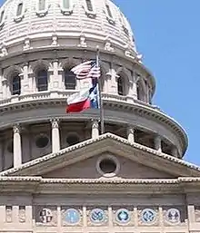
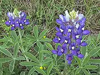
State symbols
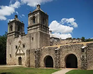
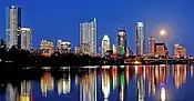
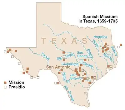
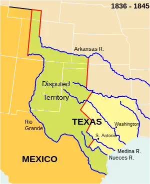
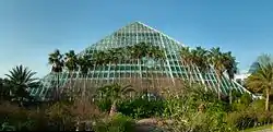
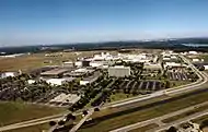
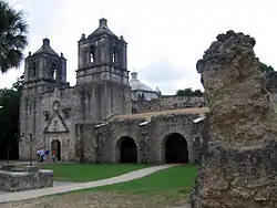
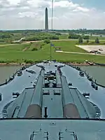
Texas topicsSelected imageSpotlight city Brownsville is a city in Cameron County, Texas. As of the 2000 census, the city population was 139,722. It is the county seat of Cameron County. Brownsville is located at 25°55′49″N 97°29′4″W / 25.93028°N 97.48444°W (25.930307, -97.484424)[1], on the U.S.-Mexico border (marked here by the Rio Grande or Río Bravo del Norte) from Matamoros, Tamaulipas. According to the United States Census Bureau, the city has a total area of 215.0 km² (83.0 mi²), making it by far the largest city in the Rio Grande Valley. Fort Texas was commissioned in 1845 less than a mile from what would become downtown Brownsville. Not even completed yet, the Mexican Army began the Siege of Fort Texas on May 3-9, 1846. One of the only two American soldiers who died in the attack was the fort's commander, Major Jacob Brown, in honor of whom the post was renamed to Fort Brown. General imagesThe following are images from various Texas-related articles on Wikipedia.
CategoriesSelect [►] to view subcategories
Texas Texas-related lists Communications in Texas Texas culture Demographics of Texas Economy of Texas Education in Texas Environment of Texas Geography of Texas Government of Texas Health in Texas History of Texas Texas law Military in Texas Native American tribes in Texas Orphanages in Texas People from Texas Politics of Texas Professional wrestling in Texas Science and technology in Texas Texas society Sports in Texas Transportation in Texas Westworth, Texas Works about Texas Images of Texas Texas stubs Related pagesRelated portals
Attractions
Federally protected areas
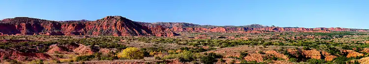 Eagle Point, Caprock Canyons State Park Things you can do
Associated WikimediaThe following Wikimedia Foundation sister projects provide more on this subject:
Sources
More portalsDiscover Wikipedia using portals
| |||||||||||||||||||||||||||||||||||||||||||||


.jpg.webp)


.png.webp)