Highway 26 | ||||
|---|---|---|---|---|
| Ruta 26 | ||||
| Expreso Román Baldorioty de Castro | ||||
| Route information | ||||
| Maintained by Puerto Rico DTPW | ||||
| Length | 15.1 km[1] (9.4 mi) | |||
| Existed | 1982 and completed in 1999–present | |||
| Major junctions | ||||
| West end | ||||
| East end | ||||
| Location | ||||
| Country | United States | |||
| Territory | Puerto Rico | |||
| Municipalities | San Juan, Carolina | |||
| Highway system | ||||
| ||||

Puerto Rico Highway 26 (PR-26),[lower-alpha 1] called the Román Baldorioty de Castro Expressway, is the main highway to the Luis Muñoz Marín International Airport and is connected to PR-66.[2] It was converted to a freeway to minimize the traffic in PR-3 and PR-17, to grant better access to the Airport.[3][4] Several exits exist to provide access to PR-187 (the main route to the Piñones area), PR-37 (Isla Verde) and PR-22 (José de Diego).[5] PR-26 is 15.1 km (9.4 mi) long.[6]
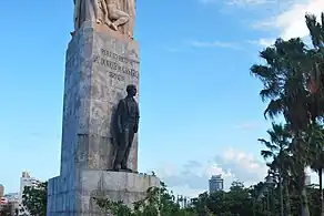 Statue of Román Baldorioty de Castro in PR-26
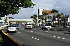 PR-26 in Isla Verde
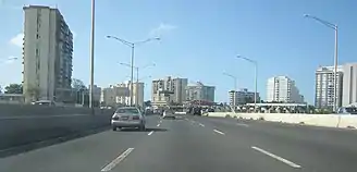 Puerto Rico Highway 26 in Isla Verde
Exit list
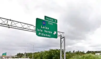 Expreso Román Baldorioty de Castro Salida 7
.jpg.webp) PR-26 in Carolina after Hurricane Maria (September 20, 2017)
PR-26 in Carolina after Hurricane Maria (September 20, 2017)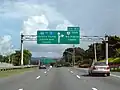 PR-26 towards PR-66 and PR-3
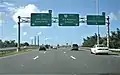 Puerto Rico Highway 66 becomes PR-26 in Carolina after the exit to PR-3
| Municipality | Location | km[1] | mi | Exit | Destinations | Notes |
|---|---|---|---|---|---|---|
| San Juan | Santurce | 0.0 | 0.0 | — | Western terminus of PR-26 | |
| 0.3 | 0.19 | — | PR-Marginal Román Baldorioty de Castro – Santurce | Eastbound exit only; one-way street | ||
| 1.4– 1.5 | 0.87– 0.93 | 1 | Eastbound exit signed as 1A | |||
| 1.7– 1.8 | 1.1– 1.1 | 1B | PR-Calle Canals – Condado, Parada 19 | Eastbound exit only; one-way street | ||
| 2.0– 2.1 | 1.2– 1.3 | 2A | Túnel Minillas | |||
| 2.3– 2.4 | 1.4– 1.5 | 2B | ||||
| 3.0– 4.1 | 1.9– 2.5 | 4 | PR-Calle Degetau / PR-Calle Providencia / PR-Calle Tapia – Ocean Park | Westbound exit signed as 4A | ||
| 4.6 | 2.9 | 4B | Westbound exit only | |||
| Carolina | Cangrejo Arriba | 5.4 | 3.4 | 5 | Westbound exit only | |
| 5.5– 6.5 | 3.4– 4.0 | 6 | ||||
| 7.3 | 4.5 | 7 | ||||
| 7.7 | 4.8 | 8A | Toll bridge | |||
| 8B | ||||||
| 9.1 | 5.7 | 9 | PR-Avenida Los Ángeles – Carolina | Eastbound exit signed as 9A | ||
| 9.5 | 5.9 | 9B | PR-Marginal Los Ángeles – Carolina | Eastbound exit only | ||
| 11.1– 11.2 | 6.9– 7.0 | 11 | Eastbound exit and westbound entrance | |||
| Sabana Abajo | 12.5 | 7.8 | 12 | PR-Avenida Roberto Sánchez Vilella – Carolina, Country Club | Eastbound exits are signed as 12A (west) and 12B (east) | |
| 13.6 | 8.5 | 13 | Eastbound exits are signed as 13A (west) and 13B (east) | |||
| 14.8– 14.9 | 9.2– 9.3 | 14 | PR-Avenida Jesús M. Fragoso – Carolina | Eastbound exit and entrance | ||
| San Antón | 15.1 | 9.4 | 15A | Eastern terminus of PR-26 | ||
| 15B | ||||||
| 1.000 mi = 1.609 km; 1.000 km = 0.621 mi | ||||||
See also
Notes
- ↑ PR-26 is the unsigned Interstate PRI3
References
- 1 2 Google (28 February 2020). "PR-26" (Map). Google Maps. Google. Retrieved 28 February 2020.
- ↑ National Geographic Maps (2011). Puerto Rico (Map). 1:125,000. Adventure Map (Book 3107). Evergreen, Colorado: National Geographic Maps. ISBN 978-1566955188. OCLC 756511572.
- ↑ "Mensaje del gobernador del Estado Libre Asociado de Puerto Rico honorable Rafael Hernández Colón en la inauguración del primer elevado de la avenida Baldorioty de Castro" (PDF). Rafael Hernández Colón (in Spanish). 1992. Retrieved 21 February 2020.
- ↑ "Mensaje del gobernador del Estado Libre Asociado de Puerto Rico honorable Rafael Hernández Colón en la inauguración del segundo puente elevado en la avenida Baldorioty de Castro" (PDF). Rafael Hernández Colón (in Spanish). 1992. Retrieved 21 February 2020.
- ↑ "Tránsito Promedio Diario (AADT)". Transit Data (Datos de Transito) (in Spanish). DTOP PR. p. 41. Archived from the original on 1 April 2019.
- ↑ Guía de Carreteras Principales, Expresos y Autopistas. Departamento de Transportación y Obras Publicas de Puerto Rico. Accessed 20 February 2020.
External links
- Hawaii Highways – Puerto Rico Interstate Photographs (2002)
| Signed | |
|---|---|
| Unsigned | |
| Lists | |
| Other | |
Routes in italics are no longer a part of the system. Major Interstates are highlighted. | |
This article is issued from Wikipedia. The text is licensed under Creative Commons - Attribution - Sharealike. Additional terms may apply for the media files.