This is a list of the National Register of Historic Places listings in western Cincinnati, Ohio.
This is intended to be a complete list of the properties and districts on the National Register of Historic Places in western Cincinnati, Ohio, United States. Western Cincinnati is defined as being all of the city outside of downtown and west of Vine Street.[a] The locations of National Register properties and districts may be seen in an online map.[1]
There are 287 properties and districts listed on the National Register in Cincinnati, including 12 National Historic Landmarks. Western Cincinnati includes 95 of these properties and districts, including 3 National Historic Landmarks; the city's remaining properties and districts are listed elsewhere. Another 2 properties in western Cincinnati were once listed but have been removed.
This National Park Service list is complete through NPS recent listings posted January 5, 2024.[2]
Current listings
| [3] | Name on the Register[4] | Image | Date listed[5] | Location | Description |
|---|---|---|---|---|---|
| 1 | American Can Company Building | 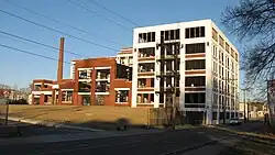 American Can Company Building |
October 17, 2007 (#07001092) |
4101 Spring Grove Ave. 39°09′37″N 84°32′14″W / 39.160278°N 84.537222°W |
Historic former factory built in 1921 where can-making machines were manufactured. Now loft-style apartments. |
| 2 | Anderson Ferry |  Anderson Ferry |
June 10, 1982 (#82003575) |
Off U.S. Route 50 39°04′35″N 84°37′28″W / 39.076389°N 84.624444°W |
|
| 3 | Apostolic Bethlehem Temple Church | 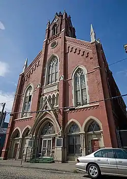 Apostolic Bethlehem Temple Church |
April 11, 1973 (#73001453) |
1205 Elm St. 39°06′29″N 84°31′07″W / 39.108056°N 84.518611°W |
|
| 4 | B&O Freight Terminal | 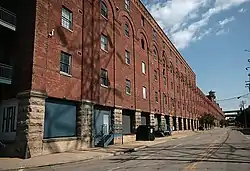 B&O Freight Terminal |
December 29, 1986 (#86003521) |
700 Pete Rose Way 39°05′44″N 84°31′28″W / 39.095556°N 84.524444°W |
|
| 5 | Balch House | 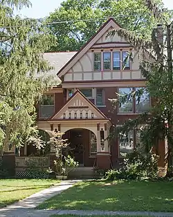 Balch House |
March 3, 1980 (#80003036) |
267 Greendale Ave. 39°09′04″N 84°31′04″W / 39.151111°N 84.517778°W |
Queen Anne style house built in 1896, designed by Cincinnati architect Samuel Hannaford for Cincinnati, Hamilton, and Dayton Railroad executive George Balch. |
| 6 | Beech Avenue Houses | 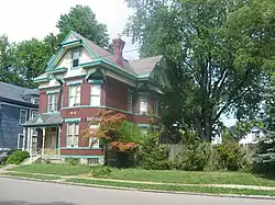 Beech Avenue Houses |
February 16, 1979 (#79001853) |
1120 and 1128 Beech Ave. 39°06′46″N 84°34′38″W / 39.112778°N 84.577222°W |
|
| 7 | Betts-Longworth Historic District | 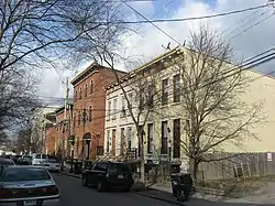 Betts-Longworth Historic District |
November 29, 1983 (#83004304) |
Roughly bounded by Ezzard Charles Dr., Central Ave., and Mound and Old Court Sts. 39°06′26″N 84°31′21″W / 39.107222°N 84.5225°W |
|
| 8 | Cedric G. and Patricia Neils Boulter House | 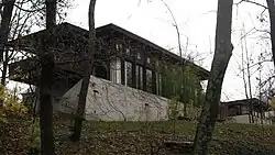 Cedric G. and Patricia Neils Boulter House |
May 14, 1999 (#99000512) |
1 Rawson Woods Circle 39°09′06″N 84°31′24″W / 39.151667°N 84.523333°W |
Designed by Frank Lloyd Wright. |
| 9 | Frederick E. and Catherine Bullerdick House | 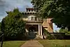 Frederick E. and Catherine Bullerdick House |
December 20, 2007 (#07001295) |
4321 Hamilton Ave. 39°09′58″N 84°32′29″W / 39.166111°N 84.541389°W |
|
| 10 | Calvary Episcopal Church Sunday School | 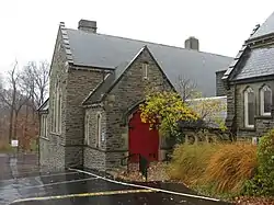 Calvary Episcopal Church Sunday School |
March 3, 1980 (#80003040) |
3770 Clifton Ave. 39°09′08″N 84°31′03″W / 39.152222°N 84.5175°W |
|
| 11 | Freeman Grant Cary Pleasant Hill Academy |  Freeman Grant Cary Pleasant Hill Academy |
April 29, 1999 (#99000511) |
5651 Hamilton Ave. 39°11′39″N 84°32′46″W / 39.194028°N 84.546111°W |
|
| 12 | Cincinnati Music Hall | 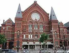 Cincinnati Music Hall |
January 26, 1970 (#70000496) |
1243 Elm St. 39°06′34″N 84°31′08″W / 39.109444°N 84.518889°W |
|
| 13 | Cincinnati Street Gas Lamps | 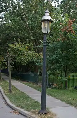 Cincinnati Street Gas Lamps |
December 22, 1978 (#78002073) |
1109 street lamps at various locations throughout Cincinnati |
|
| 14 | Cincinnati Union Terminal |  Cincinnati Union Terminal |
October 31, 1972 (#72001018) |
1301 Western Ave. 39°06′36″N 84°32′16″W / 39.11°N 84.537778°W |
|
| 15 | Cincinnati Work House and Hospital |  Cincinnati Work House and Hospital |
March 3, 1980 (#80003044) |
3208 Colerain Ave. 39°08′32″N 84°32′13″W / 39.142222°N 84.536944°W |
|
| 16 | Clifton Avenue Historic District | 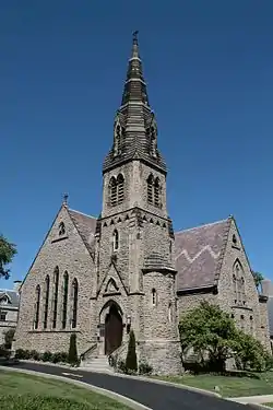 Clifton Avenue Historic District |
December 8, 1978 (#78002074) |
Irregular pattern along Clifton Ave. 39°09′18″N 84°31′01″W / 39.155°N 84.516944°W |
|
| 17 | Clifton Methodist Episcopal Church | 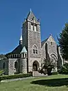 Clifton Methodist Episcopal Church |
April 12, 2007 (#07000297) |
3418 Clifton Ave. 39°08′39″N 84°31′07″W / 39.144167°N 84.518611°W |
|
| 18 | College Hill Town Hall |  College Hill Town Hall |
March 17, 1978 (#78002075) |
Belmont Ave. and Larch St. 39°11′37″N 84°32′59″W / 39.193611°N 84.549722°W |
|
| 19 | Cote Bonneville |  Cote Bonneville |
November 29, 1984 (#84000448) |
4850 Colerain Ave. 39°10′13″N 84°33′21″W / 39.170278°N 84.555833°W |
|
| 20 | George B. Cox House | 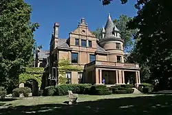 George B. Cox House |
November 6, 1973 (#73001456) |
Brookline and Jefferson Aves. 39°08′33″N 84°30′54″W / 39.1425°N 84.515°W |
Home to "Boss" Cox, Cincinnati political leader. Designed by Samuel Hannaford. |
| 21 | Crosley Building | 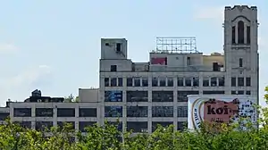 Crosley Building |
February 24, 2015 (#15000042) |
1329-1333 Arlington St. 39°08′42″N 84°32′24″W / 39.145000°N 84.540000°W |
|
| 22 | Dayton Street Historic District | 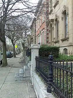 Dayton Street Historic District |
January 25, 1973 (#73001457) |
Roughly bounded by Bank, Linn, and Poplar Sts. and Winchell Ave. 39°07′03″N 84°31′50″W / 39.1175°N 84.530556°W |
|
| 23 | Benjamin Dombar House and Studio | February 10, 2022 (#100007410) |
601 West Galbraith Rd. 39°13′04″N 84°30′10″W / 39.2179°N 84.5028°W |
||
| 24 | Domhoff Buildings | 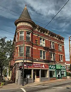 Domhoff Buildings |
March 11, 1980 (#80003047) |
4201-4203 Hamilton Ave. and 1604-1614 Chase Ave. 39°09′45″N 84°32′22″W / 39.1625°N 84.539444°W |
|
| 25 | Eighteenth District School |  Eighteenth District School |
March 3, 1980 (#80003051) |
1326 Hopple St. 39°08′14″N 84°32′18″W / 39.137222°N 84.538333°W |
|
| 26 | Episcopal Church of the Resurrection | 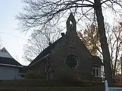 Episcopal Church of the Resurrection |
April 13, 1977 (#77001064) |
7346-7348 Kirkwood Lane 39°07′36″N 84°42′10″W / 39.126667°N 84.702778°W |
|
| 27 | Fairview Public School and Annex | 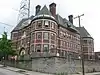 Fairview Public School and Annex |
September 16, 2010 (#10000756) |
255 Warner St. and 2232 Stratford Ave. 39°07′30″N 84°31′20″W / 39.125°N 84.522222°W |
|
| 28 | Findlay Market Building |  Findlay Market Building |
June 5, 1972 (#72001020) |
Esplanade at Elder St., between Elm and Race Sts. 39°06′55″N 84°31′09″W / 39.115278°N 84.519167°W |
|
| 29 | First German Methodist Episcopal Church | 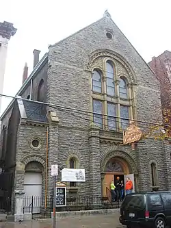 First German Methodist Episcopal Church |
March 3, 1980 (#80003054) |
1310 Race St. 39°06′35″N 84°30′59″W / 39.109722°N 84.516389°W |
|
| 30 | Freund-Heintz House |  Freund-Heintz House |
August 21, 2003 (#03000806) |
3332 Whitfield Ave. 39°08′35″N 84°31′26″W / 39.143056°N 84.523889°W |
|
| 31 | German Evangelical Protestant Cemetery Chapel |  German Evangelical Protestant Cemetery Chapel |
February 28, 2008 (#08000115) |
3701 Vine St. 39°09′21″N 84°30′32″W / 39.155833°N 84.508889°W |
|
| 32 | Moses Goldsmith Building |  Moses Goldsmith Building |
June 10, 1982 (#82003580) |
356 Bryant 39°08′45″N 84°31′18″W / 39.145833°N 84.521667°W |
|
| 33 | Sir Alfred T. Goshorn House |  Sir Alfred T. Goshorn House |
April 3, 1973 (#73001459) |
3540 Clifton Ave. 39°08′50″N 84°31′06″W / 39.147222°N 84.518333°W |
|
| 34 | Hamilton County Memorial Building | 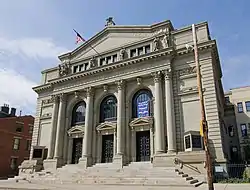 Hamilton County Memorial Building |
December 4, 1978 (#78002076) |
Elm and Grant Sts. 39°06′31″N 84°31′06″W / 39.108611°N 84.518333°W |
|
| 35 | Samuel Hannaford House | 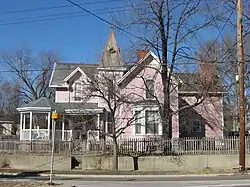 Samuel Hannaford House |
March 3, 1980 (#80003056) |
768 Derby Ave. 39°10′17″N 84°31′09″W / 39.171389°N 84.519167°W |
|
| 36 | George Hatch House | 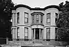 George Hatch House |
July 3, 2008 (#08000583) |
830 Dayton St. 39°07′06″N 84°31′42″W / 39.118453°N 84.528239°W |
|
| 37 | Joseph A. Hemann House | 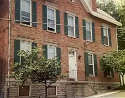 Joseph A. Hemann House |
April 16, 1980 (#80003057) |
49 W. McMillan St. 39°07′38″N 84°30′51″W / 39.127222°N 84.514167°W |
|
| 38 | Hewson-Gutting House | 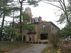 Hewson-Gutting House |
December 21, 1979 (#79001857) |
515 Lafayette Ave. 39°09′17″N 84°31′30″W / 39.154722°N 84.525°W |
|
| 39 | Hoffner Historic District | 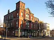 Hoffner Historic District |
October 3, 1978 (#78002077) |
Bounded by Blue Rock, Moline Court, Langland, and Hamilton Aves. 39°09′38″N 84°32′22″W / 39.160556°N 84.539444°W |
|
| 40 | Hulbert House and McAlpin Bridal Cottage | 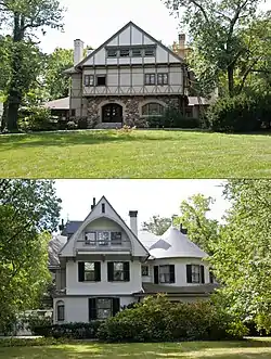 Hulbert House and McAlpin Bridal Cottage |
April 29, 1982 (#82003583) |
333 and 341 Lafayette Ave. 39°09′22″N 84°31′12″W / 39.156111°N 84.52°W |
|
| 41 | George Hummel House | 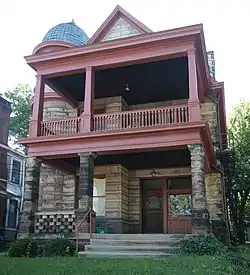 George Hummel House |
March 3, 1980 (#80003059) |
3423 Whitfield Ave. 39°08′42″N 84°31′25″W / 39.145000°N 84.523611°W |
|
| 42 | Kirby Road School | 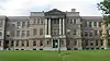 Kirby Road School |
September 3, 2013 (#13000681) |
1710 Bruce Ave. 39°10′04″N 84°32′45″W / 39.167778°N 84.545833°W |
|
| 43 | Laurel Homes Historic District | 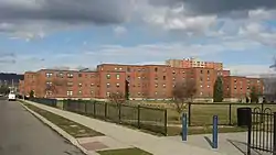 Laurel Homes Historic District |
May 19, 1987 (#87000690) |
Roughly bounded by Liberty and John Sts., Ezzard Charles Dr., and Linn St. 39°06′41″N 84°31′27″W / 39.111389°N 84.524167°W |
|
| 44 | John Uri Lloyd House |  John Uri Lloyd House |
March 7, 1973 (#73001461) |
3901 Clifton Ave. 39°09′26″N 84°31′03″W / 39.157222°N 84.5175°W |
|
| 45 | Lower Price Hill Historic District |  Lower Price Hill Historic District |
November 15, 1988 (#88002536) |
Roughly bounded by W. 8th, State, Burns, and English St. 39°06′13″N 84°33′08″W / 39.103611°N 84.552222°W |
|
| 46 | S. Gale and Agnes P. Lowrie House |  S. Gale and Agnes P. Lowrie House |
February 21, 2017 (#100000666) |
20 Rawson Woods Circle 39°09′08″N 84°31′21″W / 39.152222°N 84.522500°W |
|
| 47 | Masonic Temple Price Hill Lodge, No. 524 |  Masonic Temple Price Hill Lodge, No. 524 |
July 3, 2017 (#100001269) |
3301 Price Ave. 39°06′26″N 84°33′53″W / 39.107099°N 84.564662°W |
|
| 48 | Matthew McWilliams House | 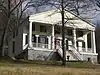 Matthew McWilliams House |
April 28, 2005 (#05000341) |
3586 River Rd. 39°04′52″N 84°35′27″W / 39.081111°N 84.590833°W |
|
| 49 | Melbourne Flats | 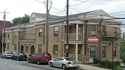 Melbourne Flats |
October 18, 1984 (#84000132) |
39 W. McMillan St. 39°07′39″N 84°30′48″W / 39.1275°N 84.513333°W |
|
| 50 | Charles A. Miller House | .jpg.webp) Charles A. Miller House |
March 3, 1980 (#80003064) |
1817 Chase Ave. 39°09′52″N 84°32′54″W / 39.16451°N 84.54836°W |
|
| 51 | Mohawk Place Historic District | 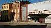 Mohawk Place Historic District |
September 1, 2015 (#15000563) |
241-290 McMicken Ave., 2009-2024 Mohawk Pl., 218-256 Mohawk St., and 2026 Central Parkway 39°07′13″N 84°31′26″W / 39.1202°N 84.5240°W |
|
| 52 | Morrison House | 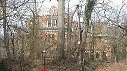 Morrison House |
April 3, 1973 (#73001463) |
750 Ludlow Ave. 39°08′54″N 84°31′43″W / 39.148333°N 84.528611°W |
|
| 53 | Mount Airy Forest | 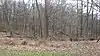 Mount Airy Forest |
April 13, 2010 (#10000191) |
5083 Colerain Ave. 39°10′47″N 84°33′57″W / 39.179728°N 84.565883°W |
|
| 54 | Northside United Methodist Church | 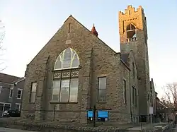 Northside United Methodist Church |
March 3, 1980 (#80003068) |
1674 Chase 39°09′50″N 84°32′37″W / 39.163889°N 84.543611°W |
|
| 55 | Oesterlein Machine Company-Fashion Frocks, Inc. Complex | 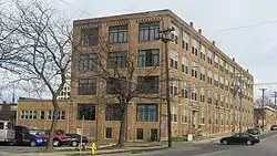 Oesterlein Machine Company-Fashion Frocks, Inc. Complex |
October 27, 2005 (#05001186) |
3301 Colerain Ave., 1326 Monmouth Ave. 39°08′36″N 84°32′20″W / 39.143333°N 84.538889°W |
|
| 56 | Ohio National Guard Armory | 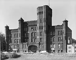 Ohio National Guard Armory |
March 3, 1980 (#80003069) |
1437-1439 Western Ave. 39°06′41″N 84°31′57″W / 39.111389°N 84.5325°W |
|
| 57 | Old College Hill Post Office | 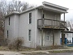 Old College Hill Post Office |
June 16, 1976 (#76001437) |
1624 Pasadena Ave. 39°11′32″N 84°32′49″W / 39.192222°N 84.546944°W |
|
| 58 | Our Lady of Mercy High School | 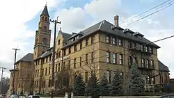 Our Lady of Mercy High School |
March 3, 1980 (#80003070) |
1409 Western Ave. 39°06′39″N 84°31′57″W / 39.110833°N 84.5325°W |
|
| 59 | Over-the-Rhine Historic District |  Over-the-Rhine Historic District |
May 17, 1983 (#83001985) |
Roughly bounded by Dorsey, Sycamore, Liberty, Reading, Central Parkway, McMicken Ave., and Vine Sts.; 308-322, 500-550 Reading Rd., 222 W. 12th St., 1208, 1416-1430, 1544, 1600, 1628, 1900 Central Pkwy. 39°06′52″N 84°30′54″W / 39.114444°N 84.515°W |
Extends into eastern Cincinnati. Second set of addresses represents a boundary increase on 2014-06-13. |
| 60 | Parkside Apartments | 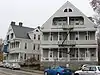 Parkside Apartments |
February 28, 2008 (#08000116) |
3315-3317 Jefferson Ave. 39°08′27″N 84°30′50″W / 39.140833°N 84.513889°W |
|
| 61 | Pinecroft | 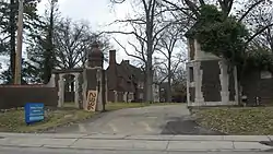 Pinecroft |
December 17, 2008 (#08001197) |
2336 Kipling Ave. 39°12′10″N 84°34′13″W / 39.202639°N 84.570278°W |
|
| 62 | Police Station No. 3 | 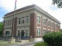 Police Station No. 3 |
May 18, 1981 (#81000435) |
3201 Warsaw Ave. 39°06′34″N 84°33′47″W / 39.109444°N 84.563056°W |
|
| 63 | Police Station No. 5 | 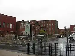 Police Station No. 5 |
March 3, 1980 (#80003075) |
1024-1026 York St. 39°07′04″N 84°31′57″W / 39.117778°N 84.5325°W |
|
| 64 | Police Station No. 7 | 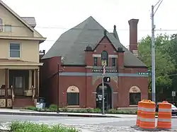 Police Station No. 7 |
May 18, 1981 (#81000437) |
355 McMillan St. 39°07′41″N 84°31′31″W / 39.128056°N 84.525278°W |
|
| 65 | Probasco Fountain | 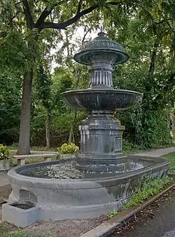 Probasco Fountain |
March 3, 1980 (#80003077) |
Clifton Ave. 39°09′02″N 84°31′07″W / 39.150556°N 84.518611°W |
|
| 66 | Henry Probasco House |  Henry Probasco House |
November 9, 1972 (#72001022) |
430 W. Cliff Lane 39°09′29″N 84°31′26″W / 39.158056°N 84.523889°W |
|
| 67 | Heinrich A. Rattermann House |  Heinrich A. Rattermann House |
May 23, 1980 (#80003080) |
510 York St. 39°07′02″N 84°31′25″W / 39.117222°N 84.523611°W |
|
| 68 | Rawson House | 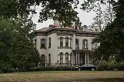 Rawson House |
July 24, 1973 (#73001465) |
3767 Clifton Ave. 39°09′08″N 84°31′10″W / 39.152222°N 84.519444°W |
|
| 69 | Regal Theater | September 5, 2023 (#100009302) |
1201 Linn St. 39°06′29″N 84°31′41″W / 39.1081°N 84.5281°W |
||
| 70 | William Resor House | 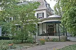 William Resor House |
March 7, 1973 (#73001466) |
254 Greendale Ave. 39°09′06″N 84°31′01″W / 39.151667°N 84.516944°W |
|
| 71 | Charles B. Russell House | 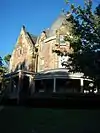 Charles B. Russell House |
March 3, 1980 (#80003081) |
3416 Brookline Ave. 39°08′35″N 84°30′54″W / 39.143056°N 84.515°W |
|
| 72 | Sacred Heart Academy |  Sacred Heart Academy |
April 11, 1973 (#73001467) |
525 Lafayette St. 39°09′11″N 84°31′38″W / 39.153056°N 84.527222°W |
|
| 73 | St. Aloysius-on-the-Ohio | 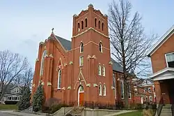 St. Aloysius-on-the-Ohio |
December 23, 2014 (#14001075) |
134 Whipple St., 6207, 6214, and 6218 Portage St., and 6206 Gracely Dr. 39°06′20″N 84°41′04″W / 39.105556°N 84.684444°W |
|
| 74 | St. Francis Hospital | 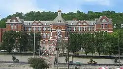 St. Francis Hospital |
April 19, 1984 (#84003714) |
1860 Queen City Ave. 39°07′37″N 84°33′37″W / 39.126944°N 84.560278°W |
|
| 75 | St. George Parish and Newman Center | 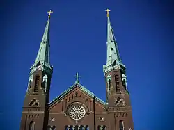 St. George Parish and Newman Center |
March 3, 1980 (#80003088) |
42 Calhoun St. 39°07′43″N 84°30′45″W / 39.128611°N 84.512500°W |
|
| 76 | St. Patrick's Catholic Church | 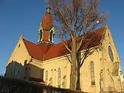 St. Patrick's Catholic Church |
December 4, 1978 (#78002081) |
1662 Blue Rock 39°09′38″N 84°32′30″W / 39.160556°N 84.541667°W |
|
| 77 | St. Peter's Lick Run Historic District | 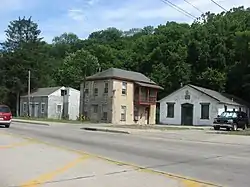 St. Peter's Lick Run Historic District |
October 4, 1989 (#89001453) |
2145-2153 Queen City Ave. 39°07′39″N 84°34′20″W / 39.127500°N 84.572222°W |
|
| 78 | George F. Sands School | .jpg.webp) George F. Sands School |
August 24, 2017 (#100001507) |
940 Poplar St. 39°06′55″N 84°31′52″W / 39.115344°N 84.53098°W |
|
| 79 | Scarlet Oaks | 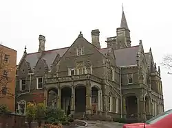 Scarlet Oaks |
March 7, 1973 (#73001468) |
440 Lafayette Ave. 39°09′25″N 84°31′32″W / 39.156944°N 84.525556°W |
|
| 80 | George Scott House | 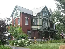 George Scott House |
March 3, 1980 (#80003084) |
565 Purcell Ave. 39°06′11″N 84°33′55″W / 39.103056°N 84.565278°W |
|
| 81 | Sedamsville River Road Historic District | 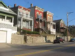 Sedamsville River Road Historic District |
October 10, 2008 (#08000975) |
2449-2734 River Rd., 309-317 Mt. Hope Ave., and 604 Mt. Echo Park Dr. 39°05′44″N 84°33′32″W / 39.095556°N 84.55875°W |
|
| 82 | Sedamsville Village Historic District | 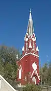 Sedamsville Village Historic District |
July 3, 2012 (#12000393) |
Steiner, Delhi, and Fairbanks Aves., and Sedam and Edwin Sts. 39°05′32″N 84°34′20″W / 39.092222°N 84.572222°W |
|
| 83 | Short Woods Park Mound |  Short Woods Park Mound |
October 1, 1974 (#74001521) |
Northern side of Sayler Park[6] 39°07′17″N 84°41′42″W / 39.1213°N 84.695°W |
|
| 84 | Spring Grove Cemetery | 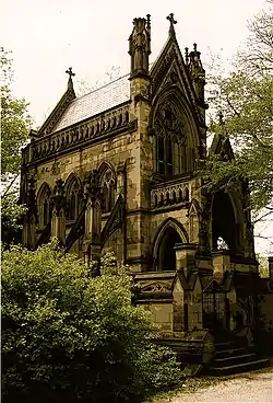 Spring Grove Cemetery |
May 13, 1976 (#76001440) |
4521 Spring Grove Ave. 39°10′11″N 84°31′32″W / 39.1697°N 84.5256°W |
|
| 85 | Spring Grove Cemetery Chapel | 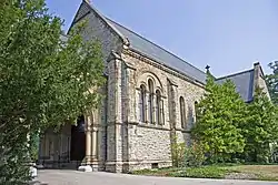 Spring Grove Cemetery Chapel |
March 3, 1980 (#80003086) |
4521 Spring Grove Ave. 39°09′52″N 84°31′25″W / 39.1644°N 84.5236°W |
|
| 86 | Story Mound | 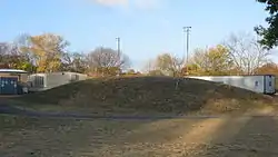 Story Mound |
June 11, 1975 (#75001436) |
Gracely Dr.[7] 39°07′01″N 84°41′21″W / 39.1169°N 84.6893°W |
In Sayler Park |
| 87 | Peter G. Thomson House |  Peter G. Thomson House |
November 29, 1979 (#79001860) |
5870 Belmont Ave. 39°11′56″N 84°33′16″W / 39.1989°N 84.5544°W |
|
| 88 | Union Baptist Cemetery | 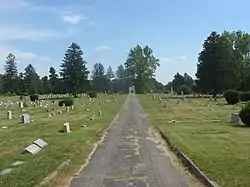 Union Baptist Cemetery |
September 20, 2002 (#02001057) |
4933 Cleves Warsaw Pike 39°07′00″N 84°36′10″W / 39.1167°N 84.6028°W |
|
| 89 | Warsaw Avenue Historic District | August 24, 2020 (#100005462) |
3104-3220 Warsaw Ave. 39°06′36″N 84°33′47″W / 39.1099°N 84.5630°W |
||
| 90 | Westwood Town Center Historic District | 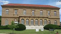 Westwood Town Center Historic District |
December 2, 1974 (#74001515) |
Epworth and Harrison Aves. 39°08′57″N 84°35′56″W / 39.1492°N 84.5989°W |
|
| 91 | Westwood United Methodist Church | 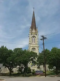 Westwood United Methodist Church |
March 3, 1980 (#80003090) |
Epworth and Urwiler Sts. 39°09′03″N 84°35′58″W / 39.1508°N 84.5994°W |
|
| 92 | Samuel and Sally Wilson House | 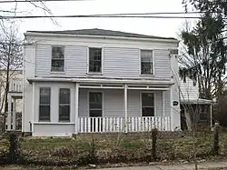 Samuel and Sally Wilson House |
November 15, 2000 (#00001295) |
1502 Aster Place 39°11′31″N 84°32′40″W / 39.1919°N 84.5444°W |
|
| 93 | Winton Place Methodist Episcopal Church | 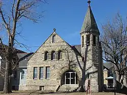 Winton Place Methodist Episcopal Church |
March 3, 1980 (#80003091) |
700 E. Epworth Ave. 39°10′24″N 84°30′59″W / 39.1733°N 84.5164°W |
|
| 94 | Winton Terrace Historic District | March 6, 2023 (#100008657) |
4848,4802-5070 and 4803-5089 Winneste Ave., 402-512 Kings Run Dr., 4703-4861 Este Ave., 1-293 Craft St., 3-59 Kings Run Ct., and 3-110 Topridge Pl. 39°10′43″N 84°30′35″W / 39.1786°N 84.5097°W |
||
| 95 | Daniel Thew Wright House | 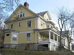 Daniel Thew Wright House |
September 28, 1982 (#82003590) |
3716 River Rd. 39°04′45″N 84°35′46″W / 39.0792°N 84.5961°W |
Former listings
| [3] | Name on the Register | Image | Date listed | Date removed | Location | Description |
|---|---|---|---|---|---|---|
| 1 | William Salway House | March 3, 1980 (#80003082) | October 29, 1985 | Gray and Winton Rds. |
||
| 2 | Sayler House | December 4, 1973 (#73002285) | September 30, 1976 | 6901 Gracely Dr. |
Severely damaged by an F5 tornado during the April 3, 1974 Super Outbreak.[8] |
See also
Notes
^ a: Stated more precisely, this list includes the portions of the city located west of a line running along Interstate 75 from the Ohio River to Central Parkway, east to Vine Street, and north to the city's northern edge.
References
- ↑ The latitude and longitude information provided in this table was derived originally from the National Register Information System, which has been found to be fairly accurate for about 99% of listings. Some locations in this table may have been corrected to current GPS standards.
- ↑ National Park Service, United States Department of the Interior, "National Register of Historic Places: Weekly List Actions", retrieved January 5, 2024.
- 1 2 Numbers represent an alphabetical ordering by significant words. Various colorings, defined here, differentiate National Historic Landmarks and historic districts from other NRHP buildings, structures, sites or objects.
- ↑ "National Register Information System". National Register of Historic Places. National Park Service. April 24, 2008.
- ↑ The eight-digit number below each date is the number assigned to each location in the National Register Information System database, which can be viewed by clicking the number.
- ↑ Location derived from Mills, William C. Archeological Atlas of Ohio. Columbus: Ohio State Archeological and Historical Society, 1914, 1914, page 31 and plate 31. The NRIS lists the site as "Address Restricted".
- ↑ Location derived from its Federal Register notice; the NRIS lists the site as "Address Restricted"
- ↑ "Visions of past glory as a landmark dies". The Cincinnati Post. October 12, 1974. p. 29. Retrieved August 15, 2022 – via Newspapers.com.
