Miiru | |
|---|---|
| Meru County | |
 Lake Michaelson is in the background | |
 Flag  Coat of arms | |
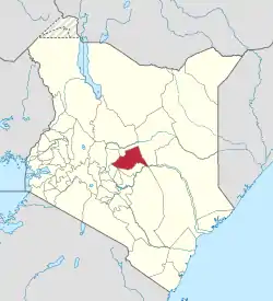 Location of Meru County in Kenya | |
| Coordinates: 0°3′N 37°38′E / 0.050°N 37.633°E | |
| Country | |
| Formed | 4 March 2013 |
| Capital and largest town | Meru |
| Government | |
| • Governor | Kawira Mwangaza |
| Area | |
| • Total | 7,006 km2 (2,705 sq mi) |
| Population (2019)[1] | |
| • Total | 1,545,714 |
| • Density | 220/km2 (570/sq mi) |
| Time zone | UTC+3 (EAT) |
| Website | meru |
Meru County is one of the 47 counties of Kenya. It borders Isiolo County to the north, Tharaka-Nithi County to the east, Nyeri County to the southwest and Laikipia County to the west. The home of the Meru people,[2] Meru County has a population of 1.35 million people.[3]
The county headquarters is in the town of Meru. The current governor of Meru County is Kawira Mwangaza of the Kenya Kwanza coalition.
Physical and topographic features
Mount Kenya (now politically divided between Meru and other counties) has been influenced by the climate of the coast, especially the eastern slopes of the mountain with altitude ranges from 300m to 5,199m above sea level. Many rivers have their streams originating from the mount Kenya and Nyambene streams. Tana and Ewaso Nyiro Rivers are used for domestic and agricultural use.[4]
When Kenya replaced its provinces with counties, Meru County was created out of the Eastern Province. It covers a total area of 7,006 km2 out of which 972.3 km2 is gazetted as forest.[5]
Climatic conditions
Annual rainfall ranges between 300 mm annually on the lower midlands to 2500 mm in the southeast. Long rains fall from mid-March to May and short rains are present from October to December.[6]
Demographics
As of the 2019 census, the county has a total population of 987,653 of which 489,691 are males, 497,942 females and 20 intersex persons. There are 244,669 household with an average household size of 4.0 persons per household.[7]
Religion
Religion in Meru County [8]
| Religion (2019 Census) | Number |
|---|---|
| Catholicism | 313,277 |
| Protestant | 615,129 |
| Evangelical Churches | 365,759 |
| African instituted Churches | 129,224 |
| Orthodox | 9,479 |
| Other Christian | 45,405 |
| Islam | 12,531 |
| Hindu | 336 |
| Traditionists | 18,898 |
| Other | 20,985 |
| No Religion Atheists | 12,551 |
| Don't Know | 2,348 |
| Not Stated | 242 |
Administrative and political units
Administrative units
Meru County has nine sub counties, thirty five divisions, one hundred and sixty one locations and three hundred and eighty six sub-locations.[9] It has nine constituencies and forty five county assembly wards.[10]
Sub-counties
- Buuri East
- Buuri West
- Igembe North
- Igembe South
- Igembe Central
- Imenti North
- Imenti South
- Imenti Central
- Tigania East
- Tigania West
Constituencies
Political leadership
The first governor of Meru County was Peter Munya, elected in the 2013 election.[11][12] In the 2017 election, Kiraitu Murungi defeated Munya to become the second governor.[13][14] The third and current governor, Kawira Mwangaza, was elected in the 2022 election.
Murungi was elected in 2013 to be the senator from Meru County. When he ran for governor, Franklin Linturi was elected to the Senate.[15][16]
Florence Kajuju was the county's first woman representative.[17] She was defeated in 2017 by Kawira Mwangaza.[18][19]
The Meru County Executive Committee comprises:[20]
| Number | |
|---|---|
| Governor | 1 |
| Deputy Governor | 1 |
| County Secretary | 1 |
| Other members | 10 |
| Total | 13 |
Source[21]
Education
There are 1,437 ECD centres, 1,030 primary schools and 372 secondary schools. The county has also 7 tertiary institutions, 6 special schools 7,483 adult education centres and 7 university campuses. Meru University of Science and Technology and Meru National Polytechnic[22] are the largest education centers in Meru County.[23]
Health
There is a total of 460 health facilities, 995 hospital beds and 73 cots in the county, staffed by 1325 health personnel.[24]
HIV prevalence rate was 2.9% in 2017, lower than the national rate of 5.9%.[25]
Transport
The county is covered by 1,260 km of road network. Of this, 767.5 km is covered by earth surface, 266.7 km is marram surface and 225.7 km of surface is covered by bitumen.[26][27] During the rainy seasons, some sections of gravel and earth surface roads are impassable.
The county is served by one airstrip; Gaitu airstrip in Meru Central.
Posts and telecommunications
There are six post offices and four sub-post offices with 7,600 installed letter boxes, 5,937 rented letter boxes, and 1,663 vacant letter boxes with numerous registered stamp vendors in the county. The six post offices are located in Meru, Maua, Nkubu, Timau, Muthara and Laare. They offer mail services, parcel delivery and other services. Most private and public organizations have embraced ICT in the day-to-day operations. Private entrepreneurs have continued to set up cyber cafes in major towns and trading centers due to high demand for internet services among others. Most of the areas in the county are covered by mobile phone network with the coverage being 95 per cent. Areas without mobile network coverage are mainly areas of Tigania bordering Isiolo County. Most of the community members rely on radio, television and newspapers as the major sources of information.
History
In 1992, Meru District was split into Meru Central District, Meru North District, Meru South District, and Tharaka District[28] In 1998, Tharaka District was again split into Nithi District and Tharaka District. A High Court decision in September 2009 ruled that the split had been unconstitutional, and the first two of these were re-amalgamated into Meru District, which became Meru County in 2010.
Population
| Year | Pop. | ±% |
|---|---|---|
| 1999 | 1,102,930 | — |
| 2009 | 1,356,301 | +23.0% |
| 2019 | 1,545,714 | +14.0% |
| source:[29] | ||
| Constituency Name | Number of wards | Wards |
|---|---|---|
| Imenti North | 5 | Municipality, Ntima East, Ntima West, Nyaki East, Nyaki West |
| Imenti South | 6 | Abogeta East, Abogeta West, Igoji West, Igoji East, Nkuene, Mitunguu |
| Imenti Central | 4 | Abothuguchi Central, Abothuguchi West, Kiagu, Mwanganthia |
| Buuri | 5 | Kiirua Naari, Timau, Kisima, Kibirichia, Ruiri Rwarera |
| Tigania West | 5 | Kianjai, Nkomo, Mbeu, Akiithi, Athwana |
| Tigania East | 5 | Muthara, Special, Karama, Kiguchwa, Mikinduri, Thangatha |
| Igembe Central | 5 | Kangeta, Njia, Igembe East, Akirang'ondu, Athiru Ruujine |
| Igembe South | 5 | Akachiu, Kanuni, Kegoi Antobuchiu, Maua, Athiru Gaiti |
| Igembe North | 5 | Amwathi, Naathu, Antubetwe Kiongo, Antuambui, Ntuene |
| Total | 45 |
Villages and settlements
References
- ↑ Munene, Evans (4 November 2019). "2019 Kenya Population and Housing Census Results". Kenya National Bureau of Statistics. Retrieved 30 May 2020.
- ↑ "Meru County Government". Meru County Government. Retrieved 28 May 2020.
- ↑ "About Meru – Discover Meru County". Retrieved 28 May 2020.
- ↑ Meru County Integrated Development Plan CIDP 2018-2022. Meru County. 2018. p. 3.
- ↑ Meru County Integrated Development Plan CIDP 2018-2022. Mer County. 2018. p. 2.
- ↑ "CoG Reports". www.cog.go.ke. Retrieved 30 May 2020.
- ↑ Munene, Evans (4 November 2019). "2019 Kenya Population and Housing Census Results". Kenya National Bureau of Statistics. Retrieved 30 May 2020.
- ↑ "2019 Kenya Population and Housing Census Volume IV: Distribution of Population by Socio-Economic Characteristics" (PDF). Kenya National Bureau of Statistics. Retrieved 2 May 2021.
- ↑ "Ministry of Interior and Coordination of National Government". Ministry of Interior and Coordination of National Government. Archived from the original on 2 May 2020. Retrieved 30 May 2020.
- ↑ "The Report of the Interim Independent Boundaries Review Commission (IIBRC): Delimitation of Constituencies and Recommendations on Local Authority Electoral Units and Administrative Boundaries for Districts and Other Units" (PDF). Interim Independent Boundaries Review Commission. 2010. Retrieved 30 May 2020.
- ↑ "Peter Munya". Mzalendo. Retrieved 30 May 2020.
- ↑ "Kiunjuri sacked, Munya replaces him in new Cabinet changes - County Review". www.countyreview.co.ke. Retrieved 30 May 2020.
- ↑ "Kiraitu Murungi". Mzalendo. Retrieved 30 May 2020.
- ↑ "Governors & Deputy Governors". cog.go.ke. Retrieved 30 May 2020.
- ↑ "Franklin Mithika Linturi". Mzalendo. Retrieved 30 May 2020.
- ↑ "Members of the Senate | The Kenyan Parliament Website". www.parliament.go.ke. Retrieved 30 May 2020.
- ↑ "Women Representatives | KEWOPA KENYA". Retrieved 30 May 2020.
- ↑ "Kawira Mwangaza Mwenda". Mzalendo. Retrieved 30 May 2020.
- ↑ "Florence Kajuju". Mzalendo. Retrieved 30 May 2020.
- ↑ "179. County executive committees - Kenya Law Reform Commission (KLRC)". www.klrc.go.ke. Retrieved 30 May 2020.
- ↑ "179. County executive committees - Kenya Law Reform Commission (KLRC)". www.klrc.go.ke. Retrieved 30 May 2020.
- ↑ The Meru National Polytechnic. "History [of The Meru National Polytechnic]". Retrieved 7 January 2024.
- ↑ "Meru County Government". Meru County Government. Retrieved 30 May 2020.
- ↑ "Meru County Government". Meru County Government. Retrieved 30 May 2020.
- ↑ "Kenya HIV Estimates Report 2018" (PDF). National AIDS Control Council. 2018. Archived from the original (PDF) on 4 September 2020. Retrieved 30 May 2020.
- ↑ "Kenya Urban Roads Authority". kura.go.ke. Archived from the original on 22 April 2020. Retrieved 30 May 2020.
- ↑ "Kenya Urban Roads Authority". www.kerra.go.ke. Archived from the original on 27 July 2020. Retrieved 30 May 2020.
- ↑ "About Meru County in Kenya". www.kenya-information-guide.com. Retrieved 28 May 2020.
- ↑ Kenya: Administrative Division population statistics