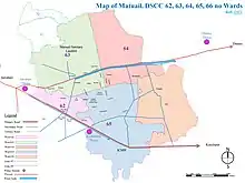
Map of Matuail
Matuail is located in Dhaka South City Corporation (DSCC), Ward no. 62(part), 63, 64, 65 & 66(part), Dhaka Division, Bangladesh. It is also located on the South side of Dhaka–Chittagong Highway and on the North side of Dhaka-Sylhet (Old Dhaka-Demra) Highway. Its geographical coordinates are 23° 43' 0" North, 90° 28' 0" East and its original name (with diacritics) is Mātuail. Its zip code is 1362. Its area is 10.16 square kilometres (3.92 sq mi). The area is about 6 kilometres (3.7 mi) away from Motijheel.
References
This article is issued from Wikipedia. The text is licensed under Creative Commons - Attribution - Sharealike. Additional terms may apply for the media files.