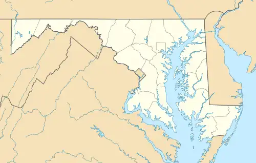
Maryland’s 54 State Parks (Hover mouse over pog to popup clickable link)
This list of Maryland state parks includes the state parks and state battlefields listed in the Maryland Department of Natural Resources's current acreage report.[1] Generally, the Maryland Park Service, a unit of and under the authority of the Maryland Department of Natural Resources (DNR), is the governing body for these parks, although some have been turned over to local authorities.
Maryland state parks
| Name[2] | County | Area[1] | Estab- lished |
River / lake / other | Remarks | Image | |
|---|---|---|---|---|---|---|---|
| acres | ha | ||||||
| Assateague State Park | Worcester | 855 acres | 346 ha | 1956 | Atlantic Ocean | Barrier island with swimming, beachcombing, sunbathing, surfing and fishing | 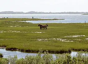 |
| Big Run State Park | Garrett | 300 acres | 120 ha | Savage River Reservoir | Camping, fishing, flat water canoeing, hiking trails, picnicking | 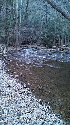 | |
| Bill Burton Fishing Pier State Park | Dorchester, Talbot | 24 acres | 9.7 ha | 1987 | Choptank River | Fishing, hiking, cycling | |
| Bohemia River State Park | Cecil | 460 acres | 190 ha | 2022 | Great Bohemia Creek | Hiking, biking, canoeing, kayaking, wildlife viewing, fishing | |
| Calvert Cliffs State Park | Calvert | 1,311 acres | 531 ha | 1960s | Chesapeake Bay | Fossil hunting, hiking trails, fishing, hunting, picnicking, youth group camping, playground, shelters. | 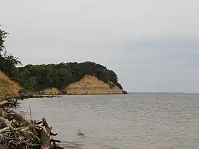 |
| Casselman River Bridge State Park | Garrett | 4 acres | 1.6 ha | 1957 | Casselman River | Historic bridge; popular fishing location |  |
| Chapel Point State Park | Charles | 821 acres | 332 ha | 1972 | Port Tobacco River | Largely undeveloped; features fishing and hunting | 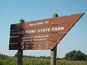 |
| Chapman State Park | Charles | 829 acres | 335 ha | 1998 | Potomac River | Home of Mount Aventine; fishing, hunting, hiking trails | 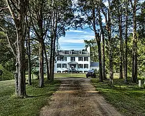 |
| Cunningham Falls State Park | Frederick | 6,080 acres | 2,460 ha | 1954 | Big Hunting Creek | Includes the Catoctin Furnace; features boating, fishing, swimming, playground, trails, hunting, and picnicking |  |
| Cypress Branch State Park | Kent | 314 acres | 127 ha | 2022 | Includes a picnic area near a 3-acre fishing pond. | ||
| Dans Mountain State Park | Allegany | 482 acres | 195 ha | 1970s | Olympic-sized swimming pool with waterslide and refreshment stand; fishing, hiking, picnic areas, playground, pavilions | ||
| Deep Creek Lake State Park | Garrett | 1,169 acres | 473 ha | 2000 | Deep Creek Lake | Boating and fishing on Maryland's largest man-made lake, camping, hunting, hiking trails |  |
| Elk Neck State Park | Cecil | 2,369 acres | 959 ha | 1936 | Chesapeake Bay | Home of Turkey Point Light; beach, picnicking, seasonal convenience store, camping, cabins, nature center, trails for hiking and biking, hunting, various water sports | 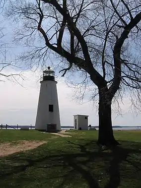 |
| Fort Frederick State Park | Washington | 722 acres | 292 ha | 1922 | Potomac River, Big Pool Lake | Stone fortification built by colonial Province of Maryland from the French and Indian War (1754-1763); visitors center, picnicking, boating, fishing, hiking, camping | |
| Fort Tonoloway State Park | Washington | 26 acres | 11 ha | Undeveloped | |||
| Franklin Point State Park | Anne Arundel | 484 acres | 196 ha | 1999 | Chesapeake Bay | Undeveloped | |
| Gambrill State Park | Frederick | 1,207 acres | 488 ha | 1934 | Picnicking, hiking, mountain biking, horseback riding, fishing pond, camping | 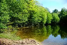 | |
| Gathland State Park | Frederick, Washington | 140 acres | 57 ha | 1949 | Former estate of George Alfred Townsend; museum, visitors center, picnicking, hiking on the Appalachian Trail |  | |
| Greenbrier State Park | Frederick, Washington | 1,420 acres | 570 ha | 1964 | Greenbrier Lake | Swimming, fishing, boating, boat rental, camping, camp store, hiking, picnicking, playground, Appalachian Trail | 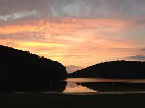 |
| Greenwell State Park | St. Mary's | 596 acres | 241 ha | 1971 | Patuxent River | Historic Rosedale Manor House; picnicking, swimming, non-motorized boating, hiking, equestrian and cycling trails, fishing, hunting | .jpg.webp) |
| Gunpowder Falls State Park | Baltimore, Harford | 14,949 acres | 6,050 ha | 1959 | Gunpowder River, Dundee Creek | Multiple non-contiguous recreational areas: Picnicking, hiking, biking, horseback riding, cross-country skiing, hunting, various water sports | 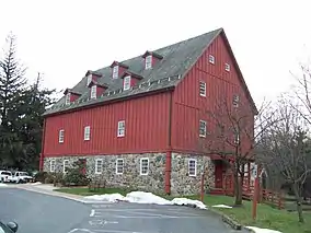 |
| Hallowing Point Waterfront Park | Calvert | 13 acres | 5.3 ha | 2017 | Patuxent River | Opening 2022; on Route 231, on the Calvert County side of the Patuxent River Bridge | |
| Harriet Tubman Underground Railroad State Park | Dorchester | 17 acres | 6.9 ha | 2007 | Dedicated to the life and work of abolitionist and Underground Railroad activist Harriet Tubman; opened in 2017 | 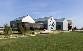 | |
| Hart-Miller Island State Park | Baltimore | 244 acres | 99 ha | 1977 | Back River Chesapeake Bay | Accessible only by boat; 3,000-foot (910 m) sandy beach | 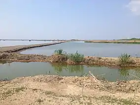 |
| Herrington Manor State Park | Garrett | 365 acres | 148 ha | 1964 | Herrington Creek | Swimming, non-motorized boating, picnicking, hiking, tennis, volleyball, cabins | |
| Janes Island State Park | Somerset | 3,160 acres | 1,280 ha | 1963 | Chesapeake Bay | Visitors center, conference center, picnicking, cabins, camping, camp store, various water sports | |
| Love Point State Park | Queen Anne's | 76 acres | 31 ha | 2007 | Chesapeake Bay | Undeveloped | |
| Martinak State Park | Caroline | 105 acres | 42 ha | 1961 | Choptank River, Watts Creek | Fishing, camping, boating, hiking, nature center | 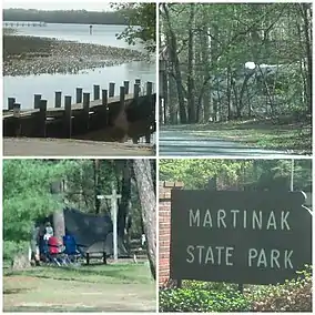 |
| Matapeake State Park | Queen Anne's | 21 acres | 8.5 ha | 2009 | Chesapeake Bay | Beach; leased by Queen Anne's County | 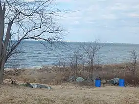 |
| Matthew Henson State Park | Montgomery | 100 acres | 40 ha | 1989 | Greenway for hiking and biking | 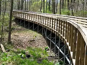 | |
| New Germany State Park | Garrett | 483 acres | 195 ha | Swimming, fishing, picnicking, boat launch, boat rental, canoeing, camping, cabins, hiking trail, cross-country skiing, nature center | 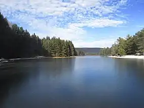 | ||
| Newtowne Neck State Park | St. Mary's | 794 acres | 321 ha | 2009 | Potomac River | Non-motorized boating, hiking, picnicking, fishing |  |
| North Point State Park | Baltimore | 1,328 acres | 537 ha | 1987 | Back River, Patapsco River, Chesapeake Bay | Former site of the Bay Shore Amusement Park; visitors center, swimming, hiking and biking trails, pier and shore fishing, picnicking |  |
| Palmer State Park | Harford | 590 acres | 240 ha | 1965 | Deer Creek | Undeveloped; hiking, fishing, canoeing | |
| Patapsco Valley State Park | Anne Arundel, Baltimore, Carroll, Howard | 14,270 acres | 5,770 ha | 1907 | Upper Patapsco River | Hiking, horseback and mountain bike trails, picnicking, canoeing, fishing, camping, historical touring |  |
| Patuxent River State Park | Howard, Montgomery | 6,703 acres | 2,713 ha | 1963 | Patuxent River | Hunting, fishing, hiking and horseback riding. | 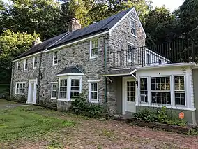 |
| Pocomoke River State Park | Worcester | 916 acres | 371 ha | 1939 | Pocomoke River | Visitors center, swimming pool, biking and hiking trails, boat launch, boat rental, fishing, flat water canoeing, camping, camp store, picnicking | .jpg.webp) |
| Point Lookout State Park | St. Mary's | 1,079 acres | 437 ha | 1963 | Chesapeake Bay, Potomac River | American Civil War prisoner-of-war camp museum/Marshland Nature Center, swimming, picnicking, boat launch, boat rental, camping, cabins, camp store, fishing, canoeing, hiking trails, hunting | 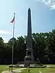 |
| Rocks State Park | Harford | 1,060 acres | 430 ha | 1949 | Deer Creek | Fishing, hiking, picnicking, wading, canoeing and tubing, bow hunting, rock climbing, repelling | 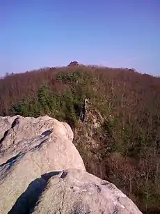 |
| Rocky Gap State Park | Allegany | 3,119 acres | 1,262 ha | 1963 | Lake Habeeb | Boating, camping, fishing, hiking | 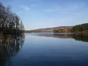 |
| Rosaryville State Park | Prince George's | 1,039 acres | 420 ha | 1976 | Mount Airy Mansion; trails for hiking, biking and equestrians |  | |
| Sandy Point State Park | Anne Arundel | 786 acres | 318 ha | 1948 | Chesapeake Bay | Swimming, fishing, crabbing, boating, picnicking, windsurfing | |
| Sang Run State Park | Garrett | 81 acres | 33 ha | 2017 | 1800s homestead and store | ||
| Seneca Creek State Park | Montgomery | 6,313 acres | 2,555 ha | 1958 | Seneca Creek | Black Rock Mill, Seneca Schoolhouse; boating, fishing, picnicking, disc golf | 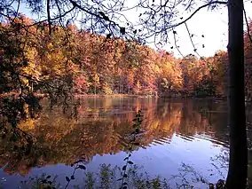 |
| Sideling Hill Creek State Park | Allegany | 865 acres | 350 ha | 2022 | Potomac River | Forest land, trails, rare species | |
| Smallwood State Park | Charles | 984 acres | 398 ha | 1958 | Mattawoman Creek | "Smallwood's Retreat" historic site; marina, picnicking, camping, nature trails | 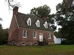 |
| South Mountain State Park | Frederick, Washington | 7,520 acres | 3,040 ha | Runs the length of South Mountain; Appalachian Trail; contiguous with other national, state and local parks | 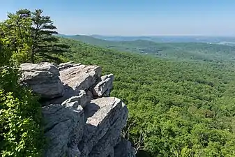 | ||
| St. Clement's Island State Park | St. Mary's | 62 acres | 25 ha | 1962 | Potomac River | Only accessible by boat; reconstructed lighthouse, memorial to first Marylanders landing March 25, 1634 (Maryland Day); hiking, picnicking, fishing | 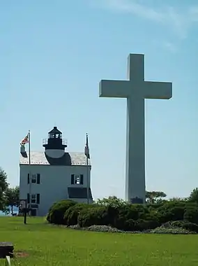 |
| St. Mary's River State Park | St. Mary's | 2,643 acres | 1,070 ha | 1968 | St. Mary's Lake | Hiking, horseback and biking trails, picnicking, boat launch, canoeing, fishing, hunting | |
| Susquehanna State Park | Cecil, Harford | 2,753 acres | 1,114 ha | 1958 | Susquehanna River, Upper Chesapeake Bay | Rock Run Historical Area; fishing, camping, picnicking, boating, hiking trails |  |
| Swallow Falls State Park | Garrett | 257 acres | 104 ha | 1930s | Youghiogheny River | Camping, hiking, picnicking, nature programs | 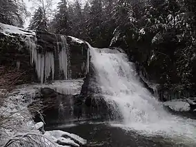 |
| Tuckahoe State Park | Caroline, Queen Anne's | 3,949 acres | 1,598 ha | 1963 | Tuckahoe Creek | Hiking, biking and equestrian trails, canoeing, picnicking, camping, cabins, hunting, archery | .jpg.webp) |
| Washington Monument State Park | Frederick, Washington | 191 acres | 77 ha | 1934 | 1827 stone monument to first President George Washington by citizens of nearby Boonsboro; picnicking, hiking on the Appalachian Trail |  | |
| Wills Mountain State Park | Allegany | 371 acres | 150 ha | 1998 | Undeveloped |  | |
| Wolf Den Run State Park | Garrett | 1,986 acres | 804 ha | 2018 | Three parcels near Kitzmiller | ||
| Wye Oak State Park | Talbot | 29 acres | 12 ha | 1939 | Site of celebrated oak tree lost in 2002; picnicking | 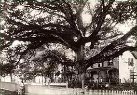 | |
Maryland state battlefields
| Name | County | Area[1] | Estab- lished |
Image | Remarks | |
|---|---|---|---|---|---|---|
| acres | ha | |||||
| North Point State Battlefield | Baltimore | 9 acres | 3.6 ha | 2015 | Preserves undeveloped land where War of 1812's Battle of North Point in the larger Battle of Baltimore on September 12, 1814 (Defenders Day) was fought with the invading British Army. | |
| South Mountain State Battlefield | Frederick, Washington | 2,465 acres | 998 ha | 1984 | Civil War historic site of Battle of South Mountain in the Maryland Campaign, September 1862 | |
Maryland natural resources management areas
| Name | County | Area[1] | Estab- lished |
River / lake / other | Remarks | Image | |
|---|---|---|---|---|---|---|---|
| acres | ha | ||||||
| Deep Creek Lake Natural Resources Management Area | Garrett | 3,900 acres | 1578.3 ha | Deep Creek Lake | Boating | .jpg.webp) | |
| Fair Hill Natural Resources Management Area | Cecil | 5,656 acres | 2288.9 ha | 1975 | Horse riding, camping, hunting | ||
| Merkle Natural Resources Management Area and Visitor Center | Prince George's | 1,670 acres | 675.8 ha | Chesapeake Bay | |||
| Monocacy River Natural Resources Area | Frederick | 1,800 acres | 728.4 ha | 1975[3] | Monocacy River | Hunting, fishing, hiking and horseback riding |  |
| Morgan Run Natural Environment Area | Carroll | 2,000 acres | 809.4 ha | 1975[4] | |||
| Sassafras Natural Resources Management Area | Kent | 1,200 acres | 485.6 | Sassafras River, Chesapeake Bay | Hiking, mountain biking, birding, horseback riding | ||
| Woodmont Natural Resources Management Area | Washington | 3,425 acres | 1,386 ha | 1995 | c/o Fort Frederick State Park | Formerly as Woodmont Rod & Gun Club property | |
| Wye Island Natural Resources Management Area | Queen Anne's | 2,450 acres | 991.5 ha | ||||
| Youghiogheny Wild River Natural Environmental Area | Garrett | ||||||
Other Maryland state areas
| Name | County | Area[1] | Estab- lished |
Remarks | Image | |
|---|---|---|---|---|---|---|
| acres | ha | |||||
| Helen Avalynne Tawes Garden | Anne Arundel | 5 acres | 2 ha | |||
| Jefferson Patterson Park & Museum | Calvert | 560 acres | 226.6 ha | 1983[5] | Hiking, exhibits, educational programs |  |
| Western Maryland Rail Trail | Washington | 1906 | 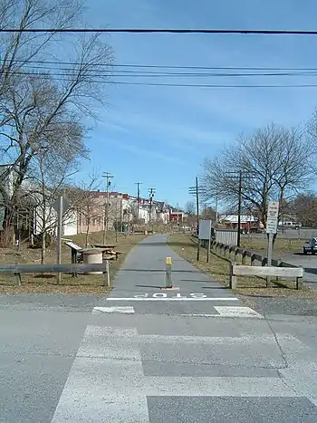 | |||
Former Maryland state parks
- The former Jonas Green State Park was transferred to Anne Arundel County and became Jonas and Anne Catharine Green Park.
See also
References
- 1 2 3 4 5 "DNR Lands Acreage Report" (PDF). Maryland Department of Natural Resources. 2022. p. 8. Retrieved March 3, 2023.
- ↑ "Maryland State Parks, by County". msa.maryland.gov. Retrieved December 29, 2022.
- ↑ Maryland, Preservation (October 5, 2016). "Live in History: Baxter Farm in the Monacacy National Resources Management Area". Preservation Maryland. Retrieved December 29, 2022.
- ↑ "Horseback Riding at Morgan Run Environmental Nature Area". hglanham.tripod.com. Retrieved January 2, 2023.
- ↑ "history". MDP, Jefferson Patterson Park and Museum. Retrieved January 2, 2023.
External links
Wikimedia Commons has media related to Maryland State Parks.
- State Park Directory Maryland Department of Natural Resources
- Maryland State Parks Maryland Manual On-Line, Maryland State Archives
This article is issued from Wikipedia. The text is licensed under Creative Commons - Attribution - Sharealike. Additional terms may apply for the media files.