This is a list of the heritage sites in Cape Town's CBD, the Waterfront, and the Bo-Kaap as recognized by the South African Heritage Resources Agency.[1][2]
For additional provincial heritage sites declared by Heritage Western Cape, the provincial heritage resources authority of the Western Cape Province of South Africa, please see the entries at the end of the list. These sites have been declared subsequent to the implementation of the new legislation on 1 April 2000 and unlike those in the SAHRA portion of the list are not former national monuments declared by the former National Monuments Council, the predecessor of both SAHRA and Heritage Western Cape. In the instance of these sites the "identifier" code used is that of Heritage Western Cape rather than SAHRA.
| SAHRA identifier | Site name | Description | Town | District | NHRA status | Coordinates | Image |
|---|---|---|---|---|---|---|---|
| 9/2/018/0003 | SAHRA, 111 Harrington Street, Cape Town | The building formerly known as Granite Lodge and the extension (for the two structures to form the St. George's Orphanage for Girls), now used as the Head Office of the SAHRA. Granite Lodge, a predominantly Georgian granite-fronted house was built c. 1834 for Anthony Oliphant, the first Attorney-General of the Cape Colony. Otto Landsberg, the famous artist and tobacconist, lived here from 1845 to 1865. Current use: Offices. | Cape Town, Central | The Cape | Provincial Heritage Site | 33°55′47″S 18°25′22″E / 33.929750°S 18.422803°E | 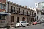 The building formerly known as Granite Lodge and the extension (for the two structures to form the St. George's Orphanage for Girls), now used as the Head Office of the SAHRA. Granite Lodge, a predominantly Georgian granite-fronted house was built c. 1834 for Anthony Oliphant, the first Attorney-General of the Cape Colony. Otto Landsberg, the famous artist and tobacconist, lived here from 1845 to 1865. Current use: Offices. |
| 9/2/018/0003-001 | Granite Lodge, 109 Harrington Street, Cape Town | Type of site: House. Current use: Offices. | Cape Town, Central | The Cape | Provincial Heritage Site | 33°55′47″S 18°25′22″E / 33.929744°S 18.422790°E |  Type of site: House. Current use: Offices. |
| 9/2/018/0003-002 | Old St George's Orphanage, Roeland Street, Cape Town | Type of site: House Current use: Offices. | Cape Town, Central | The Cape | Provincial Heritage Site | 33°55′47″S 18°25′22″E / 33.929678°S 18.422654°E |  Upload Photo |
| 9/2/018/0004/001 | Robben Island Embarkation Building, Victoria and Alfred Waterfront, Cape Town | Cape Town, Victoria and Alfred Waterfront | The Cape | Provincial Heritage Site | 33°54′15″S 18°25′16″E / 33.904240°S 18.421247°E |  | |
| 9/2/018/0007 | Tyne Building, 140, 142 and 148 Long Street, Cape Town | Current use: Commercial. | Cape Town, Central | The Cape | Provincial Heritage Site | 33°55′27″S 18°25′01″E / 33.924263°S 18.416936°E |  Current use: Commercial. |
| 9/2/018/0007-001 | 140 Long Street, Cape Town | Current use: Commercial. | Cape Town, Central | The Cape | Provincial Heritage Site | 33°55′27″S 18°25′02″E / 33.924080°S 18.417304°E |  Current use: Commercial. |
| 9/2/018/0007-002 | 142 Long Street, Cape Town | Current use: Commercial. | Cape Town, Central | The Cape | Provincial Heritage Site | 33°55′27″S 18°25′01″E / 33.924177°S 18.416998°E |  Current use: Commercial. |
| 9/2/018/0007-003 | 148 Long Street, Cape Town | Current use: Commercial. | Cape Town, Central | The Cape | Provincial Heritage Site | 33°55′27″S 18°25′01″E / 33.924266°S 18.416937°E |  Current use: Commercial. |
| 9/2/018/0009 | C H Pearne Building, 25 Adderley Street, Cape Town | Architectural style: EDWARDIAN INFL. Type of site: Commercial. | Cape Town, Central | The Cape | Provisional Protection | 33°55′27″S 18°25′16″E / 33.924181°S 18.421202°E |  Architectural style: EDWARDIAN INFL. Type of site: Commercial. |
| 9/2/018/0011 | 22 Kloof Street, Gardens, Cape Town | 33°55′40″S 18°24′44″E / 33.927790°S 18.412320°E | Upload Photo | ||||
| 9/2/018/0013 | Two reservoirs in Belvedere Avenue and Camp Street, Gardens, Cape Town | Type of site: Reservoir. | Cape Town, Gardens | The Cape | Provincial Heritage Site | 33°56′18″S 18°24′44″E / 33.938439°S 18.412198°E | 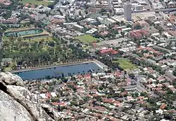 Type of site: Reservoir. |
| 9/2/018/0014 | Molteno Power Station, Molteno Road, Oranjezicht, Cape Town | Type of site: Power Station. | Cape Town, Oranjezicht | The Cape | Provincial Heritage Site | 33°56′19″S 18°24′37″E / 33.938518°S 18.410221°E | 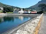 Type of site: Power Station. |
| 9/2/018/0015 | 59 Shortmarket Street, Cape Town | 33°55′17″S 18°25′07″E / 33.921419°S 18.418640°E | Upload Photo | ||||
| 9/2/018/0016 | 61 Shortmarket Street, Cape Town | 33°55′17″S 18°25′07″E / 33.921409°S 18.418607°E | Upload Photo | ||||
| 9/2/018/0017 | 63 Shortmarket Street, Cape Town | 33°55′17″S 18°25′07″E / 33.921376°S 18.418517°E | Upload Photo | ||||
| 9/2/018/0018 | 65 Shortmarket Street, Cape Town | 33°55′17″S 18°25′07″E / 33.921290°S 18.418479°E | Upload Photo | ||||
| 9/2/018/0019 | 76 Strand Street, Cape Town | Architectural style: Cape Dutch elements. Current use: Commercial. | Cape Town, Central | The Cape | Provincial Heritage Site | 33°55′11″S 18°25′14″E / 33.919756°S 18.420519°E | Upload Photo |
| 9/2/018/0020 | 78 Strand Street, Cape Town | Architectural style: Victorian elements. Current use: Commercial. | Cape Town, Central | The Cape | Provincial Heritage Site | 33°55′11″S 18°25′13″E / 33.919823°S 18.420299°E | Upload Photo |
| 9/2/018/0021 | Leinster Hall, 7 Weltevreden Street, Gardens, Cape Town | Leinster Hall was built in the 1850s by Sebastiaan Hofmeyr on a plot which previously formed part of the farm Weltevreden. The original part of the outbuildings was erected simultaneously. Type of site: House. Current use: Restaurant. | Cape Town, Gardens | The Cape | Provincial Heritage Site | 33°55′59″S 18°24′41″E / 33.932929°S 18.411353°E | Upload Photo |
| 9/2/018/0023 | 115 Hope Street, Erf 95743, Cape Town | 33°55′59″S 18°25′04″E / 33.933064°S 18.417888°E | Upload Photo | ||||
| 9/2/018/0025 | Old SA Leather Agency, 38 Buitenkant Street, Cape Town | 33°55′42″S 18°25′21″E / 33.928259°S 18.422459°E | Upload Photo | ||||
| 9/2/018/0026 | St George's Grammar School, Queen Victoria Street, Cape Town | Architectural style: Cape Revival elements. Type of site: School – the building housed St. George's Grammar School before it moved to Mowbray. | Cape Town, Central | The Cape | Provincial Heritage Site | 33°56′47″S 18°28′48″E / 33.946356°S 18.480020°E |  Architectural style: Cape Revival elements. Type of site: School – the building housed St. George's Grammar School before it moved to Mowbray. |
| 9/2/018/0027 | Winchester House, 72-74 Long Street, Cape Town | 33°55′19″S 18°25′10″E / 33.922013°S 18.419451°E | Upload Photo | ||||
| 9/2/018/0029 | 81-83 Bree Street, Cape Town | 33°55′14″S 18°25′09″E / 33.920509°S 18.419171°E |  | ||||
| 9/2/018/0030 | Hatfield Street Terrace, 129-141 Hatfield Street, Lower Gardens, Cape | 33°55′55″S 18°24′55″E / 33.931952°S 18.415412°E | Upload Photo | ||||
| 9/2/018/0030/001 | 139 Hatfield Street, Lower Gardens, Cape Town | Cape Town, Gardens | The Cape | Provincial Heritage Site | 33°55′56″S 18°24′55″E / 33.932210°S 18.415260°E | Upload Photo | |
| 9/2/018/0030/2 | 129-131 Hatfield Street, Lower Gardens, Cape Town | 33°55′55″S 18°24′55″E / 33.931952°S 18.415412°E | Upload Photo | ||||
| 9/2/018/0030/3 | 133 Hatfield Street, Lower Gardens, Cape Town | 33°55′55″S 18°24′55″E / 33.932069°S 18.415403°E | Upload Photo | ||||
| 9/2/018/0030/4 | 135 Hatfield Street, Lower Gardens, Cape Town | 33°55′56″S 18°24′55″E / 33.932121°S 18.415342°E | Upload Photo | ||||
| 9/2/018/0030/5 | 137 Hatfield Street, Lower Gardens, Cape Town | 33°55′56″S 18°24′55″E / 33.932176°S 18.415295°E | Upload Photo | ||||
| 9/2/018/0030/6 | 141 Hatfield Street, Lower Gardens, Cape Town | 33°55′56″S 18°24′55″E / 33.932261°S 18.415212°E | Upload Photo | ||||
| 9/2/018/0031 | Semi-detached houses, Hanover Road, Fresnaye, Cape Town | Cape Town | Upload Photo | ||||
| 9/2/018/0031/01 | "Dotsville" Hanover Road, Fresnaye, Erf 301, Cape Town | Cape Town | Upload Photo | ||||
| 9/2/018/0031/02 | Stanley Cottage, Hanover Road, Fresnaye, Erf 302, Cape Town | Cape Town | Upload Photo | ||||
| 9/2/018/0032 | Welgemeend, 2 Welgemeend Street, Gardens, Cape Town | Several estates on the slopes of Table Mountain above the Company’s garden and Rust en Vreugd were granted to free burghers and officials during the seventeenth century, and in the century that followed fine mansions were built on these lands.. | Cape Town, Gardens | The Cape | Provincial Heritage Site | 33°56′04″S 18°24′32″E / 33.934382°S 18.408817°E | ![Several estates on the slopes of Table Mountain above the Company’s garden and Rust en Vreugd were granted to free burghers and officials during the seventeenth century, and in the century that followed fine mansions were built on these lands..[citation needed]](../I/9_2_018_0032-Welgemeend_Stoep-Cape_Town-s.jpg.webp) Several estates on the slopes of Table Mountain above the Company’s garden and Rust en Vreugd were granted to free burghers and officials during the seventeenth century, and in the century that followed fine mansions were built on these lands.. |
| 9/2/018/0034 | Victoria & Alfred Waterfront, Granger Bay, Cape Town | 33°54′11″S 18°25′22″E / 33.903016°S 18.422789°E |  | ||||
| 9/2/018/0034/001/02 | Clock Tower, Table Bay Harbour, Cape Town | This Victorian clocktower with its Gothic characteristics was erected as a signal tower in 1883. Type of site: Clock Tower. | Cape Town, Victoria & Alfred Waterfront | The Cape | Provincial Heritage Site | 33°54′23″S 18°25′20″E / 33.906455°S 18.422173°E | .jpg.webp) This Victorian clocktower with its Gothic characteristics was erected as a signal tower in 1883. Type of site: Clock Tower. |
| 9/2/018/0034/002/03 | The Moorings, off Portswood Road, Victoria and Alfred Waterfront, Cape Town | Cape Town, Victoria and Alfred Waterfront | The Cape | Provisional Protection | 33°54′21″S 18°25′05″E / 33.905743°S 18.418014°E | Upload Photo | |
| 9/2/018/0034/002/04 | Treadmill, Erf 15, Portswood Road, Victoria and Alfred Waterfront, Cape Town | Type of site: Treadmill. | Cape Town, Victoria and Alfred Waterfront | The Cape | Provisional Protection | 33°54′19″S 18°25′05″E / 33.905380°S 18.418152°E | 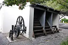 Type of site: Treadmill. |
| 9/2/018/0034/002/05 | Old Labourers' Hostel, Portswood Road, Victoria and Alfred Waterfront, Cape Town | Cape Town, Victoria and Alfred Waterfront | The Cape | Provisional Protection | 33°54′25″S 18°25′21″E / 33.906899°S 18.422480°E | Upload Photo | |
| 9/2/018/0034/002/07 | Ulundi, 1 Portswood Road, Victoria and Alfred Waterfront, Cape Town | Cape Town, Victoria and Alfred Waterfront | The Cape | Provisional Protection | 33°54′23″S 18°25′00″E / 33.906366°S 18.416553°E | 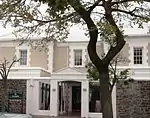 | |
| 9/2/018/0034/002/08 | Dockhouse No. 1 and No. 2, off Portswood Road, Portswood Ridge, Victoria and Alfred Waterfront, Cape Town | Cape Town, Victoria and Alfred Waterfront | The Cape | Provisional Protection | 33°54′20″S 18°25′08″E / 33.905504°S 18.418985°E |  | |
| 9/2/018/0034/002/09 | Old Production Control Office, off Portswood Road, Portswood Ridge, Victoria and Alfred Waterfront, Cape Town | Cape Town, Victoria and Alfred Waterfront | The Cape | Provisional Protection | 33°54′19″S 18°25′05″E / 33.905270°S 18.418113°E | Upload Photo | |
| 9/2/018/0034/002/10 | Embankment and Tunnel, off Portswood Road, Portswood Ridge, Victoria and Alfred Waterfront, Cape Town | Type of site: Tunnel. | Cape Town, Victoria and Alfred Waterfront | The Cape | Provisional Protection | 33°54′20″S 18°25′06″E / 33.905512°S 18.418306°E | 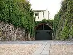 Type of site: Tunnel. |
| 9/2/018/0034/002/11 | The Moorings Gateway and Boundary Wall, Portswood Road, Victoria and Alfred Waterfront, Cape Town | Cape Town, Victoria and Alfred Waterfront | The Cape | Provisional Protection | 33°54′20″S 18°25′06″E / 33.905505°S 18.418217°E | Upload Photo | |
| 9/2/018/0034/002/12 | The Moorings No. 10, Quarry Road, Victoria and Alfred Waterfront, Cape Town | Cape Town, Victoria and Alfred Waterfront | The Cape | Provisional Protection | 33°54′20″S 18°25′06″E / 33.905571°S 18.418274°E | Upload Photo | |
| 9/2/018/0034/002/13 | The Moorings No. 5, Quarry Road, Victoria and Alfred Waterfront, Cape Town | THE MOORINGS No. 5
Dwelling inspected: September 1982 Part single-, part double-storey dwelling. Single-storey: bluestone wall, pediment, raking brick coping, hardwood casement and fanlight with quoined moulded plaster surrounds, plaster string course. |
Cape Town, Victoria and Alfred Waterfront | The Cape | Provisional Protection | 33°54′23″S 18°25′06″E / 33.906429°S 18.418426°E | Upload Photo |
| 9/2/018/0034/002/14 | The Moorings No. 2 and No. 3, off Portswood Road, Victoria and Alfred Waterfront, Cape Town | THE MOORINGS No. 2 AND No. 3
Dwellings inspected: September 1982 Double-storey, 3-bay, SW façade: Ground: plastered stoep wall and piers, steel roof sheeting. Centrally divided glazed and lower flush panelled teak door, fanlight, ovolo moulded frame. |
Cape Town, Victoria and Alfred Waterfront | The Cape | Provisional Protection | 33°54′20″S 18°25′05″E / 33.905473°S 18.418182°E |  THE MOORINGS No. 2 AND No. 3
Dwellings
inspected: September 1982
Double-storey, 3-bay, SW façade:
Ground: plastered stoep wall and piers, steel roof sheeting. Centrally divided glazed and lower flush panelled teak door, fanlight, ovolo moulded frame. |
| 9/2/018/0034/002/15 | The Moorings No. 1, off Portswood Road, Victoria and Alfred Waterfront, Cape Town | THE MOORINGS No. 1
Dwelling inspected: September 1982 Double-storey, SW corner unit contains fabric of original Breakwater Convict Station. Plastered bluestone (shown unplastered in c1890 photograph), pitched corrugated iron roof. Type of site: House. |
Cape Town, Victoria and Alfred Waterfront | The Cape | Provisional Protection | 33°54′20″S 18°25′06″E / 33.905494°S 18.418219°E |  THE MOORINGS No. 1
Dwelling
inspected: September 1982
Double-storey, SW corner unit contains fabric of original Breakwater Convict Station. Plastered bluestone (shown unplastered in c1890 photograph), pitched corrugated iron roof. Type of site: House. |
| 9/2/018/0034/002/16 | Garages, off Portswood Road, Victoria and Alfred Waterfront, Cape Town | Cape Town, Victoria and Alfred Waterfront | The Cape | Provisional Protection | 33°54′25″S 18°25′21″E / 33.906899°S 18.422480°E | Upload Photo | |
| 9/2/018/0034/002/18 | Time Ball Tower, Portswood Ridge, Victoria and Alfred Waterfront, Cape Town | This tower, which was erected in 1883, was used as a repeater-station for harbour signals between the Observatory and Signal Hill. In 1895 the tower was raised from 17 feet to 34 feet. The ball, which was hand-operated at first, was electrified in 1903. Type of site: Time Ball Tower. | Cape Town, Victoria and Alfred Waterfront | The Cape | Provincial Heritage Site | 33°54′21″S 18°25′09″E / 33.905857°S 18.419226°E | 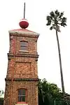 This tower, which was erected in 1883, was used as a repeater-station for harbour signals between the Observatory and Signal Hill. In 1895 the tower was raised from 17 feet to 34 feet. The ball, which was hand-operated at first, was electrified in 1903. Type of site: Time Ball Tower. |
| 9/2/018/0034/01 | Pierhead Precinct, Victoria and Alfred Waterfront, Granger Bay, | 33°54′21″S 18°25′17″E / 33.905919°S 18.421281°E | Upload Photo | ||||
| 9/2/018/0034/01/01 | Ferryman's Tavern, Victoria and Alfred Waterfront, Granger Bay, | Provincial Heritage Site | 33°54′18″S 18°25′10″E / 33.905125°S 18.419430°E |  | |||
| 9/2/018/0034/01/03 | Old Electric Power and lighting station, Pierhead Precinct, Victoria and Waterfront | Cape Town | Upload Photo | ||||
| 9/2/018/0034/02 | Portswood Precinct, Victoria and Alfred Waterfront, Granger Bay, Cape Town | Cape Town | Upload Photo | ||||
| 9/2/018/0034/02/01 | The Moorings, No 6, Erf 15, Off Portswood Road, Victoria and Alfred | Cape Town | Upload Photo | ||||
| 9/2/018/0034/02/02 | Hostel Kitchen, Erf 15, Off Portswood Road, Victoria and Alfred | Cape Town | Upload Photo | ||||
| 9/2/018/0034/02/03 | The Moorings, Erf 15, Off Portswood Road, Victoria and Alfred | Cape Town | Upload Photo | ||||
| 9/2/018/0034/02/04 | Treadmill, Erf 15, Off Portswood Road, Victoria and Alfred | Cape Town | Upload Photo | ||||
| 9/2/018/0034/02/05 | Labourer's Hostel, Erf 15, Portswood Road, Victoria and Alfred | Cape Town | Upload Photo | ||||
| 9/2/018/0034/02/07 | Ulundi Dwelling, Erf 1, Portswood Road, Victoria and Alfred | Cape Town | Upload Photo | ||||
| 9/2/018/0034/02/08 | Dockhouse, No1 and 2 Erf 1, The Ridge, Victoria and Alfred | Cape Town | prov decl 1991-1997 | Upload Photo | |||
| 9/2/018/0034/02/09 | Production Control Office, Erf 1, The Ridge, Victoria and Alfred | Cape Town | Upload Photo | ||||
| 9/2/018/0034/02/10 | Embankment & Tunnel, Erf 1, The Ridge, Victoria and Alfred Waterfront, | Cape Town | Upload Photo | ||||
| 9/2/018/0034/02/11 | The Moorings, Gateway & Boundary Wall, Erf 16, Portswood Road, | Cape Town | Upload Photo | ||||
| 9/2/018/0034/02/12 | Windermere, The Moorings No 10, Quarry Road, Victoria and Alfred | Cape Town | Upload Photo | ||||
| 9/2/018/0034/02/13 | The Moorings No 5, Erf 1, Quarry Road, Victoria and Alfred | Cape Town | Upload Photo | ||||
| 9/2/018/0034/02/14 | The Moorings No 2 & 3, Erven 1 & 16, Off Portswood Road, Victoria and | Cape Town | Upload Photo | ||||
| 9/2/018/0034/02/15 | The Moorings No 1, Erven 1 & 16, Off Portswood Road, Victoria & Alfred | Cape Town | Upload Photo | ||||
| 9/2/018/0034/02/16 | Garages, Erf 16, Off Portwood Road, Victoria and Alfred Waterfront, | Cape Town | Upload Photo | ||||
| 9/2/018/0034/02/17 | Breakwater Prison, Erf 14, Cape Town | Cape Town | Upload Photo | ||||
| 9/2/018/0034/02/18 | Time Ball Tower, Victoria and Alfred Waterfront, Cape Town | Cape Town | Upload Photo | ||||
| 9/2/018/0034/03 | New Basin Precinct, Victoria & Alfred Waterfront, Granger Bay, Cape | Cape Town | Upload Photo | ||||
| 9/2/018/0034/03/1 | Amsterdam Battery, 11 & 13 Port Road, Cape Town | 33°54′44″S 18°25′13″E / 33.912360°S 18.420394°E | Upload Photo | ||||
| 9/2/018/0034/04 | Gateway Precinct, Victoria & Alfred Waterfront, Cape Town | Cape Town | Upload Photo | ||||
| 9/2/018/0034/05 | South Arm, V&A Waterfront, Cape Town | Cape Town | Upload Photo | ||||
| 9/2/018/0034/06 | Granger Bay, V & A Waterfront, Cape Town | Cape Town | Upload Photo | ||||
| 9/2/018/0034/07 | Breakwater Precinct, Victoria and Alfred Waterfront, Cape Town | Cape Town | Upload Photo | ||||
| 9/2/018/0034/08 | Clock Tower precinct, V & A (Chavonnes battery) | 33°54′24″S 18°25′20″E / 33.906553°S 18.422218°E |  | ||||
| 9/2/018/0034/09 | Upper Basin Precinct, V& A Waterfront/ Marina | Cape Town | Upload Photo | ||||
| 9/2/018/0036 | Belvedere Building, cnr Bouquet and St John's Streets, Cape Town | Type of site: House Previous use: Hotel / offices. Current use: Commercial. | Cape Town, Central | The Cape | Provincial Heritage Site | 33°55′42″S 18°25′08″E / 33.928311°S 18.418846°E | 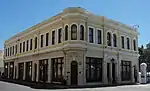 Type of site: House Previous use: Hotel / offices. Current use: Commercial. |
| 9/2/018/0038 | Block bounded by Loop, Prestwich, Long and Riebeeck Streets, Cape Town | Cape Town | Upload Photo | ||||
| 9/2/018/0040 | St George's Mall, St George's Street, Cape Town | 33°55′20″S 18°25′19″E / 33.922099°S 18.421899°E | Upload Photo | ||||
| 9/2/018/0041 | 86 Hout Street, Cape Town | 33°55′14″S 18°25′09″E / 33.920664°S 18.419258°E | Upload Photo | ||||
| 9/2/018/0042 | St Stephen's Church, Riebeeck Square, Cape Town | The only building on Riebeeck Square is St. Stephen’s Church, but it was, in fact, the first theatre or, as the Coloured people called it, the first ""komediehuis"" in South Africa.
Type of site: Church. Previous use: Theatre. Current use: Church : Dutch Reformed Mission. This building was opened as a theatre in 1800 and was taken into use as a church and school in 1839. |
Cape Town, Central | The Cape | Provincial Heritage Site | 33°55′16″S 18°25′04″E / 33.921182°S 18.417901°E | 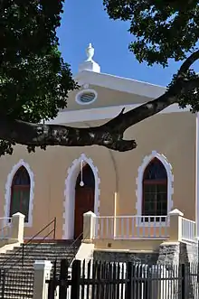 The only building on Riebeeck Square is St. Stephen’s Church, but it was, in fact, the first theatre or, as the Coloured people called it, the first ""komediehuis"" in South Africa.
Type of site: Church. Previous use: Theatre. Current use: Church : Dutch Reformed Mission.
This building was opened as a theatre in 1800 and was taken into use as a church and school in 1839. |
| 9/2/018/0042/1 | Old organ, St Stephen's Church, Riebeeck Square Cape Town | Cape Town | Upload Photo | ||||
| 9/2/018/0043 | CAPE TOWN MUNICIPAL AREA, GENERAL | Cape Town | Upload Photo | ||||
| 9/2/018/0045 | Cape Heritage House, 67-73 Burg Street, Cape Town | Type of site: Commercial. | Cape Town, Central | The Cape | Provincial Heritage Site | 33°55′25″S 18°25′10″E / 33.923586°S 18.419308°E | Upload Photo |
| 9/2/018/0046 | 8, 10, 12 and 12a Vredehoek Avenue, Oranjezicht, cape Town | Cape Town | 33°56′12″S 18°25′06″E / 33.936722°S 18.418439°E | Upload Photo | |||
| 9/2/018/0046/01 | 8 Vredehoek Avenue, Oranjezicht, Cape Town | Cape Town | 33°56′12″S 18°25′06″E / 33.936722°S 18.418439°E | Upload Photo | |||
| 9/2/018/0046/02 | 10 Vredehoek Avenue, Oranjezicht, Cape Town | Cape Town | 33°56′12″S 18°25′06″E / 33.936722°S 18.418439°E | Upload Photo | |||
| 9/2/018/0046/03 | 12 Vredehoek Avenue, Oranjezicht, Cape Town | Cape Town | 33°56′12″S 18°25′06″E / 33.936722°S 18.418439°E | Upload Photo | |||
| 9/2/018/0046/04 | 12a Vredehoek Avenue, Oranjezicht, Cape Town | Cape Town | 33°56′12″S 18°25′06″E / 33.936722°S 18.418439°E | Upload Photo | |||
| 9/2/018/0047 | 79-81 Kloof Street, Gardens, Cape Town | Cape Town | 33°55′50″S 18°24′38″E / 33.930466°S 18.410569°E | Upload Photo | |||
| 9/2/018/0047/001 | 79 Kloof Street, Gardens, Cape Town | Cape Town, Gardens | The Cape | Provincial Heritage Site | 33°55′50″S 18°24′38″E / 33.930465°S 18.410587°E | Upload Photo | |
| 9/2/018/0047/002 | 81 Kloof Street, Gardens, Cape Town | Cape Town, Gardens | The Cape | Provincial Heritage Site | 33°55′50″S 18°24′38″E / 33.930516°S 18.410528°E | Upload Photo | |
| 9/2/018/0050 | 3-5, 7 and 9 Breda Street, Earl's Court, Hiddingh Avenue, Model Villa, Hiddingh Avenue, Gardens, Cape Town | Cape Town, Gardens | The Cape | Provisional Protection | 33°56′05″S 18°24′59″E / 33.934796°S 18.416462°E |  | |
| 9/2/018/0050/001 | 3-5 Breda Street, Gardens, Cape Town | Cape Town, Gardens | The Cape | Provisional Protection | 33°56′04″S 18°24′59″E / 33.934320°S 18.416440°E | Upload Photo | |
| 9/2/018/0050/002 | 7 Breda Street, Gardens, Cape Town | s/s Type of site: House. | Cape Town, Gardens | The Cape | Provisional Protection | 33°56′05″S 18°24′59″E / 33.934610°S 18.416453°E | s/s Type of site: House. |
| 9/2/018/0050/003 | 9 Breda Street, Gardens, Cape Town | Cape Town, Gardens | The Cape | Provisional Protection | 33°56′05″S 18°24′59″E / 33.934800°S 18.416460°E | Upload Photo | |
| 9/2/018/0050/004 | Earl's Court, 6 Hiddingh Avenue, Gardens, Cape Town | Cape Town, Gardens | The Cape | Provisional Protection | 33°56′04″S 18°25′00″E / 33.934373°S 18.416761°E | Upload Photo | |
| 9/2/018/0050/005 | Model Villa, 4 Hiddingh Avenue, Gardens, Cape Town | Type of site: House | Cape Town, Gardens | The Cape | Provisional Protection | 33°56′03″S 18°25′00″E / 33.934205°S 18.416707°E | Upload Photo |
| 9/2/018/0051 | Valkenberg Hospital building complex, Observatory, Cape Town | Type of site: Hospital | Cape Town, Observatory | The Cape | Provincial Heritage Site | 33°56′21″S 18°28′54″E / 33.939276°S 18.481541°E | Upload Photo |
| 9/2/018/0052 | Victoria Court, 301-305 Long Street, Cape Town | Cape Town | 33°55′38″S 18°24′52″E / 33.927121°S 18.414510°E | Upload Photo | |||
| 9/2/018/0054 | Wolseley House, 22 Sophia Street, Oranjezicht, Cape Town | Cape Town, Oranjezicht | The Cape | Provincial Heritage Site | 33°56′26″S 18°25′00″E / 33.940521°S 18.416701°E |  | |
| 9/2/018/0055 | Carl Hermann Building, 5-7 Corporation Street, Cape Town | Type of site: Commercial. | Cape Town, Central | The Cape | Provincial Heritage Site | 33°55′34″S 18°25′21″E / 33.926095°S 18.422507°E | 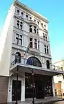 Type of site: Commercial. |
| 9/2/018/0056 | The Castle of Good Hope, Cape Town | On 8 April 1652, Jan van Riebeeck took possession of the "Cape Outpost" in the name of the United East India Company and their most Noble and High Mightinesses the States General of the United Netherlands. He built his "Fort of Good Hope". Type of site: Fort. | Cape Town, Central | The Cape | National Heritage Site | 33°55′33″S 18°25′40″E / 33.925883°S 18.427883°E | 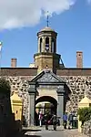 On 8 April 1652, Jan van Riebeeck took possession of the "Cape Outpost" in the name of the United East India Company and their most Noble and High Mightinesses the States General of the United Netherlands. He built his "Fort of Good Hope". Type of site: Fort. |
| 9/2/018/0056/01 | The William Fehr Collection, Castle, Rust en Vreugd | Cape Town | 33°55′34″S 18°25′41″E / 33.926071°S 18.428076°E | Upload Photo | |||
| 9/2/018/0058 | Stuttafords Building, Adderley Street, Cape Town | Cape Town | Upload Photo | ||||
| 9/2/018/0059 | Stone wall, Buitengracht, Cape Town | Type of site: Wall. | Cape Town, Central | The Cape | National Heritage Site | 33°55′28″S 18°24′47″E / 33.924562°S 18.412996°E | 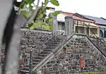 Type of site: Wall. |
| 9/2/018/0059-001 | VR Post Box, Buitengracht, Cape Town | Type of site: Post Box Current use: Post box. | Cape Town, Central | The Cape | Provincial Heritage Site | 33°55′28″S 18°24′47″E / 33.924577°S 18.412995°E | 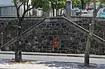 Type of site: Post Box Current use: Post box. |
| 9/2/018/0060 | 6 Bellevue Street, Oranjezicht, Cape Town | Cape Town, Oranjezicht | The Cape | Provincial Heritage Site | 33°56′12″S 18°24′16″E / 33.936643°S 18.404518°E |  | |
| 9/2/018/0061 | Gardens Presbyterian Church, 151 Hatfield Street, Gardens, Cape Town | Type of site: Church Current use: Church : Presbyterian. | Cape Town, Gardens | The Cape | Provincial Heritage Site | 33°55′59″S 18°24′51″E / 33.933142°S 18.414128°E | 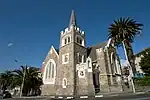 Type of site: Church Current use: Church : Presbyterian. |
| 9/2/018/0063 | ICS Building, 10 Dock Road, Cape Town | Type of site: Commercial Current use: Offices / Shops. | Cape Town, Central | The Cape | Provincial Heritage Site | 33°54′17″S 18°25′06″E / 33.904650°S 18.418263°E | Upload Photo |
| 9/2/018/0065 | Van Rheede van Oudtshoorn Vault, Faure Street, Gardens, Cape Town | Type of site: Vault. | Cape Town, Gardens | The Cape | Provincial Heritage Site | 33°55′51″S 18°24′41″E / 33.930718°S 18.411332°E | 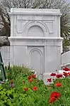 Type of site: Vault. |
| 9/2/018/0066 | Moravian Church and Parsonage, Moravian Hill, District Six, Cape Town | Type of site: Church and Parsonage Current use: Church : Moravian. | Cape Town, District Six | The Cape | Provincial Heritage Site | 33°55′55″S 18°25′57″E / 33.932041°S 18.432374°E | 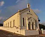 Type of site: Church and Parsonage Current use: Church : Moravian. |
| 9/2/018/0068 | Grand Parade, Cape Town | The Parade is inseparably associated with the Castle of Good Hope. Most of the garrison at the Cape were billeted in the Castle and a parade ground was essential for their proper training. Consequently steps were taken even before the Castle was completed.
The Grand Parade is one of Cape Town's historical squares and was the military parade ground during the eighteenth and nineteenth centuries. |
Cape Town, Central | The Cape | Provincial Heritage Site | 33°55′29″S 18°25′28″E / 33.924826°S 18.424527°E |  The Parade is inseparably associated with the Castle of Good Hope. Most of the garrison at the Cape were billeted in the Castle and a parade ground was essential for their proper training. Consequently steps were taken even before the Castle was completed.
The Grand Parade is one of Cape Town's historical squares and was the military parade ground during the eighteenth and nineteenth centuries. |
| 9/2/018/0069 | Sunny Lodge, 3 Flower Street, Gardens, Cape Town | Cape Town | 33°56′16″S 18°25′03″E / 33.937743°S 18.417529°E | Upload Photo | |||
| 9/2/018/0070 | Dunkley Mews, 14 Wandel Street, 14-26 Dunkley Street, 31 Barnet | Cape Town | 33°55′55″S 18°25′01″E / 33.931809°S 18.416961°E | .jpg.webp) | |||
| 9/2/018/0070/001 | 18 Dunkley Street, Gardens, Cape Town | Cape Town, Gardens | The Cape | Provincial Heritage Site | 33°55′54″S 18°25′00″E / 33.931652°S 18.416757°E |  | |
| 9/2/018/0070/002 | 22 Dunkley Street, Gardens, Cape Town | Cape Town, Gardens | The Cape | Provincial Heritage Site | 33°55′54″S 18°25′01″E / 33.931718°S 18.416857°E |  | |
| 9/2/018/0070/003 | 24 Dunkley Street, Gardens, Cape Town | Cape Town, Gardens | The Cape | Provincial Heritage Site | 33°55′54″S 18°25′01″E / 33.931746°S 18.416902°E |  | |
| 9/2/018/0070/004 | Maria's Greek Restaurant, 31 Barnet Street, Gardens, Cape Town | These five properties form an integral part of a row of nine double-storeyed Cape-Georgian terraced houses that were erected in 1886 by William James Hatfield. The corner shop units were added in 1901. Current use: Restaurant. | Cape Town, Gardens | The Cape | Provincial Heritage Site | 33°55′53″S 18°25′00″E / 33.931525°S 18.416679°E | Upload Photo |
| 9/2/018/0070/005 | 14 Dunkley Street, Gardens, Cape Town | These five properties form an integral part of a row of nine double-storeyed Cape-Georgian terraced houses that were erected in 1886 by William James Hatfield. The corner shop units were added in 1901. | Cape Town, Gardens | The Cape | Provincial Heritage Site | 33°55′54″S 18°25′00″E / 33.931630°S 18.416697°E | 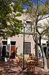 These five properties form an integral part of a row of nine double-storeyed Cape-Georgian terraced houses that were erected in 1886 by William James Hatfield. The corner shop units were added in 1901. |
| 9/2/018/0070/006 | 16 Dunkley Street, Gardens, Cape Town | These five properties form an integral part of a row of nine double-storeyed Cape-Georgian terraced houses that were erected in 1886 by William James Hatfield. The corner shop units were added in 1901. | Cape Town, Gardens | The Cape | Provincial Heritage Site | 33°55′54″S 18°25′00″E / 33.931573°S 18.416804°E | Upload Photo |
| 9/2/018/0070/007 | 20 Dunkley Street, Gardens, Cape Town | These five properties form an integral part of a row of nine double-storeyed Cape-Georgian terraced houses that were erected in 1886 by William James Hatfield. The corner shop units were added in 1901. | Cape Town, Gardens | The Cape | Provincial Heritage Site | 33°55′54″S 18°25′01″E / 33.931697°S 18.416808°E | 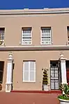 These five properties form an integral part of a row of nine double-storeyed Cape-Georgian terraced houses that were erected in 1886 by William James Hatfield. The corner shop units were added in 1901. |
| 9/2/018/0070/009 | Roxy, 14 Wandel Street, Gardens, Cape Town | Current use: Restaurant. These five properties form an integral part of a row of nine double-storeyed Cape-Georgian terraced houses that were erected in 1886 by William James Hatfield. The corner shop units were added in 1901. | Cape Town, Gardens | The Cape | Provincial Heritage Site | 33°55′55″S 18°25′01″E / 33.931810°S 18.416954°E |  Current use: Restaurant. These five properties form an integral part of a row of nine double-storeyed Cape-Georgian terraced houses that were erected in 1886 by William James Hatfield. The corner shop units were added in 1901. |
| 9/2/018/0070/8 | 26 Dunkley Street, Gardens, Cape Town | Cape Town | 33°55′55″S 18°25′01″E / 33.931809°S 18.416961°E | Upload Photo | |||
| 9/2/018/0071 | 158 Buitengracht, Cape Town | Cape Town, Bo-Kaap | The Cape | Provincial Heritage Site | 33°55′22″S 18°24′52″E / 33.922883°S 18.414486°E | Upload Photo | |
| 9/2/018/0072 | 151, 159–161 Loop Street, Cape Town | Cape Town | 33°55′26″S 18°24′59″E / 33.924025°S 18.416427°E | Upload Photo | |||
| 9/2/018/0073 | SA Museum, Queen Victoria Street, Cape Town | Cape Town | 33°55′43″S 18°24′54″E / 33.928591°S 18.414921°E |  | |||
| 9/2/018/0074 | 2-12 Grove Road, Mowbray, Cape Town | Cape Town | 33°56′45″S 18°28′22″E / 33.945945°S 18.472645°E |  | |||
| 9/2/018/0074/3 | 6 Gove Road, Mowbray, Cape Town | Cape Town | 33°56′45″S 18°28′22″E / 33.945945°S 18.472645°E | Upload Photo | |||
| 9/2/018/0078 | 65-69 Buitengracht Street, Cape Town | Cape Town | 33°55′13″S 18°25′05″E / 33.920152°S 18.417971°E | Upload Photo | |||
| 9/2/018/0079 | Lutheran Church, Strand Street, Cape Town | This unique group of eighteenth century buildings stands in Strand Street, higher up and across the street from Koopmans-de Wet House. It owes its attraction to the fact that these buildings were designed as an architectural entity. Type of site: Church. | Cape Town, Central | The Cape | Provincial Heritage Site | 33°55′08″S 18°25′10″E / 33.918878°S 18.419492°E | 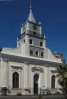 This unique group of eighteenth century buildings stands in Strand Street, higher up and across the street from Koopmans-de Wet House. It owes its attraction to the fact that these buildings were designed as an architectural entity. Type of site: Church. |
| 9/2/018/0080 | see 9/2/111/0060 | Cape Town | Upload Photo | ||||
| 9/2/018/0082 | Methodist Publishing House, cnr Church & Burg Street, Cape Town | Cape Town | 33°55′24″S 18°25′09″E / 33.923405°S 18.419289°E | Upload Photo | |||
| 9/2/018/0085 | 71 Roeland Street, Cape Town | Architectural style: EDWARDIAN. Type of site: Commercial. Current use: Commercial. | Cape Town, Central | The Cape | Provincial Heritage Site | 33°55′45″S 18°25′18″E / 33.929036°S 18.421573°E | 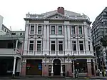 Architectural style: EDWARDIAN. Type of site: Commercial. Current use: Commercial. |
| 9/2/018/0086 | Centre for the Book, Queen Victoria Street, Cape Town | Architectural style: Edwardian. Type of site: Government. Previous use: Archives. Current use: Library. | Cape Town, Central | The Cape | Provincial Heritage Site | 33°55′37″S 18°24′57″E / 33.927010°S 18.415763°E | 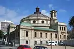 Architectural style: Edwardian. Type of site: Government. Previous use: Archives. Current use: Library. |
| 9/2/018/0087 | Silverknowles, 20 Brownlow Street, Tamboerskloof, Cape Town | Cape Town, Tamboerskloof | The Cape | Provincial Heritage Site | 33°55′38″S 18°24′18″E / 33.927201°S 18.405116°E | Upload Photo | |
| 9/2/018/0088 | Oslo House, 1 Belvedere Avenue, Oranjezicht, Cape Town | Type of site: House. | Cape Town, Oranjezicht | The Cape | Provincial Heritage Site | 33°56′23″S 18°24′54″E / 33.939690°S 18.415097°E |  Type of site: House. |
| 9/2/018/0091 | Table Bay Panorama Painting, by J L Pickering (1885), Cape Town | The Cape | Heritage Object | 33°55′22″S 18°25′12″E / 33.922876°S 18.420068°E | Upload Photo | ||
| 9/2/018/0092 | Greenmarket Square, Cape Town | Greenmarket Square – one of the squares around which Cape Town developed. In early times it was the site of the vegetable and fruit market. During the seventeenth century a number of streets came into existence above fashionable Sea Street (Strand Street) in which the Koopmans-de Wet House and the unique group of buildings of the Lutheran Church still survive today. Type of site: Square. | Cape Town, Central | The Cape | Provincial Heritage Site | 33°55′22″S 18°25′12″E / 33.922898°S 18.420026°E | 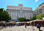 Greenmarket Square – one of the squares around which Cape Town developed. In early times it was the site of the vegetable and fruit market. During the seventeenth century a number of streets came into existence above fashionable Sea Street (Strand Street) in which the Koopmans-de Wet House and the unique group of buildings of the Lutheran Church still survive today. Type of site: Square. |
| 9/2/018/0093 | Bellevue, St John's Hostel, Upper Kloof Street, Gardens, Cape Town | Cape Town, Higgovale | The Cape | Provincial Heritage Site | 33°56′18″S 18°24′07″E / 33.938449°S 18.401919°E | Upload Photo | |
| 9/2/018/0094 | Mount Nelson Hotel, Oranje Street, Gardens | Cape Town | 33°55′54″S 18°24′45″E / 33.931695°S 18.412431°E |  | |||
| 9/2/018/0094/003 | Outbuildings, Mount Nelson Hotel, Orange Street, Gardens, Cape Town | Type of site: Outbuilding. | Cape Town, Gardens | The Cape | Provincial Heritage Site | 33°55′54″S 18°24′41″E / 33.931739°S 18.411264°E | Type of site: Outbuilding. |
| 9/2/018/0094/01 | Taunton House & Taunton Cottage, 6 & 8 Hof Street, Gardens, Cape Town | Cape Town | 33°55′55″S 18°24′46″E / 33.932032°S 18.412881°E | Upload Photo | |||
| 9/2/018/0094/02 | 10 Hof Street, Gardens, Cape Town | Cape Town | 33°55′56″S 18°24′45″E / 33.932350°S 18.412569°E | Upload Photo | |||
| 9/2/018/0094/04 | Buitenkommen Tuin (Helmsley Hotel) Hof Street, Gardens Cape Town | Cape Town | Upload Photo | ||||
| 9/2/018/0095 | see 9/2/111/0020 | Cape Town | Upload Photo | ||||
| 9/2/018/0096 | Longkloof Complex, Kloof Street, Gardens, Cape Town | Cape Town | Upload Photo | ||||
| 9/2/018/0097 | Ammunition Magazine, Tamboerskloof, Cape Town | Type of site: Magazine. | Cape Town, Tamboerskloof | The Cape | Provincial Heritage Site | 33°55′30″S 18°24′29″E / 33.925012°S 18.407939°E | Upload Photo |
| 9/2/018/0098 | Zorgvliet, Sir George Grey Street, Gardens, Cape Town | Zorgvliet is one of the oldest properties in the Cape and dates, according to Dr. Mary Cook, back to 1669, when a small freehold grant of 2 morgan was made to Matthuys Coeymans. In 1774 it was in the possession of Hendrik Oostewald Eksteen. Type of site: House. Current use: House. This house with its Cape Dutch and Victorian characteristics is situated on one of the oldest properties in the Cape Province. The property was granted to Matthys Coeymans as early as 1669. The Victorianisation dates from the 1850s when tall shuttered Victorian casements replaced the half sashes. Other woodwork was also altered in the interests of prestigious living and the doorways in the front facade were replaced with wide neo-gothic doors. | Cape Town, Gardens | The Cape | Provincial Heritage Site | 33°56′18″S 18°24′57″E / 33.938314°S 18.415791°E | Upload Photo |
| 9/2/018/0100 | Rust en Vreugd, Buitenkant Street, Cape Town | Rust en Vreugd is one of the few impressive and beautifully finished town houses that survived from the eighteenth century. It is situated on land that, according to old maps of Cape Town, had already been granted to a free burgher in the 17th century. Type of site: House. Previous use: House. Current use: Museum. | Cape Town, Central | The Cape | Provincial Heritage Site | 33°55′49″S 18°25′14″E / 33.930366°S 18.420505°E | 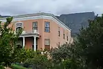 Rust en Vreugd is one of the few impressive and beautifully finished town houses that survived from the eighteenth century. It is situated on land that, according to old maps of Cape Town, had already been granted to a free burgher in the 17th century. Type of site: House. Previous use: House. Current use: Museum. |
| 9/2/018/0101 | Huguenot House, 66-66a Loop Street, Cape Town | Cape Town | 33°55′15″S 18°25′10″E / 33.920806°S 18.419503°E | Upload Photo | |||
| 9/2/018/0102 | Tafelberg Dutch Reformed Church, Buitenkant Street, Cape Town | This late Victorian church complex which dates from 1892 was given in trust to the Nieuwe Kerk by Susanna Maria Johanna Hertzog with the stipulation that when a self supporting congregation came into being in the area, it be transferred to them. The Church complex divides into three sections: the symmetrical fronted Church itself, the Cornelia Home on Cornelia Avenue, and the William Frederick School Building on Commercial Street.
The Church building has a finely carved corner foundation stone. Type of site: Church. Current use: Church : Dutch Reformed. |
Cape Town, Central | The Cape | Provincial Heritage Site | 33°55′43″S 18°25′22″E / 33.928601°S 18.422710°E |  This late Victorian church complex which dates from 1892 was given in trust to the Nieuwe Kerk by Susanna Maria Johanna Hertzog with the stipulation that when a self supporting congregation came into being in the area, it be transferred to them. The Church complex divides into three sections: the symmetrical fronted Church itself, the Cornelia Home on Cornelia Avenue, and the William Frederick School Building on Commercial Street.
The Church building has a finely carved corner foundation stone.
Type of site: Church. Current use: Church : Dutch Reformed. |
| 9/2/018/0103 | Milestones, Main Road, Cape Town | Cape Town | Upload Photo | ||||
| 9/2/018/0104 | Rolfes House, 6 Dorman Street, Cape Town | Cape Town | 33°55′44″S 18°24′45″E / 33.928759°S 18.412619°E | Upload Photo | |||
| 9/2/018/0105 | First National Bank, Adderley Street, Cape Town | Cape Town | 33°55′23″S 18°25′20″E / 33.923027°S 18.422342°E | Upload Photo | |||
| 9/2/018/0106 | Groote Kerk, Adderley Street, Cape Town | The first church on this land was built in 1678. It was replaced by the present building in 1841, but the original tower was retained. The pulpit is the work of Anton Anreith and the carpenter Jacob Graaff and was put into use in 1789.
Type of site: Church. Current use: Church : Dutch Reformed. |
Cape Town, Central | The Cape | Provincial Heritage Site | 33°55′29″S 18°25′15″E / 33.924710°S 18.420719°E | 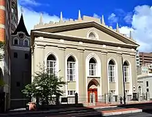 The first church on this land was built in 1678. It was replaced by the present building in 1841, but the original tower was retained. The pulpit is the work of Anton Anreith and the carpenter Jacob Graaff and was put into use in 1789.
Type of site: Church. Current use: Church : Dutch Reformed. |
| 9/2/018/0107 | Riebeeck Square (block bounded by Shortmarket, Bree, Church and Buitengracht Streets), Cape Town | Riebeeck Square – one of the squares round which Cape Town developed. It was first known as Boeren-plein, and later as Hottentot Square. Here the farmers
outspanned their wagons and off-loaded their products. During the seventeenth century Cape Town expanded for the most part from the sea towards Table Mountain along the axis of the Heerengracht or Adderley Street. During the eighteenth century it expanded laterally also, and began to fill Table Valley. Type of site: Square. |
Cape Town, Central | The Cape | Provincial Heritage Site | 33°55′16″S 18°25′03″E / 33.921225°S 18.417471°E |  Riebeeck Square – one of the squares round which Cape Town developed. It was first known as Boeren-plein, and later as Hottentot Square. Here the farmers
outspanned their wagons and off-loaded their products. During the seventeenth century Cape Town expanded for the most part from the sea towards Table Mountain along the axis of the Heerengracht or Adderley Street. During the eighteenth century it expanded laterally also, and began to fill Table Valley. Type of site: Square. |
| 9/2/018/0110 | Old YMCA, 60 Queen Victoria Street, Cape Town | Cape Town | 33°55′38″S 18°24′58″E / 33.927190°S 18.416023°E | Upload Photo | |||
| 9/2/018/0111 | St. Andrew's Presbyterian Church, Somerset Road, Cape Town | Cape Town | Upload Photo | ||||
| 9/2/018/0113 | Old Drill Hall, Darling Street, Cape Town | Type of site: Drill Hall Previous use: Drill hall. | Cape Town, Central | The Cape | Provincial Heritage Site | 33°55′33″S 18°25′28″E / 33.925761°S 18.424328°E | 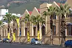 Type of site: Drill Hall Previous use: Drill hall. |
| 9/2/018/0114 | 50 Orange Street, Gardens, Cape Town | Type of site: House Previous use: House. Current use: Restaurant. Once threatened by decay and demolition, this fine Cape Georgian building, constructed for the Lieschings, one of the Cape's most prominent families, has been restored to form one of the finest remaining examples of its particular architectural period in | Cape Town, Gardens | The Cape | Register | 33°55′44″S 18°24′47″E / 33.929007°S 18.412968°E | Upload Photo |
| 9/2/018/0115 | City Hall, Darling Street, Cape Town | Type of site: City Hall Current use: City Hall. This City Hall which is predominantly in the Italian Renaissance style, was designed by the architects Harry Austin Reid and Frederick George Green of Johannesburg and erected by the builders Thomas Howard and John Gibson Scott. The corner-stone was laid | Cape Town, Central | The Cape | Provincial Heritage Site | 33°55′31″S 18°25′27″E / 33.92532°S 18.42407°E |  Type of site: City Hall Current use: City Hall. This City Hall which is predominantly in the Italian Renaissance style, was designed by the architects Harry Austin Reid and Frederick George Green of Johannesburg and erected by the builders Thomas Howard and John Gibson Scott. The corner-stone was laid |
| 9/2/018/0116 | Zonnebloem College Complex, Woodstock, Cape Town | Cape Town | Upload Photo | ||||
| 9/2/018/0117 | 2 Dorman Street, Gardens, Cape Town | Cape Town, Gardens | The Cape | Provisional Protection | 33°55′44″S 18°24′46″E / 33.928875°S 18.412816°E | Upload Photo | |
| 9/2/018/0118 | City and Civil Service Club, Queen Victoria Street, Cape Town | Cape Town | Upload Photo | ||||
| 9/2/018/0119 | 4 Dorman Street, Gardens, Cape Town | Cape Town | 33°55′44″S 18°24′46″E / 33.928843°S 18.412758°E | Upload Photo | |||
| 9/2/018/0120 | Block bounded by Adderley, Longmarket & Parliament Streets, Cape Town | Cape Town | Upload Photo | ||||
| 9/2/018/0121 | Old YMCA Building, 44 Long Street, Cape Town | Architectural style: VICTORIAN. Type of site: YMCA Current use: Commercial. | Cape Town, Central | The Cape | Provincial Heritage Site | 33°55′17″S 18°25′13″E / 33.921270°S 18.420209°E |  Architectural style: VICTORIAN. Type of site: YMCA Current use: Commercial. |
| 9/2/018/0122 | Coowatool Islam Mosque, 214 Loop Street, Cape Town | Architectural style: CLASSICAL MIHRAB. Type of site: Mosque Current use: Mosque. | Cape Town, Central | The Cape | Provincial Heritage Site | 33°55′35″S 18°24′49″E / 33.926393°S 18.413634°E |  Architectural style: CLASSICAL MIHRAB. Type of site: Mosque Current use: Mosque. |
| 9/2/018/0123 | "Klein Melkbosch", Melkboschstrand, Cape Town | Cape Town | Upload Photo | ||||
| 9/2/018/0124 | Millners Dental Suppliers, 88 Long Street, Cape Town | Cape Town | 33°55′20″S 18°25′09″E / 33.922291°S 18.419147°E | Upload Photo | |||
| 9/2/018/0125 | Metropolitan Methodist Church, Greenmarket Square, Cape Town | Cape Town | 33°55′22″S 18°25′11″E / 33.922893°S 18.419678°E | Upload Photo | |||
| 9/2/018/0126 | "HMS Sceptre Memorial", Cape Town Harbour, Cape Town | Cape Town | Upload Photo | ||||
| 9/2/018/0127/001 | Botuin, Leeuwenhof, Hof Street, Cape Town | Above Hof Street, just behind Leeuwenhof, the official residence of the Administrator of the Cape, there is an interesting little group of buildings known as Botuin. It consists of a gabled house, a long building at right angles to it and high garden wall Type of site: House Current use: Residential.
"Botuin" was a portion of the historical old farm Leeuwenhof. |
Cape Town, Oranjezicht | The Cape | Provincial Heritage Site | 33°56′19″S 18°24′21″E / 33.938663°S 18.405770°E | 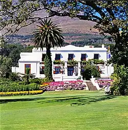 Above Hof Street, just behind Leeuwenhof, the official residence of the Administrator of the Cape, there is an interesting little group of buildings known as Botuin. It consists of a gabled house, a long building at right angles to it and high garden wall Type of site: House Current use: Residential.
"Botuin" was a portion of the historical old farm Leeuwenhof. |
| 9/2/018/0127/002 | Leeuwenhof, Hof Street, Cape Town | This important old Cape house, at present the official residence of the Administrator of the Cape Province, was built circa 1782 by J. C. Bräsler.
1693 Simon van der Stel granted land to Guillaum Heems, a Burgher Councillor at the Cape. House probably bu Type of site: House. This important old Cape house, at present the official residence of the Administrator of the Cape Province, was built circa 1782 by J. C. Bräsler. |
Cape Town, Oranjezicht | The Cape | Provincial Heritage Site | 33°56′17″S 18°24′21″E / 33.938184°S 18.405758°E |  This important old Cape house, at present the official residence of the Administrator of the Cape Province, was built circa 1782 by J. C. Bräsler.
1693 Simon van der Stel granted land to Guillaum Heems, a Burgher Councillor at the Cape. House probably bu Type of site: House. This important old Cape house, at present the official residence of the Administrator of the Cape Province, was built circa 1782 by J. C. Bräsler. |
| 9/2/018/0128 | Block bounded by Bree, Shortmarket, Hout & Buitengracht Streets, Erven 2081 | Cape Town | 33°55′14″S 18°25′06″E / 33.920483°S 18.418241°E |  | |||
| 9/2/018/0128-001 | 108 Shortmarket Street, Cape Town | Architectural style: CAPE DUTCH ELEMENTS. Current use: Commercial. | Cape Town, Central | The Cape | Provincial Heritage Site | 33°55′14″S 18°25′04″E / 33.920566°S 18.417789°E | Architectural style: CAPE DUTCH ELEMENTS. Current use: Commercial. |
| 9/2/018/0131 | Inn on the Square, Greenmarket Square, Cape Town | Cape Town, Central | The Cape | Provincial Heritage Site | 33°55′21″S 18°25′11″E / 33.922469°S 18.419665°E |  | |
| 9/2/018/0132 | Old Synagogue Jewish Museum, Gardens Avenue & Hatfield Street | Cape Town | 33°55′52″S 18°24′58″E / 33.930989°S 18.416092°E | Upload Photo | |||
| 9/2/018/0133 | Old Granary, Buitenkant Street, Cape Town | Cape Town | 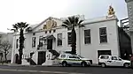 | ||||
| 9/2/018/0134 | Old gracht walls, Castle Street, Cape Town | Cape Town | 33°55′30″S 18°25′34″E / 33.925022°S 18.426123°E | Upload Photo | |||
| 9/2/018/0135 | Platteklip and mill, Van Riebeeck Park, Oranjezicht, Cape Town | Cape Town | 33°56′39″S 18°25′04″E / 33.944219°S 18.417739°E | Upload Photo | |||
| 9/2/018/0137 | St. Philip's Chapel,. Chapel Street, Zonnebloem | Cape Town | 33°55′45″S 18°26′09″E / 33.929102°S 18.435847°E | Upload Photo | |||
| 9/2/018/0138 | St. Mark's Church, St. Mark's Street, Zonnebloem, Cape Town | Cape Town | 33°55′52″S 18°25′52″E / 33.931006°S 18.431206°E | Upload Photo | |||
| 9/2/018/0139 | De Waal Park, Gardens, Cape Town | This park was originally part of the Van Breda estate, Oranjezicht. For 170 years the estate belonged to this family and it extended from the Platteklip Gorge against the slope of Table Mountain to Molteno Road and Camp Street. Type of site: Park. The De Waal Park was laid out through the endeavours of David Christiaan de Waal, M.L.A., Mayor of Cape Town (1889-90) and opened in 1895 as a park for the use of the general public. | Cape Town, Gardens | The Cape | Provincial Heritage Site | 33°56′12″S 18°24′45″E / 33.936796°S 18.412590°E | 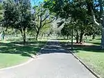 This park was originally part of the Van Breda estate, Oranjezicht. For 170 years the estate belonged to this family and it extended from the Platteklip Gorge against the slope of Table Mountain to Molteno Road and Camp Street. Type of site: Park. The De Waal Park was laid out through the endeavours of David Christiaan de Waal, M.L.A., Mayor of Cape Town (1889-90) and opened in 1895 as a park for the use of the general public. |
| 9/2/018/0140 | Church Square, Cape Town | Church Square.- One of the squares round which Cape Town developed. It was the square used by churchgoers of the Groote Kerk.
While he was still occupied with the building of his fort, Jan van Riebeeck started to lay out a garden between the fort and the Fresh River. As time went on, the garden was extended in the direction of the mountain. Type of site: Square. |
Cape Town, Central | The Cape | Provincial Heritage Site | 33°55′31″S 18°25′17″E / 33.925217°S 18.421377°E | 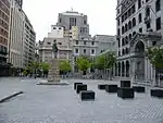 Church Square.- One of the squares round which Cape Town developed. It was the square used by churchgoers of the Groote Kerk.
While he was still occupied with the building of his fort, Jan van Riebeeck started to lay out a garden between the fort and the Fresh River. As time went on, the garden was extended in the direction of the mountain. Type of site: Square. |
| 9/2/018/0141 | Old Town House, Greenmarket Square, Cape Town | This building stands as a proud example of eighteenth century architecture and symbolises the development of local government in Cape Town.
When free colonists were created the Company granted them representation in the Council of Justice. Type of site: Town Hall. |
Cape Town, Central | The Cape | Provincial Heritage Site | 33°55′23″S 18°25′12″E / 33.923098°S 18.419903°E | 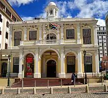 This building stands as a proud example of eighteenth century architecture and symbolises the development of local government in Cape Town.
When free colonists were created the Company granted them representation in the Council of Justice. Type of site: Town Hall. |
| 9/2/018/0142 | Rheezicht, Gorge Road, Cape Town | Type of site: House Current use: Dwelling. | Cape Town, Oranjezicht | The Cape | Provincial Heritage Site | 33°56′27″S 18°25′04″E / 33.940733°S 18.417762°E | Upload Photo |
| 9/2/018/0143 | 161 Long Street, Cape Town | Cape Town | 33°55′28″S 18°25′02″E / 33.924335°S 18.417294°E | Upload Photo | |||
| 9/2/018/0144 | Old Fire Station, Strand Street, Cape Town | Cape Town | Upload Photo | ||||
| 9/2/018/0145 | 25 Montrose Avenue, Oranjezicht, Cape Town | Cape Town | 33°56′29″S 18°24′34″E / 33.941301°S 18.409507°E | Upload Photo | |||
| 9/2/018/0146 | Gardens Commercial High School, Paddock Avenue, Gardens, Cape Town | Type of site: School Current use: School. | Cape Town, Gardens | The Cape | Provincial Heritage Site | 33°55′48″S 18°24′59″E / 33.929989°S 18.416350°E |  Type of site: School Current use: School. |
| 9/2/018/0149 | Company Gardens, Cape Town | This garden is situated on the site where commander van Riebeeck originally laid out a garden supply visiting ships with fresh provisions
The settlement at the Cape began with a fort and a garden. ""Choose . . . a place for the fort . . . Then choose good soil for the gardens . . . Also plant fruit trees.""These were some of Jan van Riebeeck’s instructions. So he built his Fort of Good Hope Type of site: Botanical Garden. " |
Cape Town, Central | The Cape | Provincial Heritage Site | 33°55′39″S 18°25′00″E / 33.927445°S 18.416663°E |  This garden is situated on the site where commander van Riebeeck originally laid out a garden supply visiting ships with fresh provisions
The settlement at the Cape began with a fort and a garden. ""Choose . . . a place for the fort . . . Then choose good soil for the gardens . . . Also plant fruit trees.""These were some of Jan van Riebeeck’s instructions. So he built his Fort of Good Hope Type of site: Botanical Garden.
" |
| 9/2/018/0150 | 178-196 Long Street, Cape Town | Cape Town, Central | The Cape | Provisional Protection | 33°55′32″S 18°24′57″E / 33.925474°S 18.415894°E |  | |
| 9/2/018/0151 | 5-7 Wandel Street, Gardens, Cape Town | Cape Town, Gardens | The Cape | Provincial Heritage Site | 33°55′54″S 18°25′02″E / 33.931627°S 18.417316°E |  | |
| 9/2/018/0152 | 15 Belvedere Avenue, Oranjezicht, Cape Town | Type of site: House. This imposing dwelling with its late-Victorian features was erected at the turn of the century. It is one of the earliest dwellings to be erected in Belvedere Avenue, which is itself an architecturally important area in the suburb of Oranjezicht. | Cape Town, Oranjezicht | The Cape | Provincial Heritage Site | 33°56′22″S 18°24′49″E / 33.939520°S 18.413473°E |  Type of site: House. This imposing dwelling with its late-Victorian features was erected at the turn of the century. It is one of the earliest dwellings to be erected in Belvedere Avenue, which is itself an architecturally important area in the suburb of Oranjezicht. |
| 9/2/018/0154 | DISTRICT SIX LOCAL AREA, GENERAL | Cape Town | Upload Photo | ||||
| 9/2/018/0158 | 15 Glynville Terrace, Gardens, Cape Town | Cape Town | Upload Photo | ||||
| 9/2/018/0159 | 3 Camp Street, Gardens, Cape Town | Cape Town | 33°56′04″S 18°24′37″E / 33.934412°S 18.410311°E | Upload Photo | |||
| 9/2/018/0160 | 5 Camp Street, Gardens, Cape Town | Cape Town | 33°56′04″S 18°24′37″E / 33.934320°S 18.410197°E | Upload Photo | |||
| 9/2/018/0161 | 1 Welgemeend Street, Gardens, Cape Town | Cape Town | 33°56′04″S 18°24′36″E / 33.934563°S 18.410040°E | Upload Photo | |||
| 9/2/018/0162 | 98 Long Street, Cape Town | Cape Town | 33°55′21″S 18°25′07″E / 33.922569°S 18.418668°E | Upload Photo | |||
| 9/2/018/0163 | Queens Hotel, Dock Road, Cape Town | Cape Town | 33°54′22″S 18°25′08″E / 33.906099°S 18.418955°E |  | |||
| 9/2/018/0165 | see 9/2/018/0067/4 | Cape Town | Upload Photo | ||||
| 9/2/018/0168 | Cape Gallery, 60 Church Street, Cape Town | Cape Town | 33°55′20″S 18°25′04″E / 33.922241°S 18.417754°E | Upload Photo | |||
| 9/2/018/0170 | Wagenaers Dam, Golden Acre, Adderley Street, Cape Town | Cape Town |  | ||||
| 9/2/018/0175 | Old National Mutual Building, 17 Church Square, Cape Town | Architectural style: CAPE REVIVAL. Type of site: Commercial Current use: Office. | Cape Town, Central | The Cape | Provincial Heritage Site | 33°55′30″S 18°25′18″E / 33.925116°S 18.421649°E |  Architectural style: CAPE REVIVAL. Type of site: Commercial Current use: Office. |
| 9/2/018/0176/1 | Old Stables, Salibury Street, Cape Town | Cape Town | Upload Photo | ||||
| 9/2/018/0177 | Old Slave Lodge, Adderley Street, Cape Town | The Old Supreme Court at the top of the former Heerengracht (now Adderley Street) and adjoining Church Square is a remarkable building. Its history, its architectural merits and its symbolic significance make it unique in South Africa.
The proper housing Previous use: Supreme Court, Slave Lodge. Current use: Museum. This building was originally completed in 1680 as the Dutch East India Company's Slave Lodge. It was converted for use as government offices in the 19th century by Thibault (Inspector of Government Buildings), Anreith (sculptor) and Schutte (contractor). |
Cape Town, Central | The Cape | Provincial Heritage Site | 33°55′30″S 18°25′13″E / 33.92513°S 18.42041°E |  The Old Supreme Court at the top of the former Heerengracht (now Adderley Street) and adjoining Church Square is a remarkable building. Its history, its architectural merits and its symbolic significance make it unique in South Africa.
The proper housing Previous use: Supreme Court, Slave Lodge. Current use: Museum. This building was originally completed in 1680 as the Dutch East India Company's Slave Lodge. It was converted for use as government offices in the 19th century by Thibault (Inspector of Government Buildings), Anreith (sculptor) and Schutte (contractor). |
| 9/2/018/0178 | Molteno Reservoir, Gardens, Cape Town | Cape Town | 33°56′19″S 18°24′44″E / 33.938571°S 18.412212°E | Upload Photo | |||
| 9/2/018/0179 | Hiddigh Campus, Orange Street, Cape Town | Cape Town | 33°55′47″S 18°24′47″E / 33.929775°S 18.412955°E |  | |||
| 9/2/018/0179/001 | Egyptian building, Orange Street, Cape Town | Just above Bertram House, also to the right of the Avenue, the so-called "Egyptian Building" of the University of Cape Town is situated. It lies concealed behind the old white wall of the Company’s park for beasts of prey and a beautiful gateway gives acc. This building was completed in 1841 for the South African College, later the University of Cape Town. It is the first building erected for higher education in South Africa and today still serves the same purpose. | Cape Town, Central | The Cape | Provincial Heritage Site | 33°55′49″S 18°24′50″E / 33.930271°S 18.413951°E |  Just above Bertram House, also to the right of the Avenue, the so-called "Egyptian Building" of the University of Cape Town is situated. It lies concealed behind the old white wall of the Company’s park for beasts of prey and a beautiful gateway gives acc. This building was completed in 1841 for the South African College, later the University of Cape Town. It is the first building erected for higher education in South Africa and today still serves the same purpose. |
| 9/2/018/0180 | IDASA, 6 Spin Street, Cape Town | This predominantly Edwardian building was erected in about 1902 and its design is attributed to Sir Herbert Baker. The building also forms an integral part of Church Square, which is bounded on all four sides by historical buildings. Current use: Commercial. | Cape Town, Central | The Cape | Provincial Heritage Site | 33°55′32″S 18°25′17″E / 33.925451°S 18.421479°E |  This predominantly Edwardian building was erected in about 1902 and its design is attributed to Sir Herbert Baker. The building also forms an integral part of Church Square, which is bounded on all four sides by historical buildings. Current use: Commercial. |
| 9/2/018/0181 | 134-136 Long Street, Cape Town | Architectural style: ART NOUVEAU ELEMENTS. Current use: Commercial. | Cape Town, Central | The Cape | Provincial Heritage Site | 33°55′25″S 18°25′03″E / 33.923696°S 18.417532°E |  Architectural style: ART NOUVEAU ELEMENTS. Current use: Commercial. |
| 9/2/018/0182 | King's blockhouse, Cape Town | After the First British occupation of the Cape in 1795, General J. H. Craig extended the French Line by building three more blockhouses further up Devil’s Peak. They were the Queen’s Blockhouse on the Zonnebloem estate, the Prince of Wales at a height of Type of site: Blockhouse Previous use: Fortification. | Cape Town | The Cape | Provincial Heritage Site | 33°57′02″S 18°27′01″E / 33.950566°S 18.450394°E |  After the First British occupation of the Cape in 1795, General J. H. Craig extended the French Line by building three more blockhouses further up Devil’s Peak. They were the Queen’s Blockhouse on the Zonnebloem estate, the Prince of Wales at a height of Type of site: Blockhouse Previous use: Fortification. |
| 9/2/018/0183 | Locomotive, Cape Town Station, Cape Town | Here in the midst of Cape Town in the modern railway station building stands a monument which calls our attention for a moment from the romantic past, epitomised in the Castle and Parade, to the realities of the age of the machine : an old railway engine. Type of site: Locomotive. | Cape Town, Central | The Cape | Heritage Object | 33°55′20″S 18°25′30″E / 33.922198°S 18.425021°E |  Here in the midst of Cape Town in the modern railway station building stands a monument which calls our attention for a moment from the romantic past, epitomised in the Castle and Parade, to the realities of the age of the machine : an old railway engine. Type of site: Locomotive. |
| 9/2/018/0184 | Good Hope Lodge, Cape Town | De Mist himself described the Lodge as the most beautiful in the world. The strong and bold façade of the building was, and still is, very striking. The interior was indeed impressive. From the entrance hall steps led up to the Temple—a huge hall with a f These buildings were erected in 1804, and are one of the most important examples of the collaboration of Anreith, Thibault and Schutte, the architect, the sculptor and the builder respectively, who exercised a great influence on architecture at the Cape a | Cape Town, Central | The Cape | Provincial Heritage Site | 33°55′43″S 18°25′05″E / 33.928635°S 18.417960°E | Upload Photo |
| 9/2/018/0186 | South African National Library, Cape Town | The old building of the South African Library was designed by W. H. Kohler in the neo-classical style. The foundation stone was laid by Sir George Grey in 1858 and the building was officially opened by Prince Alfred in 1860.
The library was established Type of site: Library. |
Cape Town, Central | The Cape | Provincial Heritage Site | 33°55′32″S 18°25′07″E / 33.925465°S 18.418669°E |  The old building of the South African Library was designed by W. H. Kohler in the neo-classical style. The foundation stone was laid by Sir George Grey in 1858 and the building was officially opened by Prince Alfred in 1860.
The library was established Type of site: Library. |
| 9/2/018/0187 | 122 Bree Street, Cape Town | This house is one of the few remaining Georgian double-storeyed houses in Cape Town, and is therefore an inalienable part of the city's architectural heritage. | Cape Town, Central | The Cape | Provincial Heritage Site | 33°55′20″S 18°25′00″E / 33.922224°S 18.416656°E |  This house is one of the few remaining Georgian double-storeyed houses in Cape Town, and is therefore an inalienable part of the city's architectural heritage. |
| 9/2/018/0188 | 173 Bree Street, Cape Town | Type of site: Commercial Current use: Shop. In its present form this Victorian double-storeyed shop building with its cast-iron balcony dates from the end of the nineteenth century. | Cape Town, Central | The Cape | Provincial Heritage Site | 33°55′26″S 18°24′55″E / 33.924022°S 18.415262°E | 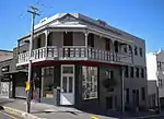 Type of site: Commercial Current use: Shop. In its present form this Victorian double-storeyed shop building with its cast-iron balcony dates from the end of the nineteenth century. |
| 9/2/018/0189 | Jan de Waal House, 93 Bree Street, Cape Town | Jan de Waal House is a double-storey five-bay town house with a shallow rusticated plaster front and finely detailed Georgian teak joinery (c. 1830). It also has an eight panelled entrance door with fanlight, as well as sashes, louvered shutters and a cem This double-storeyed house with its predominantly Georgian characteristics was presumably erected by Jan de Waal shortly after the property was granted to him in 1752 by the Governor Ryk Tulbagh. The present Georgian windows and door replaced those in the Architectural style: GEORGIAN ELEMENTS. Type of site: House Current use: Commercial. The erf of which this Georgian double-storeyed house stands, was granted to Jan de Waal in 1752. The house, which was presumably erected shortly afterwards, received its Georgian character early in the nineteenth century. | Cape Town, Central | The Cape | Provincial Heritage Site | 33°55′16″S 18°25′07″E / 33.921066°S 18.418547°E | 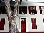 Jan de Waal House is a double-storey five-bay town house with a shallow rusticated plaster front and finely detailed Georgian teak joinery (c. 1830). It also has an eight panelled entrance door with fanlight, as well as sashes, louvered shutters and a cem This double-storeyed house with its predominantly Georgian characteristics was presumably erected by Jan de Waal shortly after the property was granted to him in 1752 by the Governor Ryk Tulbagh. The present Georgian windows and door replaced those in the Architectural style: GEORGIAN ELEMENTS. Type of site: House Current use: Commercial. The erf of which this Georgian double-storeyed house stands, was granted to Jan de Waal in 1752. The house, which was presumably erected shortly afterwards, received its Georgian character early in the nineteenth century. |
| 9/2/018/0190 | Bertram House, Government Avenue, Cape Town | This house clearly expresses the more important features of Georgian architecture. The exterior is undistinguished—a cube-shaped double-storeyed building in which the natural colour of its unplastered and un coloured brick walls is emphasised. It has sash Bertram House, which occupies an important place in the history of South African architecture, is one of several buildings erected within the original confines of the Dutch East India Company’s garden. It is partly hidden by a high wall near the top of th Type of site: House Previous use: Residential. Current use: Museum. Bertram House is probably the only surviving example of the brick houses of the English Georgian style. It was built during the first quarter of the nineteenth century. | Cape Town, Central | The Cape | Provincial Heritage Site | 33°55′50″S 18°24′49″E / 33.930558°S 18.413736°E |  This house clearly expresses the more important features of Georgian architecture. The exterior is undistinguished—a cube-shaped double-storeyed building in which the natural colour of its unplastered and un coloured brick walls is emphasised. It has sash Bertram House, which occupies an important place in the history of South African architecture, is one of several buildings erected within the original confines of the Dutch East India Company’s garden. It is partly hidden by a high wall near the top of th Type of site: House Previous use: Residential. Current use: Museum. Bertram House is probably the only surviving example of the brick houses of the English Georgian style. It was built during the first quarter of the nineteenth century. |
| 9/2/018/0191 | WALMER ESTATE LOCAL AREA, GENERAL | Cape Town | Upload Photo | ||||
| 9/2/018/0192 | 14 Keerom Street, Cape Town | This typical Cape eighteenth-century town house is situated on land which was originally granted to Hermanus Smuts in 1751 and is an important link with Cape Town's past. | Cape Town, Central | The Cape | Provincial Heritage Site | 33°55′28″S 18°25′03″E / 33.924564°S 18.417627°E | Upload Photo |
| 9/2/018/0193 | Blue Lodge, 206-208 Long Street, Cape Town | The Blue Lodge Hotel consists of a treble-storeyed building with two balconies and a steep roof with dormer windows, pinnacled gables and a corner turret of exuberant late-victorian design, just before 1900. The balconies have intricate moulded MacFarlane This impressive late Victorian building, which was erected at the turn of the century, forms an integral part of the architectural character of Long Street, a part of Cape Town where a uniformity of character has to a large extent remained. Architectural style: VICTORIAN. Type of site: Commercial. This impressive late Victorian building, which was erected at the turn of the century, forms an integral part of the architectural character of Long Street, a part of Cape Town where a uniformity of character has to a large extent remained. | Cape Town, Central | The Cape | Provincial Heritage Site | 33°55′30″S 18°24′59″E / 33.925019°S 18.416357°E | 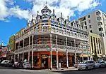 The Blue Lodge Hotel consists of a treble-storeyed building with two balconies and a steep roof with dormer windows, pinnacled gables and a corner turret of exuberant late-victorian design, just before 1900. The balconies have intricate moulded MacFarlane This impressive late Victorian building, which was erected at the turn of the century, forms an integral part of the architectural character of Long Street, a part of Cape Town where a uniformity of character has to a large extent remained. Architectural style: VICTORIAN. Type of site: Commercial. This impressive late Victorian building, which was erected at the turn of the century, forms an integral part of the architectural character of Long Street, a part of Cape Town where a uniformity of character has to a large extent remained. |
| 9/2/018/0194 | SA Mission Foundation Museum, 40 Long Street, Cape Town | The Sendinggestig, which is the oldest indigenous mission church in the country, was erected shortly after the establishment of the South African Mission Society in 1799. The building was completed early in 1804 and consecrated on 15 March 1804 by the Rev Type of site: Church Current use: Museum. | Cape Town, Central | The Cape | Provincial Heritage Site | 33°55′16″S 18°25′13″E / 33.921080°S 18.420299°E | 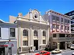 The Sendinggestig, which is the oldest indigenous mission church in the country, was erected shortly after the establishment of the South African Mission Society in 1799. The building was completed early in 1804 and consecrated on 15 March 1804 by the Rev Type of site: Church Current use: Museum. |
| 9/2/018/0195 | Old YWCA Building, 78 Long Street, Cape Town | The YWCA is a triple-storeyed Victorian building with a double-level cast-iron verandah. The main entrance doors are twin four-panelled teak doors. The ground floor has a grey granite surround with chrome trim around large windows. The facade of the build This Victorian building, which was rebuilt in 1903 by J. Parker of the firm Forsyth and Parker and dedicated to the memory of Minnie and Maria, daughters of J. A. Bam who died in Germany, forms an integral part of the architectural character of Long Street Architectural style: VICTORIAN. Type of site: YWCA Current use: Commercial. | Cape Town, Central | The Cape | Provincial Heritage Site | 33°55′20″S 18°25′10″E / 33.922307°S 18.419336°E |  The YWCA is a triple-storeyed Victorian building with a double-level cast-iron verandah. The main entrance doors are twin four-panelled teak doors. The ground floor has a grey granite surround with chrome trim around large windows. The facade of the build This Victorian building, which was rebuilt in 1903 by J. Parker of the firm Forsyth and Parker and dedicated to the memory of Minnie and Maria, daughters of J. A. Bam who died in Germany, forms an integral part of the architectural character of Long Street Architectural style: VICTORIAN. Type of site: YWCA Current use: Commercial. |
| 9/2/018/0196 | Huguenot Memorial Building, 48 Queen Victoria Street, Cape Town | This predominantly Edwardian building was erected by the Synod of the Dutch Reformed Church to commemorate the arrival of the French Huguenots (1688). The foundation stone was laid on 24 August 1899 and the building was officially opened on 15 October 190 Type of site: Memorial Current use: Institutional. | Cape Town, Central | The Cape | Provincial Heritage Site | 33°55′35″S 18°25′01″E / 33.926309°S 18.416921°E |  This predominantly Edwardian building was erected by the Synod of the Dutch Reformed Church to commemorate the arrival of the French Huguenots (1688). The foundation stone was laid on 24 August 1899 and the building was officially opened on 15 October 190 Type of site: Memorial Current use: Institutional. |
| 9/2/018/0197 | Martin Melck House, Strand Street, Cape Town | When he built the "warehouse", Martin Melck kept the eventual need for a parsonage in mind and took care to have possession of the land to the east of the church. At a later stage he transferred it to the church and after his death a parsonage was built o | Cape Town, Central | The Cape | Provincial Heritage Site | 33°55′09″S 18°25′11″E / 33.919157°S 18.419645°E | ![When he built the "warehouse", Martin Melck kept the eventual need for a parsonage in mind and took care to have possession of the land to the east of the church. At a later stage he transferred it to the church and after his death a parsonage was built o[clarification needed]](../I/Martin_Melck_House.JPG.webp) When he built the "warehouse", Martin Melck kept the eventual need for a parsonage in mind and took care to have possession of the land to the east of the church. At a later stage he transferred it to the church and after his death a parsonage was built o |
| 9/2/018/0198 | Koopmans-de Wet House, 35 Strand Street, Cape Town | The first street in Cape Town was Sea Street, directly opposite Van Riebeeck’s Fort of Good Hope, along the beach to the west of the Heerengracht. This street today is far from the sea. Type of site: House Previous use: House. Current use: Museum. | Cape Town, Central | The Cape | Provincial Heritage Site | 33°55′15″S 18°25′17″E / 33.920937°S 18.421303°E |  The first street in Cape Town was Sea Street, directly opposite Van Riebeeck’s Fort of Good Hope, along the beach to the west of the Heerengracht. This street today is far from the sea. Type of site: House Previous use: House. Current use: Museum. |
| 9/2/018/0199 | Sexton's House, Strand Street, Cape Town | This building at the corner of Strand and Buitengracht Streets was probably built at the same time as the Parsonage, that is between 1779 and 1783. It was originally separated from the Church by another house which the Church Council let out to tenants, b | Cape Town, Central | The Cape | Provincial Heritage Site | 33°55′08″S 18°25′10″E / 33.918878°S 18.419492°E | ![This building at the corner of Strand and Buitengracht Streets was probably built at the same time as the Parsonage, that is between 1779 and 1783. It was originally separated from the Church by another house which the Church Council let out to tenants, b[clarification needed]](../I/Sexton's_House.JPG.webp) This building at the corner of Strand and Buitengracht Streets was probably built at the same time as the Parsonage, that is between 1779 and 1783. It was originally separated from the Church by another house which the Church Council let out to tenants, b |
| 9/2/018/0200 | Zorgwyk, 36 Breda Street, Gardens, Cape Town | This house, which was built predominantly in the Georgian style, was originally the homestead of the loan farm Zorgwyk. The house, which is indicated on a map of 1820, is one of but a few of the homesteads of the early loan farms in the Upper Table Valley Type of site: House Current use: House. | Cape Town, Gardens | The Cape | Provincial Heritage Site | 33°56′16″S 18°24′58″E / 33.937646°S 18.416228°E | Upload Photo |
| 9/2/018/0201 | 3 Faure Street, Gardens, Cape Town | This house, which was erected in the late nineteenth century, consists of a single-storeyed building with bay window and finely decorated cast-iron verandah. The entrance has a single teak door with side and fanlights. The windows are all large-paned sash. This house with its impressive Cast-iron verandah dates from the late nineteenth century. It is an excellent example of late Victorian architecture. | Cape Town, Gardens | The Cape | Provincial Heritage Site | 33°55′47″S 18°24′43″E / 33.929810°S 18.411991°E | Upload Photo |
| 9/2/018/0202 | 7 Glynville Terrace, Gardens, Cape Town | Type of site: Terraced House. | Cape Town, Gardens | The Cape | Provincial Heritage Site | 33°55′55″S 18°25′00″E / 33.931994°S 18.416748°E |  Type of site: Terraced House. |
| 9/2/018/0203 | Ravenswood, Hatfield Street, Gardens, Cape Town | Ravenswood House is the only known example in Cape Town of the late classical Georgian architectural style of the beginning of the 19th century. This double-storeyed building was probably erected between 1817 and 1835 by M. A. de Kock as one of a series o Type of site: House. | Cape Town, Gardens | The Cape | Provincial Heritage Site | 33°55′55″S 18°24′55″E / 33.931900°S 18.415180°E | 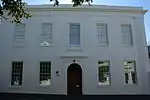 Ravenswood House is the only known example in Cape Town of the late classical Georgian architectural style of the beginning of the 19th century. This double-storeyed building was probably erected between 1817 and 1835 by M. A. de Kock as one of a series o Type of site: House. |
| 9/2/018/0204 | Waterhof, 56 Hof Street, Gardens, Cape Town | "Waterhof" was originally a part of Leeuwenhof, but became a separate property in 1782. The house was probably built in 1785 or 1786 and is one of the historic 18th-century houses on the slopes of Table Mountain.
Just below Leeuwenhof, on the opposite s Type of site: House. "Waterhof" was originally a part of Leeuwenhof, but became a separate property in 1782. The house was probably built in 1785 or 1786 and is one of the historic 18th-century houses on the slopes of Table Mountain. |
Cape Town, Gardens | The Cape | Provincial Heritage Site | 33°56′14″S 18°24′28″E / 33.93713°S 18.407830°E | Upload Photo |
| 9/2/018/0205 | Anrieth pediment, Glaston House, 127-139 Bree Street, Cape Town | As the town developed in the direction of Signal Hill at the end of the eighteenth century, the smart residential area of the rich merchants began to expand from Sea Street (Strand Street) towards Bree Street. Only a few stately eighteenth century double- . In the cornice and pediment there is a sculpture designed by well-known Cape architect Anton Anreith. It is the only example left of such embossment on a building in Cape Town, of which there were formerly at least twenty. | Cape Town, Central | The Cape | Heritage Object | 33°55′11″S 18°24′38″E / 33.919644°S 18.410580°E | ![As the town developed in the direction of Signal Hill at the end of the eighteenth century, the smart residential area of the rich merchants began to expand from Sea Street (Strand Street) towards Bree Street. Only a few stately eighteenth century double- .[clarification needed] In the cornice and pediment there is a sculpture designed by well-known Cape architect Anton Anreith. It is the only example left of such embossment on a building in Cape Town, of which there were formerly at least twenty.](../I/Anrieth_pediment_in_background.jpg.webp) As the town developed in the direction of Signal Hill at the end of the eighteenth century, the smart residential area of the rich merchants began to expand from Sea Street (Strand Street) towards Bree Street. Only a few stately eighteenth century double- . In the cornice and pediment there is a sculpture designed by well-known Cape architect Anton Anreith. It is the only example left of such embossment on a building in Cape Town, of which there were formerly at least twenty. |
| 9/2/018/0207 | 7 Union Street, Gardens, Cape Town | This is an impressive late nineteenth-century house surrounded by a low masonry wall, with cast-iron infill. There are two bay windows on a projecting bay and the other a corner bay beneath the turret. There is a verandah running two lengths of the building. This impressive house, with its unusual hexagonal turret that surmounts the front verandah, was presumably erected in 1895. Its magnificent marble fireplaces are an exceptional feature. | Cape Town, Gardens | The Cape | Provincial Heritage Site | 33°56′00″S 18°24′38″E / 33.933326°S 18.410617°E | 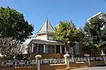 This is an impressive late nineteenth-century house surrounded by a low masonry wall, with cast-iron infill. There are two bay windows on a projecting bay and the other a corner bay beneath the turret. There is a verandah running two lengths of the building. This impressive house, with its unusual hexagonal turret that surmounts the front verandah, was presumably erected in 1895. Its magnificent marble fireplaces are an exceptional feature. |
| 9/2/018/0208 | 5 Upper Union Street, Gardens, Cape Town | Type of site: House Previous use: Residential. Current use: Commercial. | Cape Town, Gardens | The Cape | Provincial Heritage Site | 33°55′55″S 18°24′30″E / 33.931816°S 18.408214°E | Upload Photo |
| 9/2/018/0209 | Somerset Hospital, Green Point, Cape Town | East wing added in 1891. Verandahs added 1897 Queen's Jubilee The "New Somerset Hospital" was opened in 1862. It was the first hospital where doctors were trained in South Africa and played an important part in the history of Hospitals. Type of site: Hospital. | Cape Town, Green Point | The Cape | Provincial Heritage Site | 33°54′16″S 18°25′01″E / 33.904504°S 18.416952°E | 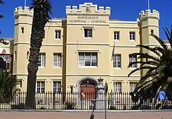 East wing added in 1891. Verandahs added 1897 Queen's Jubilee The "New Somerset Hospital" was opened in 1862. It was the first hospital where doctors were trained in South Africa and played an important part in the history of Hospitals. Type of site: Hospital. |
| 9/2/018/0210 | De Goede Verwachting, 17 Cavalcade Road, Green Point, Cape Town | De Goede Verwachting, which bears the date 1815 on its moulded front, is a building in the Georgian neo classical style. It stands in Cavalcade Road, Green Point, which is reached from York Road which turns sharply off the main road in a southerly direction.
A fine example of an early nineteenth-century house at the Cape. It bears the date 1815 and is an example of a Georgian house in the neo-classicistic style of building. |
Cape Town, Green Point | The Cape | Provincial Heritage Site | 33°54′35″S 18°24′33″E / 33.909700°S 18.409269°E | Upload Photo |
| 9/2/018/0214 | San Remo, Camp Street, Gardens, Cape Town | Cape Town | Upload Photo | ||||
| 9/2/018/0215 | 105 Hatfield Street, Gardens, Cape Town | Cape Town | 33°55′52″S 18°24′58″E / 33.931189°S 18.416023°E | Upload Photo | |||
| 9/2/018/0216 | Chimney, 9 Bree Street, Cape Town | Cape Town | 33°55′04″S 18°25′20″E / 33.917767°S 18.422158°E | Upload Photo | |||
| 9/2/018/0217 | Van Breda memorial and graves, 8 Montrose Avenue, Oranjezicht, Cape | Cape Town | 33°56′28″S 18°24′47″E / 33.941206°S 18.413015°E | Upload Photo | |||
| 9/2/018/0219 | Hurling Pump, Prince Street, Cape Town | The old pump-house at the corner of Prince and Sir George Grey Streets is a completely different kind of structure from the stately houses at the foot of Table Mountain. From the seventeenth century onwards water for domestic purposes was carried by slave Type of site: Pump. | Cape Town, Gardens | The Cape | Provincial Heritage Site | 33°56′17″S 18°24′56″E / 33.937949°S 18.415646°E | 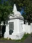 The old pump-house at the corner of Prince and Sir George Grey Streets is a completely different kind of structure from the stately houses at the foot of Table Mountain. From the seventeenth century onwards water for domestic purposes was carried by slave Type of site: Pump. |
| 9/2/018/0220 | 7 Belvedere Avenue, Oranjezicht, Cape Town | Cape Town, Oranjezicht | The Cape | Provincial Heritage Site | 33°56′23″S 18°24′53″E / 33.939654°S 18.414618°E |  | |
| 9/2/018/0222 | 21 Belvedere Avenue, Oranjezicht, Cape Town | Type of site: House. This impressive double-storeyed manor-house, which was erected shortly after the turn of the century, is an excellent example of Edwardian architecture, and has neo classical and Victorian features. | Cape Town, Oranjezicht | The Cape | Provincial Heritage Site | 33°56′22″S 18°24′46″E / 33.939435°S 18.412877°E | 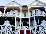 Type of site: House. This impressive double-storeyed manor-house, which was erected shortly after the turn of the century, is an excellent example of Edwardian architecture, and has neo classical and Victorian features. |
| 9/2/018/0223 | 23 Belvedere Avenue, Oranjezicht, Cape Town | Cape Town, Oranjezicht | The Cape | Provincial Heritage Site | 33°56′22″S 18°24′45″E / 33.939426°S 18.412628°E | 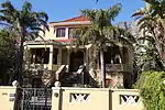 | |
| 9/2/018/0224 | Villa Catharina, 1 Rosebank Place, Oranjezicht, Cape Town | This double-storey Victorian house is at the end of a row of attached town houses. It has an asbestos cement slate roof with a tall chimney and double-storey triangular bay window. The gable extends out over the barge decoration the cast-iron vent.
The do Type of site: House. This beautiful Victorian row house, which dates from the late nineteenth century, is an excellent and well-preserved example of its kind. The front facade is particularly good, with excellent detailing. The decorative barge ornamentation and orpate cast i |
Cape Town, Oranjezicht | The Cape | Provincial Heritage Site | 33°56′14″S 18°24′52″E / 33.937310°S 18.414477°E | 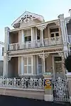 This double-storey Victorian house is at the end of a row of attached town houses. It has an asbestos cement slate roof with a tall chimney and double-storey triangular bay window. The gable extends out over the barge decoration the cast-iron vent.
The do Type of site: House. This beautiful Victorian row house, which dates from the late nineteenth century, is an excellent and well-preserved example of its kind. The front facade is particularly good, with excellent detailing. The decorative barge ornamentation and orpate cast i |
| 9/2/018/0225 | Muritai, 22 Rosemount Avenue, Oranjezicht, Cape Town | Type of site: House. | Cape Town, Oranjezicht | The Cape | Provincial Heritage Site | 33°56′25″S 18°24′54″E / 33.940166°S 18.414988°E | 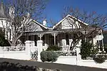 Type of site: House. |
| 9/2/018/0231 | St Cyprians School, Belmonth Avenue, Oranjezicht, Cape Town | Cape Town | 33°56′32″S 18°25′02″E / 33.942192°S 18.417216°E |  | |||
| 9/2/018/0231/001 | Gateway and walls, St Cyprian's School, Belmont Avenue, Oranjezicht, Cape Town | This gateway and these walls date from the end of the 18th century and are situated on a portion of the historic Nooitgedacht property. Because of the impressive architectural style of the gateway and walls it is often stated that they were designed by Lo Type of site: Gateway. | Cape Town, Oranjezicht | The Cape | Provincial Heritage Site | 33°56′27″S 18°25′01″E / 33.940846°S 18.416995°E | This gateway and these walls date from the end of the 18th century and are situated on a portion of the historic Nooitgedacht property. Because of the impressive architectural style of the gateway and walls it is often stated that they were designed by Lo Type of site: Gateway. |
| 9/2/018/0234 | Houses of Parliament, Parliament Street, Cape Town | The Garden and Avenue are of such an age that even buildings that must be regarded as encroaching on them have achieved historical importance. The Houses of Parliament at the lower end of the Avenue were completed in 1885. The building was to serve for tw Architectural style: NEO CLASSICAL ELEMENTS. Type of site: Government Current use: Parliament. | Cape Town, Central | The Cape | National Heritage Site | 33°55′32″S 18°25′10″E / 33.925627°S 18.41937°E | 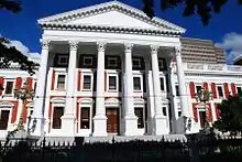 The Garden and Avenue are of such an age that even buildings that must be regarded as encroaching on them have achieved historical importance. The Houses of Parliament at the lower end of the Avenue were completed in 1885. The building was to serve for tw Architectural style: NEO CLASSICAL ELEMENTS. Type of site: Government Current use: Parliament. |
| 9/2/018/0235 | Tuynhuys, Stalplein, Cape Town | Architectural style: CAPE DUTCH. Type of site: Government House Current use: Residential. | Cape Town, Central | The Cape | Provincial Heritage Site | 33°55′38″S 18°25′07″E / 33.927351°S 18.418538°E | 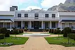 Architectural style: CAPE DUTCH. Type of site: Government House Current use: Residential. |
| 9/2/018/0236 | St. Mary's Cathedral, Roeland Street, Cape Town | Cape Town | 33°55′42″S 18°25′10″E / 33.928260°S 18.419388°E | _Front.jpg.webp) | |||
| 9/2/018/0237 | 46-56 Barnet Street, Gardens, Cape Town | Cape Town | 33°55′52″S 18°25′00″E / 33.931181°S 18.416729°E | Upload Photo | |||
| 9/2/018/0237/001 | 46 Barnet Street, Gardens, Cape Town | These three double-storeyed houses form an integral part of a row of six similar late-nineteenth-century terraced houses with Georgian and Victorian features. These three double-storeyed houses form an integral part of a row of six similar late-nineteenth-century terraced houses with Georgian and Victorian features. | Cape Town, Gardens | The Cape | Provincial Heritage Site | 33°55′52″S 18°25′00″E / 33.931134°S 18.416791°E | Upload Photo |
| 9/2/018/0237/002 | 48 Barnet Street, Gardens, Cape Town | These three double-storeyed houses form an integral part of a row of six similar late-nineteenth-century terraced houses with Georgian and Victorian features. These three double-storeyed houses form an integral part of a row of six similar late-nineteenth-century terraced houses with Georgian and Victorian features. | Cape Town, Gardens | The Cape | Provincial Heritage Site | 33°55′52″S 18°25′00″E / 33.931180°S 18.416730°E | Upload Photo |
| 9/2/018/0237/006 | 56 Barnet Street, Gardens, Cape Town | These three double-storeyed houses form an integral part of a row of six similar late-nineteenth-century terraced houses with Georgian and Victorian features. | Cape Town, Gardens | The Cape | Provincial Heritage Site | 33°55′53″S 18°25′00″E / 33.931305°S 18.416610°E | Upload Photo |
| 9/2/018/0237/3 | 50 Barnet Street, Gardens, Cape Town | Cape Town | 33°55′52″S 18°25′00″E / 33.931218°S 18.416688°E | Upload Photo | |||
| 9/2/018/0237/4 | 52 Barnet Street, Gardens, Cape Town | Cape Town | 33°55′53″S 18°25′00″E / 33.931260°S 18.416649°E | Upload Photo | |||
| 9/2/018/0237/5 | 54 Barnet Street, Gardens, Cape Town | Cape Town | 33°55′53″S 18°25′00″E / 33.931299°S 18.416610°E | Upload Photo | |||
| 9/2/018/0239 | Old Mutual Building, Darling Street, Cape Town | Cape Town | 33°55′27″S 18°25′21″E / 33.924185°S 18.422426°E | Upload Photo | |||
| 9/2/018/0240 | ORANJEZICHT, GENERAL | Cape Town | Upload Photo | ||||
| 9/2/018/0242 | Government Avenue, Cape Town | The Government Avenue which even today gives its own particular character to the Gardens and, indeed, to Cape Town, was mentioned as early as 1685 by Chavalier de Chaumont : "The main walk, which is fourteen hundred and fifty paces (about I 305 metres) lo Type of site: Avenue. | Cape Town, Central | The Cape | Provincial Heritage Site | 33°55′37″S 18°25′05″E / 33.926930°S 18.417919°E |  The Government Avenue which even today gives its own particular character to the Gardens and, indeed, to Cape Town, was mentioned as early as 1685 by Chavalier de Chaumont : "The main walk, which is fourteen hundred and fifty paces (about I 305 metres) lo Type of site: Avenue. |
| 9/2/018/0242/001 | Western Gateway (Lioness gate), Government Avenue, Cape Town | The walls and gates are part of the improvements made in the avenue by the well-known architect Thibault in 1803-1804 at the instance of Governor Janssens. The lionesses at the western gate is the work of Anreith. This gate is therefore an example of the co-operation between these famous artists. The lionesses on the western gateway (Signal Hill side) are still the original sculptures of Anreith.[3] In the course of years the lionesses on the western gateway were damaged, but they were restored at the request of the Commission.[4] Type of site: Gateway. | Cape Town, Central | The Cape | Provincial Heritage Site | 33°55′49″S 18°24′51″E / 33.930191°S 18.414299°E |  The walls and gates are part of the improvements made in the avenue by the well-known architect Thibault in 1803-1804 at the instance of Governor Janssens. The lionesses at the western gate is the work of Anreith. This gate is therefore an example of the co-operation between these famous artists. The lionesses on the western gateway (Signal Hill side) are still the original sculptures of Anreith.[3] In the course of years the lionesses on the western gateway were damaged, but they were restored at the request of the Commission.[4] Type of site: Gateway. |
| 9/2/018/0242/002 | Eastern Gateway (Lion gate), Government Avenue, Cape Town | The walls and gates are part of the improvements made in the avenue by the well-known architect Thibault in 1803-1804 at the instance of Governor Janssens.[5] The original lions on this gate, the work of Anreith, were removed in the 19th century, and replaced in the 1950s with the modern lion sculptures of Ivan Mitford-Barberton.[3] Type of site: Gateway. | Cape Town, Central | The Cape | Provincial Heritage Site | 33°55′49″S 18°24′52″E / 33.930299°S 18.414440°E | The walls and gates are part of the improvements made in the avenue by the well-known architect Thibault in 1803-1804 at the instance of Governor Janssens.[5] The original lions on this gate, the work of Anreith, were removed in the 19th century, and replaced in the 1950s with the modern lion sculptures of Ivan Mitford-Barberton.[3] Type of site: Gateway. |
| 9/2/018/0243 | Conservation areas, Cape Town | Cape Town | Upload Photo | ||||
| 9/2/018/0243/1 | Conservation areas, Central Cape Town | Cape Town | Upload Photo | ||||
| 9/2/018/0244 | Old Gaol, Roeland Street, Cape Town | Type of site: Gaol Previous use: Prison. Current use: Archives. | Cape Town, Central | The Cape | Provincial Heritage Site | 33°55′54″S 18°25′26″E / 33.931559°S 18.423799°E | 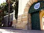 Type of site: Gaol Previous use: Prison. Current use: Archives. |
| 9/2/018/0246 | Preserverance Tavern, 83 Buitenkant Street, Cape Town | Cape Town | 33°55′50″S 18°25′15″E / 33.930500°S 18.420855°E |  | |||
| 9/2/018/0247 | Stemmets Building, 48 Corporation Street, Cape Town | Cape Town | 33°55′33″S 18°25′21″E / 33.925843°S 18.422556°E | Upload Photo | |||
| 9/2/018/0248 | see 9/2/018/0022 | Cape Town | Upload Photo | ||||
| 9/2/018/0249 | Admiralty Oar, SA Cultural History Museum, Cape Town | The symbolic Vice-Admiralty oar of the Cape of Good Hope is a rare George III oar, with cylindrical shaft, two moulded knobs, larger detachable terminal button and flat blade. It is engraved with the Royal Arms, the eagle and thunderbolt of Zeus, the foul | Cape Town, Central | The Cape | Heritage Object | 33°55′21″S 18°25′21″E / 33.922428°S 18.422408°E | 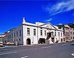 The symbolic Vice-Admiralty oar of the Cape of Good Hope is a rare George III oar, with cylindrical shaft, two moulded knobs, larger detachable terminal button and flat blade. It is engraved with the Royal Arms, the eagle and thunderbolt of Zeus, the foul |
| 9/2/018/0250 | Old Vredehoek Synagogue, 16 Vredehoek Avenue, Vredehoek, Cape Town | Cape Town | 33°56′13″S 18°25′09″E / 33.936919°S 18.419028°E | 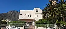 | |||
| 9/2/018/0253 | 256 Buitengracht Street, Cape Town | Cape Town | 33°55′38″S 18°24′39″E / 33.927143°S 18.410747°E | Upload Photo | |||
| 9/2/018/0258 | T Gibson Building, 34 Long Street, Cape Town | The T Gibson building in Long street, Cape Town is a two-storey building with a unique terracotta hard burnt clay finish. Designed by architect Anthony M de Witt, this building was originally occupied by Sellers Gents Outfitters, and later it became an art gallery. Current use: Commercial. | Cape Town, Central | The Cape | Provisional Protection | 33°55′15″S 18°25′15″E / 33.920716°S 18.420707°E | 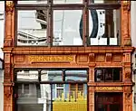 The T Gibson building in Long street, Cape Town is a two-storey building with a unique terracotta hard burnt clay finish. Designed by architect Anthony M de Witt, this building was originally occupied by Sellers Gents Outfitters, and later it became an art gallery. Current use: Commercial. |
| 9/2/018/0262 | Block bounded by Ebenezer, Prestwitch, Liddle & Somerset Roads | Cape Town | Upload Photo | ||||
| 9/2/018/0263 | Miniature Ship Models, S A Maritime Museum, V & A Waterfront, Cape | Cape Town | 33°54′25″S 18°25′21″E / 33.906905°S 18.422483°E | Upload Photo | |||
| 9/2/018/0268 | 47 De Villiers Street, Cape Town | Cape Town | Upload Photo | ||||
| 9/2/018/0271 | The Town Fountains and remains of Oranjezicht Estate, Oranjezicht, Cape Town | Cape Town, Oranjezicht | The Cape | Provincial Heritage Site | 33°56′31″S 18°24′52″E / 33.941983°S 18.414557°E |  | |
| 9/2/018/0274 | Hanover Street, District Six, Cape Town | Cape Town | 33°55′41″S 18°25′41″E / 33.928035°S 18.428008°E | Upload Photo | |||
| 9/2/018/0275 | Terrace Houses, Osborne and Francis Streets, District Six, Cape Town | Type of site: Terrace. | Cape Town, District Six | The Cape | Provincial Heritage Site | 33°55′42″S 18°26′22″E / 33.928333°S 18.439390°E | Upload Photo |
| 9/2/018/0282 | Block Bounded By Darling, Plein, Castle and Parliament Streets, CAPE TOWN, | Cape Town | Upload Photo | ||||
| 9/2/018/0285 | Lion Battery, Military Road, Cape Town | Cape Town | .jpg.webp) | ||||
| 9/2/018/0289 | GARDENS LOCAL AREA, GENERAL | Cape Town | Upload Photo | ||||
| 9/2/018/0291 | FRESNAYE LOCAL | Cape Town | Upload Photo | ||||
| 9/2/018/0293 | Standard Bank Building, Adderley Street | Cape Town | 33°55′24″S 18°25′19″E / 33.92341065300219°S 18.422039353444145°E |  | |||
| 9/2/018/0297 | Culembourg Site, Cape Town | Cape Town | Upload Photo | ||||
| 9/2/018/0301 | "Rosmead", 29 Rosmead Avenue, Oranjezicht | Cape Town | 33°56′24″S 18°24′28″E / 33.939945°S 18.407712°E | Upload Photo | |||
| 9/2/018/0302 | Congregational Church, Harrington Street, Cape Town | Cape Town | 33°55′45″S 18°25′22″E / 33.929039800989536°S 18.42276480934171°E | Upload Photo | |||
| 9/2/018/0303 | FORESHORE LOCAL AREA, GENERAL | Cape Town | Upload Photo | ||||
| 9/2/018/0317 | Van Plettenberg Beacon, SA Cultural History Museum, Cape Town | The beacon is two metres high and consists of two fiat, blue slate slabs, about 30 centimetres wide, 13 cm thick and bolted with lead. On 6 November 1778, Governor Joachim Baron van Plettenberg and his party, after an extensive journey which took them as far as the present Colesberg, arrived at this bay at which the Keurbooms and Piesangs Rivers flow into the sea and now renamed it, o Type of site: Beacon. | Cape Town | The Cape | Heritage Object | The beacon is two metres high and consists of two fiat, blue slate slabs, about 30 centimetres wide, 13 cm thick and bolted with lead. On 6 November 1778, Governor Joachim Baron van Plettenberg and his party, after an extensive journey which took them as far as the present Colesberg, arrived at this bay at which the Keurbooms and Piesangs Rivers flow into the sea and now renamed it, o Type of site: Beacon. | |
| HM\CAPE TOWN METRO\CAPE TOWN CBD \ST GEORGE'S CATHEDRAL | St George's Cathedral | Cape Town, Central | The Cape | Provincial Heritage Site |  | ||
| HM\CAPE TOWN METRO\DISTRICT SIX \HAROLD CRESSY HIGH SCHOOL | Harold Cressy High School | Cape Town, District Six | The Cape | National Heritage Site |  |
References
- ↑ "South African Heritage Resource Agency". Retrieved 22 May 2017.
- ↑ "Declared Sites". SAHRA. Retrieved 22 May 2017.
- 1 2 3 4 "Company's Garden Self Guided Walk. City of Cape Town Heritage Pamphlet No. 10, 2005" (PDF). City of Cape Town. Retrieved 8 March 2018.
- 1 2 "SAHRA heritage site 9/2/018/0242/001". South African Heritage Resources Agency (SAHRA). Retrieved 8 March 2018.
- 1 2 "SAHRA heritage site 9/2/018/0242/002". South African Heritage Resources Agency (SAHRA). Retrieved 8 March 2018.
Lists of South African Heritage Resources | ||||||||||||||||||||
|---|---|---|---|---|---|---|---|---|---|---|---|---|---|---|---|---|---|---|---|---|
| SAHRA Heritage sites |
| Flag of South Africa | ||||||||||||||||||
| World heritage sites | ||||||||||||||||||||