
East Sussex shown in England
There are over 9300 Grade I listed buildings in England. This page is a list of these buildings in the county of East Sussex.
Eastbourne
| Name | Location | Type | Completed [note 1] | Date designated | Grid ref.[note 2] Geo-coordinates |
Entry number [note 3] | Image |
|---|---|---|---|---|---|---|---|
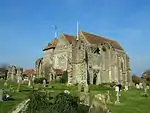
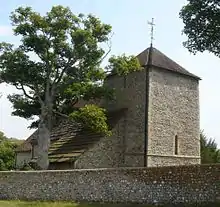
| Church of St Mary | Old Town, Eastbourne | Bell Tower | Early 14th century | 27 May 1949 | TV5986399460 50°46′22″N 0°15′57″E / 50.772698°N 0.265863°E |
1293915 |  Church of St Mary |
| Compton Place | Eastbourne | House | 1726 | 27 May 1949 | TV6029498582 50°45′53″N 0°16′18″E / 50.76469°N 0.271588°E |
1353113 | |
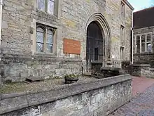
| The Stables and Coachhouses at Compton Place | Eastbourne | Courtyard | 18th century | 27 May 1949 | TV6035998606 50°45′54″N 0°16′21″E / 50.764888°N 0.27252°E |
1190359 |  Upload Photo |
.jpg.webp)
Hastings
| Name | Location | Type | Completed [note 1] | Date designated | Grid ref.[note 2] Geo-coordinates |
Entry number [note 3] | Image |
|---|---|---|---|---|---|---|---|
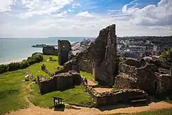
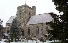
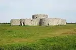
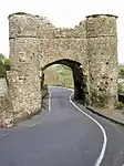
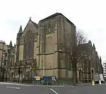
| Hastings Castle | Hastings | Castle | c. 1070 | 19 January 1951 | TQ8202709482 50°51′22″N 0°35′05″E / 50.856204°N 0.584848°E |
1043579 |
Lewes
| Name | Location | Type | Completed [note 1] | Date designated | Grid ref.[note 2] Geo-coordinates |
Entry number [note 3] | Image |
|---|---|---|---|---|---|---|---|
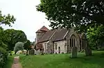
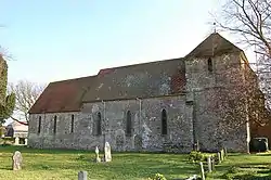
| Church of St Andrew | Beddingham, Lewes | Church | Norman | 20 August 1965 | TQ4450107897 50°51′09″N 0°03′05″E / 50.852547°N 0.05147°E |
1276141 | 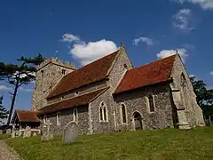 Church of St Andrew |
| Wings Place (Anne of Cleves House) | Ditchling, Lewes | Timber Framed House | Late 16th century | 17 March 1952 | TQ3249915208 50°55′16″N 0°06′59″W / 50.921126°N 0.116284°W |
1043969 |  Wings Place (Anne of Cleves House) |
| Church of St Margaret | Ditchling, Lewes | Church | Pre Conquest | 20 August 1965 | TQ3253915237 50°55′17″N 0°06′57″W / 50.921378°N 0.115704°W |
1352964 | .JPG.webp) Church of St Margaret |
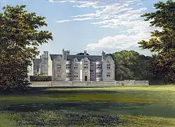
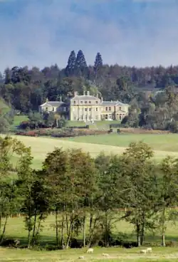
| Firle Place | Firle, Lewes | Country House | Late 15th century | 17 March 1952 | TQ4734507131 50°50′42″N 0°05′30″E / 50.844946°N 0.091537°E |
1217315 | |
| Church of St Peter | Firle, Lewes | Church | 13th century | 20 August 1965 | TQ4712207128 50°50′42″N 0°05′18″E / 50.844976°N 0.08837°E |
1043939 |  Church of St Peter |
| Glynde Place | Glynde, Lewes | Country House | 16th century | 17 March 1952 | TQ4565009356 50°51′55″N 0°04′06″E / 50.86537°N 0.068362°E |
1221546 | |
| Glynde Place Stables | Glynde, Lewes | Wall | Between 1755 and 1760 | 17 March 1952 | TQ4562809296 50°51′53″N 0°04′05″E / 50.864837°N 0.068026°E |
1221605 | 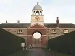 Glynde Place Stables |
| Shelley's Folly | Cooksbridge, Hamsey, Lewes | House | Late 17th century | 17 March 1952 | TQ4033615008 50°55′03″N 0°00′18″W / 50.917478°N 0.004932°W |
1221876 | 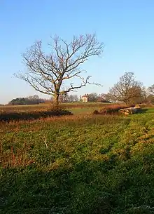 Shelley's Folly |
| Church of St Peter | Hamsey, Lewes | Church | Early 12th century | 20 August 1965 | TQ4143212116 50°53′28″N 0°00′34″E / 50.89122°N 0.00953°E |
1222114 | 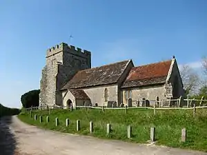 Church of St Peter |
| Swanborough Manor and the Dovecote to North West of the House | Iford, Lewes | House | 18th century | 17 March 1952 | TQ4009407806 50°51′10″N 0°00′40″W / 50.852812°N 0.011131°W |
1274722 | Upload Photo |
| Church of St Nicholas | Iford, Lewes | Church | Early 12th century | 20 August 1965 | TQ4083407333 50°50′54″N 0°00′03″W / 50.848382°N 0.000807°W |
1222119 | |
| Church of St Anne | Lewes | Church | Early 12th century | 25 February 1952 | TQ4093510005 50°52′21″N 0°00′06″E / 50.87237°N 0.001655°E |
1043687 | 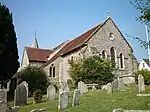 Church of St Anne |
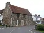
| Church of St John the Baptist | Southover, Lewes | Church | Late 11th century or early 12th century | 25 February 1952 | TQ4126309649 50°52′09″N 0°00′22″E / 50.869091°N 0.006176°E |
1353095 | 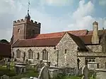 Church of St John the Baptist |
| Church of St Michael and Railings | Lewes | Gate | 13th century | 25 February 1952 | TQ4132210002 50°52′20″N 0°00′26″E / 50.872249°N 0.00715°E |
1287005 | .jpg.webp) Church of St Michael and Railings |
| Jireh Chapel and Sunday School to North | Cliffe, Lewes | Sunday School | 1874 | 25 February 1952 | TQ4211910381 50°52′32″N 0°01′07″E / 50.87546°N 0.018617°E |
1192055 | 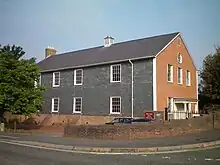 Jireh Chapel and Sunday School to North |
| Keep to Lewes Castle | Lewes | Castle | c. 1100 | 25 February 1952 | TQ4132710068 50°52′22″N 0°00′26″E / 50.872841°N 0.007247°E |
1043894 | 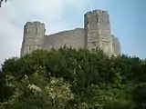 Keep to Lewes Castle |
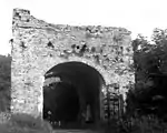
| Barbican to Lewes Castle and Walls to South | Lewes | Wall | Early 14th century | 25 February 1952 | TQ4140210071 50°52′22″N 0°00′30″E / 50.87285°N 0.008313°E |
1043895 | 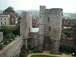 Barbican to Lewes Castle and Walls to South |
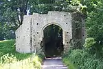
| Remains of Inner Gatehouse and Walls to East and West, Lewes castle | Lewes | Wall | 12th century | 16 March 1970 | TQ4140610084 50°52′23″N 0°00′30″E / 50.872965°N 0.008375°E |
1293875 | 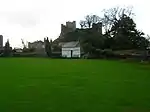 Remains of Inner Gatehouse and Walls to East and West, Lewes castle |
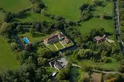
| Malling House | Malling, Lewes | Country House | Mid 17th century | 25 February 1952 | TQ4164611125 50°52′56″N 0°00′44″E / 50.882262°N 0.012187°E |
1043904 | |
| Ruins of Lewes Priory | Lewes | Country House | 1537-1540 | 25 February 1952 | TQ4142909558 50°52′06″N 0°00′31″E / 50.868233°N 0.008499°E |
1190737 | |
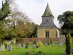
| Church of St John | Piddinghoe, Lewes | Church | Early 13th century | 20 August 1965 | TQ4351003080 50°48′34″N 0°02′08″E / 50.809504°N 0.035517°E |
1238098 | 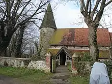 Church of St John |
| Church of St Michael and All Angels | Plumpton, Lewes | Anglican Church | c. 1200 | 20 August 1965 | TQ3567813503 50°54′18″N 0°04′18″W / 50.905065°N 0.071716°W |
1238266 | 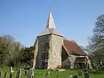 Church of St Michael and All Angels |
| Church of St Mary the Virgin | Ringmer, Lewes | Church | Medieval | 20 August 1965 | TQ4457812509 50°53′38″N 0°03′16″E / 50.893974°N 0.054385°E |
1238690 | 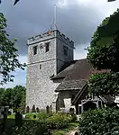 Church of St Mary the Virgin |
| Church of St Peter | Rodmell, Lewes | Church | Early 12th century | 20 August 1965 | TQ4216806267 50°50′19″N 0°01′04″E / 50.838476°N 0.017717°E |
1238975 | 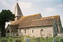 Church of St Peter |
| Church of St Andrew | Bishopstone, Lewes | Church | Saxon | 2 March 1950 | TQ4724500979 50°47′23″N 0°05′16″E / 50.789686°N 0.087651°E |
1044059 | 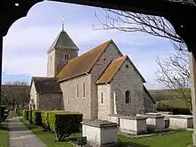 Church of St Andrew |
| Church of St Leonard | Seaford, Lewes | Parish Church | Early 12th century | 2 March 1950 | TV4826299028 50°46′19″N 0°06′05″E / 50.771895°N 0.101283°E |
1352955 | .jpg.webp) Church of St Leonard |
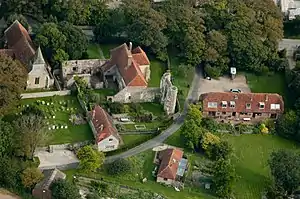
| Southease Parish Church | Southease, Lewes | Church | 11th century | 20 August 1965 | TQ4230205271 50°49′46″N 0°01′09″E / 50.829492°N 0.019232°E |
1239384 | 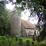 Southease Parish Church |
| Church of St Mary | Tarring Neville, Lewes | Church | Transitional Norman | 20 August 1965 | TQ4440803785 50°48′56″N 0°02′55″E / 50.815616°N 0.048531°E |
1222661 | 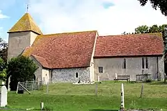 Church of St Mary |
| Church of St Lawrence | Telscombe, Lewes | Church | 12th century | 20 August 1965 | TQ4054803365 50°48′46″N 0°00′23″W / 50.812791°N 0.006387°W |
1222720 |  Church of St Lawrence |
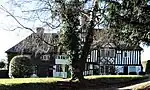
| Great Ote Hall | Wivelsfield, Lewes | House | Modern | 17 March 1952 | TQ3312120282 50°58′00″N 0°06′20″W / 50.966585°N 0.105587°W |
1223018 | .jpg.webp) Great Ote Hall |

.jpg.webp)
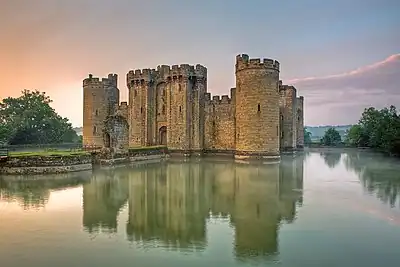
Rother
.jpg.webp)

.JPG.webp)
.JPG.webp)
.jpg.webp)

.jpg.webp)
.JPG.webp)
.JPG.webp)
.jpg.webp)
.jpg.webp)
.JPG.webp)

The City of Brighton and Hove
| Name | Location | Type | Completed [note 1] | Date designated | Grid ref.[note 2] Geo-coordinates |
Entry number [note 3] | Image |
|---|---|---|---|---|---|---|---|
| Arundel House | The City of Brighton and Hove | Guest House | 1950- | 13 October 1952 | TQ3331903426 50°48′54″N 0°06′32″W / 50.815046°N 0.108914°W |
1379917 | Upload Photo |
| Church of All Saints | The City of Brighton and Hove | Church | 1889-91 | 24 March 1950 | TQ2918005020 50°49′49″N 0°10′01″W / 50.83031°N 0.167073°W |
1187592 | |
| Church of St Andrew including Walls, Railings and Gates | The City of Brighton and Hove | Gate | 1827-8 | 24 March 1950 | TQ2992104282 50°49′25″N 0°09′25″W / 50.823512°N 0.156819°W |
1298653 | 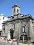 Church of St Andrew including Walls, Railings and Gates |
| Church of St Bartholomew | The City of Brighton and Hove | Anglican Church | 1872-1874 | 13 October 1952 | TQ3128905135 50°49′51″N 0°08′14″W / 50.83087°N 0.137102°W |
1379913 | |
| Church of St Michael and All Angels and Attached Walls | The City of Brighton and Hove | Wall | Designed 1858 | 20 August 1971 | TQ3040204734 50°49′39″N 0°08′59″W / 50.827466°N 0.149833°W |
1381083 | 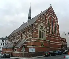 Church of St Michael and All Angels and Attached Walls |
| Church of St Wulfran | Ovingdean, The City of Brighton and Hove | Tower | Late 13th century | 13 October 1952 | TQ3553903559 50°48′57″N 0°04′39″W / 50.815727°N 0.077371°W |
1380550 | |
| Falmer House Including Moat Within Courtyard | The City of Brighton and Hove | Moat | 1960-1962 | 30 August 1993 | TQ3459008940 50°51′52″N 0°05′20″W / 50.86431°N 0.088859°W |
1381044 |  Falmer House Including Moat Within Courtyard |
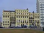
| Marlborough House and Attached Railings | The City of Brighton and Hove | House | 1765 | 13 October 1952 | TQ3120904031 50°49′15″N 0°08′19″W / 50.820965°N 0.138632°W |
1380671 | _(September_2018)_(2).jpg.webp) Marlborough House and Attached Railings |
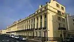
| Nos 1-29 Brunswick Square and attached railings | The City of Brighton and Hove | Terrace | 1825-27 | 24 March 1950 | TQ2981104365 50°49′27″N 0°09′30″W / 50.824282°N 0.15835°W |
1187544 | |
| Nos 1-6, Brunswick Terrace and attached railings | The City of Brighton and Hove | Apartment | 1950 | 24 March 1950 | TQ2991504232 50°49′23″N 0°09′25″W / 50.823064°N 0.156921°W |
1204829 | |
| Nos 7-19, Brunswick Terrace and attached railings | The City of Brighton and Hove | Apartment | 1992 | 24 March 1950 | TQ2983304249 50°49′24″N 0°09′29″W / 50.823235°N 0.158079°W |
1281033 | |
| Nos 20-32, Brunswick Terrace and attached railings | The City of Brighton and Hove | Apartment | By 1992 | 24 March 1950 | TQ2964804288 50°49′25″N 0°09′38″W / 50.823627°N 0.16069°W |
1187546 | |
| Nos 33-42, Brunswick Terrace and attached railings | The City of Brighton and Hove | Apartment | 1950 | 24 March 1950 | TQ2953904306 50°49′26″N 0°09′44″W / 50.823813°N 0.162231°W |
1204856 | |
| Nos 30-58, 30a and 33a (consecutive), Brunswick Square and attached railings | The City of Brighton and Hove | Terrace | 1825-27 | 24 March 1950 | TQ2976304485 50°49′31″N 0°09′32″W / 50.825372°N 0.158989°W |
1281017 | |
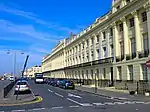
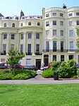
| Nos 1-14, Lewes Crescent and attached Railings | The City of Brighton and Hove | Terrace | 1823-1828 | 13 October 1952 | TQ3306703559 50°48′59″N 0°06′45″W / 50.8163°N 0.112441°W |
1381658 | 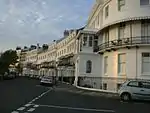 Nos 1-14, Lewes Crescent and attached Railings |
| Numbers 15-28, Lewes Crescent and attached Railings | The City of Brighton and Hove | Apartment | 1952 | 13 October 1952 | TQ3325603501 50°48′57″N 0°06′35″W / 50.815735°N 0.109781°W |
1381659 | .JPG.webp) Numbers 15-28, Lewes Crescent and attached Railings |
| Numbers 1-14, Chichester Terrace and Chichester House and attached Railings | The City of Brighton and Hove | Terrace | 1824-1855 | 13 October 1952 | TQ3297003541 50°48′58″N 0°06′50″W / 50.81616°N 0.113824°W |
1380256 | _(December_2016)_(5).JPG.webp) Numbers 1-14, Chichester Terrace and Chichester House and attached Railings |
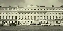
| Numbers 1-10, Sussex Square and attached Piers and Railings | The City of Brighton and Hove | Terrace | 1825-1827 | 13 October 1952 | TQ3313503621 50°49′01″N 0°06′41″W / 50.816841°N 0.111454°W |
1380969 | 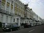 Numbers 1-10, Sussex Square and attached Piers and Railings |
| Numbers 11-40, Sussex Square and attached Railings | The City of Brighton and Hove | Apartment | 1999 | 13 October 1952 | TQ3322503728 50°49′04″N 0°06′36″W / 50.817782°N 0.110138°W |
1380970 | Upload Photo |
| Numbers 41-50, Sussex Square and attached Railings | The City of Brighton and Hove | Apartment | 1999 | 13 October 1952 | TQ3324103587 50°48′59″N 0°06′36″W / 50.816511°N 0.109962°W |
1380971 | _(September_2018)_(2).JPG.webp) Numbers 41-50, Sussex Square and attached Railings |
| Stanmer House | Stanmer Park, The City of Brighton and Hove | House | Pre 1722 | 2 November 1954 | TQ3364509466 50°52′09″N 0°06′08″W / 50.869256°N 0.102088°W |
1380958 | |
| The Corn Exchange and Dome Theatre | The City of Brighton and Hove | Corn Exchange | 1868 | 13 October 1952 | TQ3122404297 50°49′24″N 0°08′18″W / 50.823353°N 0.138324°W |
1380398 | |
| The Royal Pavilion | The City of Brighton and Hove | Farmhouse | 1770s | 13 October 1952 | TQ3127304188 50°49′21″N 0°08′16″W / 50.822362°N 0.137668°W |
1380680 | 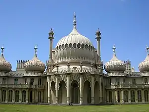 The Royal Pavilion |
| The West Pier | The City of Brighton and Hove | Kiosk | 1865-1866 | 9 October 1969 | TQ3027603796 50°49′09″N 0°09′07″W / 50.819064°N 0.151954°W |
1381655 | 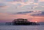 The West Pier |
.JPG.webp)
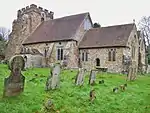
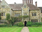
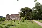
Wealden
| Name | Location | Type | Completed [note 1] | Date designated | Grid ref.[note 2] Geo-coordinates |
Entry number [note 3] | Image |
|---|---|---|---|---|---|---|---|
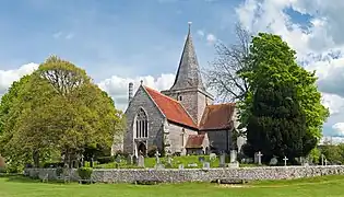
| Alciston Parish Church | Alciston, Wealden | Parish Church | Norman | 30 August 1966 | TQ5058505551 50°49′48″N 0°08′13″E / 50.829914°N 0.136876°E |
1353272 | 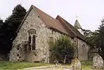 Alciston Parish Church |
| Tithe Barn South West of Court House Farm | Alciston, Wealden | Abbey | Probably 16th century | 13 October 1952 | TQ5050505515 50°49′47″N 0°08′09″E / 50.829612°N 0.135726°E |
1191019 | 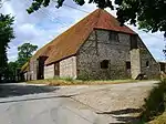 Tithe Barn South West of Court House Farm |
| Church of St Andrew | Alfriston, Wealden | Parish Church | c. 1360 | 30 August 1966 | TQ5215103001 50°48′24″N 0°09′29″E / 50.806591°N 0.158039°E |
1043353 | |
| The Market Cross | Alfriston, Wealden | Market Cross | Medieval | 13 October 1952 | TQ5204203164 50°48′29″N 0°09′24″E / 50.808084°N 0.15656°E |
1353268 | 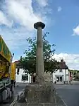 The Market Cross |
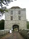
| Michelham Priory Barbican Tower and Bridge over the Moat | Milton Hide, Arlington, Wealden | Tower | 15th century | 30 August 1966 | TQ5581209377 50°51′46″N 0°12′46″E / 50.862912°N 0.212665°E |
1191633 | |
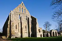
| Michelham Priory | Milton Hide, Arlington, Wealden | Augustinian Monastery | 13th century | 13 October 1952 | TQ5588809319 50°51′45″N 0°12′49″E / 50.86237°N 0.21372°E |
1353289 | |
| Church of St Pancras | Arlington, Wealden | Parish Church | Norman Transitional | 30 August 1966 | TQ5428307468 50°50′46″N 0°11′25″E / 50.846167°N 0.190152°E |
1353287 | 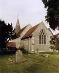 Church of St Pancras |
| Church of St Michael and All Angels | Berwick, Wealden | Parish Church | 13th century | 30 August 1966 | TQ5188404921 50°49′26″N 0°09′18″E / 50.823914°N 0.155046°E |
1043294 | .jpg.webp) Church of St Michael and All Angels |
| Church of St Margaret | Buxted, Wealden | Parish Church | 13th century | 26 November 1953 | TQ4859723042 50°59′15″N 0°06′57″E / 50.987606°N 0.115783°E |
1028437 | |
| Church of St Bartholomew | Chalvington with Ripe, Wealden | Parish Church | 13th century | 30 August 1966 | TQ5189809334 50°51′49″N 0°09′25″E / 50.863566°N 0.157073°E |
1286911 | .jpg.webp) Church of St Bartholomew |
| Church of St John the Baptist | Chalvington with Ripe, Wealden | Parish Church | Perpendicular | 30 August 1966 | TQ5138609862 50°52′06″N 0°09′00″E / 50.868445°N 0.150022°E |
1043087 | 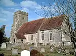 Church of St John the Baptist |
| Chiddingly Parish Church | Chiddingly, Wealden | Parish Church | 13th century | 30 August 1966 | TQ5446614156 50°54′22″N 0°11′44″E / 50.906216°N 0.195572°E |
1353279 |  Chiddingly Parish Church |
| Lullington Parish Church | Lullington, Cuckmere Valley, Wealden | Parish Church | 13th century or early 14th century | 30 August 1966 | TQ5282303057 50°48′25″N 0°10′03″E / 50.806917°N 0.167592°E |
1182150 | 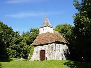 Lullington Parish Church |
| Church of All Saints | Westdean, Cuckmere Valley, Wealden | Parish Church | Norman | 30 August 1966 | TV5250699691 50°46′36″N 0°09′42″E / 50.776753°N 0.161701°E |
1184445 | 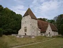 Church of All Saints |
| Church of St Michael the Archangel | Litlington, Cuckmere Valley, Wealden | Parish Church | 12th century | 30 August 1966 | TQ5233801955 50°47′50″N 0°09′37″E / 50.797142°N 0.160257°E |
1353380 | 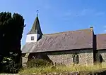 Church of St Michael the Archangel |
| Friston Place | East Dean and Friston, Wealden | House | 16th century | 13 October 1952 | TV5484898840 50°46′07″N 0°11′40″E / 50.768486°N 0.194535°E |
1353299 | Upload Photo |
| Church of Saint James | Friston, East Dean and Friston, Wealden | Parish Church | Saxon | 30 August 1966 | TV5517298181 50°45′45″N 0°11′56″E / 50.762478°N 0.198848°E |
1043259 | 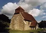 Church of Saint James |
| Church of St Simon and St Jude | East Dean and Friston, Wealden | Parish Church | Saxon | 30 August 1966 | TV5573197699 50°45′29″N 0°12′24″E / 50.757997°N 0.206564°E |
1366117 | 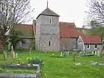 Church of St Simon and St Jude |
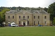
| Sheffield Park House | Sheffield Park Gardens, Fletching, Wealden | House | About 1779 | 26 November 1953 | TQ4135524138 50°59′57″N 0°00′47″E / 50.999278°N 0.013098°E |
1028395 | 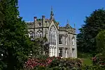 Sheffield Park House |
| Church of St Andrew and St Mary | Fletching, Wealden | Parish Church | Norman | 31 December 1982 | TQ4290423460 50°59′34″N 0°02′06″E / 50.992803°N 0.034891°E |
1028414 | 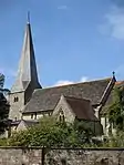 Church of St Andrew and St Mary |
| Hammerwood Park | Hammerwood, Forest Row, Wealden | House | c. 1795 | 26 November 1953 | TQ4422238852 51°07′51″N 0°03′35″E / 51.130792°N 0.059789°E |
1191730 | |
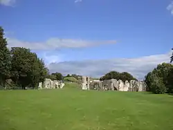
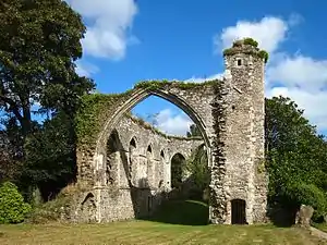
| Bayham Abbey Ruins | Frant, Wealden | Abbey | Founded about 1200 | 26 November 1953 | TQ6501936498 51°06′15″N 0°21′20″E / 51.104034°N 0.355684°E |
1192095 | 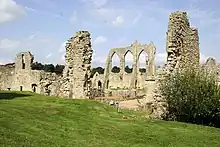 Bayham Abbey Ruins |
| Church of Saint Mary | Hailsham, Wealden | Parish Church | c. 1425 | 30 August 1966 | TQ5916609498 50°51′47″N 0°15′37″E / 50.863086°N 0.260338°E |
1043232 | 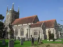 Church of Saint Mary |
| Holwych Farmhouse | Cowden, Hartfield, Wealden | House | 17th century or earlier | 26 November 1953 | TQ4837640236 51°08′32″N 0°07′11″E / 51.142169°N 0.119683°E |
1286541 | Upload Photo |
| Church of St Mary | Hartfield, Wealden | Parish Church | 13th century | 26 November 1953 | TQ4796635722 51°06′06″N 0°06′43″E / 51.101712°N 0.111976°E |
1192522 | 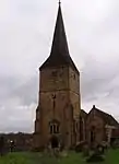 Church of St Mary |
| Church of All Saints | Waldron Village, Heathfield and Waldron, Wealden | Parish Church | 13th century | 30 August 1966 | TQ5490019227 50°57′06″N 0°12′14″E / 50.951666°N 0.203893°E |
1284195 | 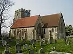 Church of All Saints |
| Horselunges Manor | Hellingly, Wealden | House | Early 15th century | 13 October 1952 | TQ5821512010 50°53′09″N 0°14′53″E / 50.885919°N 0.247921°E |
1285385 | |
| Church of St Peter and St Paul | Hellingly, Wealden | Parish Church | Transitional Norman | 30 August 1966 | TQ5808412302 50°53′19″N 0°14′46″E / 50.888578°N 0.246187°E |
1043186 | 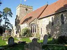 Church of St Peter and St Paul |
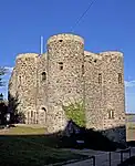
| Herstmonceux Castle with Attached Bridges to North and South and Causeway with Moat Retaining Walls to West | Herstmonceux Park, Herstmonceux, Wealden | Castle | c. 1441 | 24 July 1989 | TQ6465210335 50°52′09″N 0°20′19″E / 50.869072°N 0.338601°E |
1272785 | 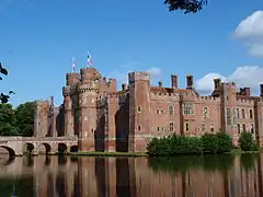 Herstmonceux Castle with Attached Bridges to North and South and Causeway with Moat Retaining Walls to West |
| Herstmonceux Place | Herstmonceux, Wealden | Flats | Early 18th century | 13 October 1952 | TQ6393711082 50°52′34″N 0°19′44″E / 50.875987°N 0.328783°E |
1043172 | 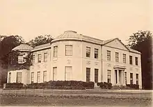 Herstmonceux Place |
| Church of All Saints | Herstmonceux, Wealden | Parish Church | Late 12th century | 30 August 1966 | TQ6427110186 50°52′04″N 0°19′59″E / 50.867841°N 0.333124°E |
1353333 | 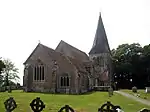 Church of All Saints |
| Church of St Oswald | Hooe, Wealden | Parish Church | 13th century | 30 August 1966 | TQ6827409168 50°51′27″N 0°23′22″E / 50.857545°N 0.389491°E |
1043159 | 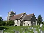 Church of St Oswald |
| Church of St Margaret | Isfield, Wealden | Parish Church | 12th century | 26 November 1953 | TQ4438818125 50°56′40″N 0°03′14″E / 50.94449°N 0.053907°E |
1353561 | .JPG.webp) Church of St Margaret |
| Church of All Saints | Laughton, Wealden | Parish Church | 13th century | 30 August 1966 | TQ5007212575 50°53′35″N 0°07′57″E / 50.893167°N 0.132475°E |
1181698 | 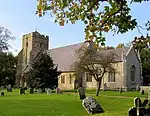 Church of All Saints |
| Church of Saint Peter | Folkington, Long Man, Wealden | Parish Church | 13th century | 30 August 1966 | TQ5593803804 50°48′46″N 0°12′44″E / 50.8128°N 0.212085°E |
1193438 | .jpg.webp) Church of Saint Peter |
| Church of St Mary and St Peter | The Street, Long Man, Wealden | Parish Church | 12th century | 30 August 1966 | TQ5441104280 50°49′03″N 0°11′26″E / 50.817486°N 0.190627°E |
1028509 | |
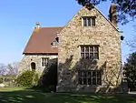
| Wilmington Priory | The Street, Long Man, Wealden | House | 13th century | 30 August 1966 | TQ5438904254 50°49′02″N 0°11′25″E / 50.817258°N 0.190304°E |
1185052 | |
| Church of St Bartholomew | Maresfield, Wealden | Parish Church | c. 1080 | 26 November 1953 | TQ4658624017 50°59′49″N 0°05′15″E / 50.996883°N 0.087545°E |
1192995 | 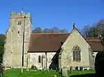 Church of St Bartholomew |
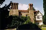
| Middle House Hotel | Mayfield and Five Ashes, Wealden | Hotel | 1575 | 26 November 1953 | TQ5870626983 51°01′13″N 0°15′41″E / 51.020321°N 0.261418°E |
1028215 | 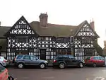 Middle House Hotel |
| The Old Palace (the Convent of the Holy Child Jesus, St Leonard's Mayfield School) | Mayfield and Five Ashes, Wealden | Archbishops Palace | 13th century | 26 November 1953 | TQ5873627111 51°01′17″N 0°15′43″E / 51.021463°N 0.261901°E |
1353594 | |
| Church of St Dunstan | Mayfield and Five Ashes, Wealden | Parish Church | 13th century | 26 November 1953 | TQ5864827027 51°01′15″N 0°15′38″E / 51.020733°N 0.260611°E |
1193663 | |
| Church of St Mary | Ninfield, Wealden | Parish Church | 13th century | 30 August 1966 | TQ7050212288 50°53′06″N 0°25′21″E / 50.884924°N 0.42257°E |
1182294 | 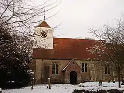 Church of St Mary |
| Church of St Nicolas | Pevensey, Wealden | Parish Church | 13th century | 30 August 1966 | TQ6469604835 50°49′11″N 0°20′12″E / 50.819642°N 0.336754°E |
1353406 | |
| Church of St Denys | Rotherfield, Wealden | Parish Church | 13th century | 26 November 1953 | TQ5560529750 51°02′46″N 0°13′06″E / 51.046031°N 0.218428°E |
1193874 | 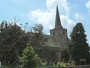 Church of St Denys |
| Church of St Peter and St Paul | Wadhurst, Wealden | Parish Church | 12th century | 26 November 1953 | TQ6407131871 51°03′46″N 0°20′24″E / 51.062734°N 0.340056°E |
1028097 | 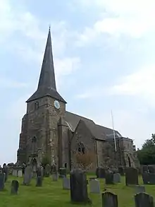 Church of St Peter and St Paul |
| The New House | Wadhurst Park, Wadhurst, Wealden | Country House | 1982-1986 | 2 July 2020 | TQ6323328810 51°02′08″N 0°19′36″E / 51.035470°N 0.326729°E |
1457638 | Upload Photo |
| Church of St Mary Magdalene | Wartling, Wealden | Parish Church | 13th century | 30 August 1966 | TQ6578009162 50°51′30″N 0°21′15″E / 50.85821°N 0.354086°E |
1353420 | 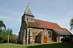 Church of St Mary Magdalene |
| Church of St Mary | Westham, Wealden | Parish Church | Medieval | 30 August 1966 | TQ6416404588 50°49′03″N 0°19′45″E / 50.817573°N 0.329098°E |
1353431 | |
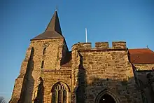
| Church of St Andrew | Willingdon and Jevington, Wealden | Parish Church | Saxon | 30 August 1966 | TQ5614301508 50°47′32″N 0°12′50″E / 50.792114°N 0.214017°E |
1043127 |  Church of St Andrew |
| Church of St Mary the Virgin | Willingdon and Jevington, Wealden | Parish Church | Late 12th century to early 13th century | 30 August 1966 | TQ5894302452 50°47′59″N 0°15′15″E / 50.799836°N 0.254119°E |
1184822 | .jpg.webp) Church of St Mary the Virgin |
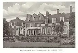
| 1–11 Church Street | The Hoo, Willingdon and Jevington, Wealden | House | 1902 | 10 December 1973 | TQ5889002406 50°47′58″N 0°15′12″E / 50.799437°N 0.253348°E |
1184911 | |
| Church of St Michael | Withyham, Wealden | Parish Church | Medieval | 26 November 1953 | TQ4939535564 51°06′00″N 0°07′56″E / 51.099922°N 0.132305°E |
1180384 | .jpg.webp) Church of St Michael |

.jpg.webp)
.jpg.webp)
.JPG)
See also
Notes
- 1 2 3 4 5 6 The date given is the date used by Historic England as significant for the initial building or that of an important part in the structure's description.
- 1 2 3 4 5 6 Sometimes known as OSGB36, the grid reference is based on the British national grid reference system used by the Ordnance Survey.
- 1 2 3 4 5 6 The "List Entry Number" is a unique number assigned to each listed building and scheduled monument by Historic England.
References
External links
![]() Media related to Grade I listed buildings in East Sussex at Wikimedia Commons
Media related to Grade I listed buildings in East Sussex at Wikimedia Commons
This article is issued from Wikipedia. The text is licensed under Creative Commons - Attribution - Sharealike. Additional terms may apply for the media files.