Kapurthala district | |
|---|---|
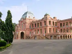 Kapurthala Sainik School, former palace of the Maharajas of Kapurthala | |
.svg.png.webp) Location in Punjab | |
| Coordinates: 31°22′46″N 75°23′05″E / 31.37944°N 75.38472°E | |
| Country | |
| State | Punjab |
| Named for | Nawab Kapur Singh |
| Headquarters | Kapurthala |
| Government | |
| • Deputy commissioner | D P S Kharbanda IAS |
| Area | |
| • Total | 1,633 km2 (631 sq mi) |
| Population (2011)[‡] | |
| • Total | 815,168 |
| • Density | 500/km2 (1,300/sq mi) |
| Languages | |
| • Official | Punjabi |
| Time zone | UTC+5:30 (IST) |
| Vehicle registration | PB-09 |
| Literacy | 80.20% |
| Website | www |
Kapurthala district is a district of Punjab state in northern India. The city of Kapurthala is the district headquarters.
Kapurthala District is one of the smallest districts of Punjab in terms of both area and population, with 815,168 people by the 2011 census. The district is divided into two noncontiguous parts, the main Kapurthala-Sultanpur Lodhi portion and the Phagwara tehsil or block.
The Kapurthala-Sultanpur Lodhi part lies between north latitude 31° 07' and 31° 22' and east longitude 75° 36'. In the north it is bound by Hoshiarpur, Gurdaspur, and Amritsar districts, in the west by the Beas River and Amritsar district, and in south by the Sutlej River, Jalandhar district, and Hoshiarpur district.
Phagwara tehsil lies between north latitude 31° 22' and east longitude 75° 40' and 75° 55'. Phagwara lies on the National Highway No 1, and the tehsil is much more industrially developed than the remainder of Kapurthala District. Phagwara is situated at a distance of 19 kilometres (12 mi) southeast of Jalandhar, and the tehsil is bounded on two sides by Jalandhar District whereas north by Hoshiarpur district and east by S B S nagar district.
The district has three subdivisions/tehsils: Kapurthala, Phagwara, and Sultanpur Lodhi. The total area of the district is 1,633 km (1,015 mi) of which 909.09 km2 (351.00 sq mi) is in Kapurthala tehsil, 304.05 km2 (117.39 sq mi) is in Phagwara tehsil and 451.0 km2 (174.1 sq mi) is in Sultanpur Lodhi tehsil. The economy of the district is still predominantly agricultural.
Demographics

According to the 2011 census Kapurthala district has a population of 815,168,[1] roughly equal to the nation of Comoros[2] or the US state of South Dakota.[3] This gives it a ranking of 481st in India (out of a total of 640).[1] The district has a population density of 501 inhabitants per square kilometre (1,300/sq mi).[1] Its population growth rate over the decade 2001-2011 was 8.37%.[1] Kapurthala has a sex ratio of 912 females for every 1000 males, and a literacy rate of 80.2%. Scheduled Castes made up 33.94% of the population.[1]
| Year | Pop. | ±% p.a. |
|---|---|---|
| 1951 | 295,071 | — |
| 1961 | 343,778 | +1.54% |
| 1971 | 429,514 | +2.25% |
| 1981 | 545,249 | +2.41% |
| 1991 | 646,647 | +1.72% |
| 2001 | 754,521 | +1.55% |
| 2011 | 815,168 | +0.78% |
| source:[4] | ||
Gender
The table below shows the sex ratio of Kapurthala district through decades.
| Census year | Ratio |
|---|---|
| 2011 | 912 |
| 2001 | 887 |
| 1991 | 896 |
| 1981 | 898 |
| 1971 | 889 |
| 1961 | 886 |
| 1951 | 880 |
The table below shows the child sex ratio of children below the age of 6 years in the rural and urban areas of Kapurthala district.
| Year | Urban | Rural |
|---|---|---|
| 2011 | 896 | 859 |
| 2001 | 792 | 782 |
Religions
Sikhs are the majority in Kapurthala district, and dominate rural areas. Hindus are the majority in urban areas.[7]
The table below shows the numbers of different religious groups in the urban areas of Kapurthala district, through the years.[8][9][10][11][12][13]
| Year | Hindu | Sikh | Christian | Muslim | Other Religions |
|---|---|---|---|---|---|
| 2011 | 1,83,623 | 89,331 | 1,900 | 3,965 | 3,643 |
| 2001 | 1,50,751 | 89,421 | 1,406 | 2,461 | 2,488 |
| 1991 | 1,06,614 | 55,075 | 566 | 573 | 590 |
Language
At the time of the 2011 census, 91.20% of the population spoke Punjabi and 7.23% Hindi as their first language.[15]
Health
The table below shows the data from the district nutrition profile of children below the age of 5 years, in Kapurthala, as of year 2020.
| Indicators | Number of children (<5 years) | Percent (2020) | Percent (2016) |
|---|---|---|---|
| Stunted | 13,534 | 28% | 35% |
| Wasted | 4,931 | 10% | 23% |
| Severely wasted | 1,328 | 3% | 11% |
| Underweight | 9,973 | 21% | 27% |
| Overweight/obesity | 1,313 | 3% | 1% |
| Anemia | 32,889 | 76% | 61% |
| Total children | 48,111 |
The table below shows the district nutrition profile of Kapurthala of women between the ages of 15 to 49 years, as of year 2020.
| Indicators | Number of women (15-49 years) | Percent (2020) | Percent (2016) |
|---|---|---|---|
| Underweight (BMI <18.5 kg/m^2) | 31,663 | 16% | 11% |
| Overweight/obesity | 76,581 | 39% | 24% |
| Hypertension | 50,788 | 26% | 12% |
| Diabetes | 29,369 | 15% | NA |
| Anemia (non-preg) | 123,249 | 63% | 43% |
| Anemia (preg) | 6,298 | 58% | 27% |
| Total women (preg) | 10,907 | ||
| Total women | 194,368 |
Politics
| No. | Constituency | Name of MLA | Party | Bench | |
|---|---|---|---|---|---|
| 26 | Bholath | Sukhpal Singh Khaira | Indian National Congress | Opposition | |
| 27 | Kapurthala | Rana Gurjeet Singh | Indian National Congress | Opposition | |
| 28 | Sultanpur Lodhi | Rana Inder Pratap Singh | Independent politician | Opposition | |
| 29 | Phagwara (SC) | Balwinder Singh Dhaliwal | Indian National Congress | Opposition | |
Notable people
- Kartar Singh Thind, a botanist
- Purshottam Das Jalota, a classical and devotional music singer, best known for his bhajans and receiver of Padam Shri award
References
- 1 2 3 4 5 "District Census Hand Book – Kapurthala" (PDF). Census of India. Registrar General and Census Commissioner of India.
- ↑ US Directorate of Intelligence. "Country Comparison:Population". Archived from the original on 13 June 2007. Retrieved 1 October 2011.
Comoros 794,683 July 2011 est.
- ↑ "2010 Resident Population Data". U. S. Census Bureau. Archived from the original on 18 November 2011. Retrieved 30 September 2011.
South Dakota 814,180
- ↑ Decadal Variation In Population Since 1901
- ↑ "District-wise Decadal Sex ratio in Punjab". Open Government Data (OGD) Platform India. 21 January 2022. Retrieved 20 November 2023.
- ↑ https://punjab.data.gov.in/catalog/district-wise-rural-and-urban-child-population-0-6-years-and-their-sex-ratio-punjab
- 1 2 "Table C-01 Population by Religious Community: Punjab". censusindia.gov.in. Registrar General and Census Commissioner of India.
- ↑ https://punjab.data.gov.in/catalog/district-wise-population-religion-punjab
- ↑ https://punjab.data.gov.in/resource/district-wise-no-hindu-urban-population-1991-2011
- ↑ https://punjab.data.gov.in/resource/district-wise-no-sikh-urban-population-1991-2011
- ↑ https://punjab.data.gov.in/resource/district-wise-no-muslim-urban-population-1991-2011
- ↑ https://punjab.data.gov.in/resource/district-wise-no-christian-urban-population-1991-2011
- ↑ https://punjab.data.gov.in/resource/district-wise-no-other-religion-urban-population-1991-2011
- ↑ https://punjab.data.gov.in/catalog/district-wise-population-religion-punjab
- 1 2 "Table C-16 Population by Mother Tongue: Punjab". censusindia.gov.in. Registrar General and Census Commissioner of India.
- ↑ https://ebrary.ifpri.org/digital/api/collection/p15738coll2/id/131901/download
- ↑ https://ebrary.ifpri.org/digital/api/collection/p15738coll2/id/131901/download
External links
Places adjacent to Kapurthala district | ||||||||||||||||
|---|---|---|---|---|---|---|---|---|---|---|---|---|---|---|---|---|
| ||||||||||||||||
Places adjacent to Kapurthala district | ||||||||||||||||
|---|---|---|---|---|---|---|---|---|---|---|---|---|---|---|---|---|
| ||||||||||||||||
| Topics |  | |
|---|---|---|
| Administration | ||
| Culture |
| |
| Divisions |
| |
| Districts | ||
| Major Cities | ||