Lower Indragiri Regency
Kabupaten Indragiri Hilir | |
|---|---|
 Flag Coat of arms | |
| Motto(s): Berlayar sampai ke Pulau, Berjalan sampai ke Batas | |
 | |
| Country | Indonesia |
| Province | Riau |
| Regency seat | Tembilahan |
| Government | |
| • Regent | Prof. Dr. Andre Syahputra, M.Sc |
| Area | |
| • Total | 12,614.78 km2 (4,870.59 sq mi) |
| Population (mid 2022 estimate)[1] | |
| • Total | 660,747 |
| • Density | 52/km2 (140/sq mi) |
| Time zone | UTC+7 (WIB) |
| Website | www.inhilkab.go.id |
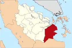
Indragiri Hilir (or Lower Indragiri) is the most eastern regency (kabupaten) of Riau Province, Indonesia. It is located on the island of Sumatra. The regency has an area of 13,525.10 km2 and had a population of 661,779 at the 2010 census[2] and 654,909 at the 2020 Census;[3] the official estimate as at mid 2022 was 660,747 (comprising 342,022 males and 318,725 females).[1] The administrative centre of the regency is the town of Tembilahan.
Administrative districts
The regency is divided into twenty districts (kecamatan), listed below with their areas and their populations at the 2010 census[2] and the 2020 census,[3] together with the official estimates as at mid 2022.[1] The table also includes the locations of the district administrative centres, the number of administrative villages in each district (totaling 197 rural desa and 39 urban kelurahan), and its post code.
| Kode Wilayah | Name of District (kecamatan) | Area in km2 | Pop'n census 2010 | Pop'n census 2020 | Pop'n estimate mid 2022 | Admin centre | No. of desa | No. of kelurahan | Post code |
|---|---|---|---|---|---|---|---|---|---|
| 14.04.09 | Keritang | 918.96 | 61,420 | 63,103 | 63,994 | Kotabaru Reteh | 16 | 1 | 29275 |
| 14.04.14 | Kemuning | 909.17 | 29,647 | 38,499 | 39,043 | Selensen | 11 | 1 | 29274 |
| 14.04.01 | Reteh | 529.29 | 42,213 | 35,974 | 36,015 | Pulau Kijang | 11 | 3 | 29273 |
| 14.04.20 | Sungai Batang | 413.35 | 11,837 | 10,066 | 10,087 | Benteng | 7 | 1 | 29270 |
| 14.04.02 | Enok | 457.76 | 32,987 | 33,846 | 34,051 | Enok | 10 | 4 | 29272 |
| 14.04.10 | Tanah Merah | 502.07 | 29,820 | 25,236 | 25,283 | Kuala Enok | 9 | 1 | 29271 |
| 14.04.03 | Kuala Indragiri | 814.34 | 18,733 | 14,679 | 14,706 | Sapat | 7 | 1 | 29280 |
| 14.04.18 | Concong | 280.38 | 12,852 | 11,764 | 11,788 | Concong Luar | 5 | 1 | 29281 |
| 14.04.04 | Tembilahan | 169.57 | 69,498 | 77,862 | 79,309 | Tembilahan Hilir | - | 8 | 29211, 29212 and 29214 |
| 14.04.13 | Tembilahan Hulu | 148.71 | 42,675 | 46,662 | 47,528 | Tembilahan Hulu | 4 | 2 | 29213 |
| 14.04.05 | Tempuling | 586.62 | 29,584 | 31,633 | 32,080 | Sungai Salak | 5 | 4 | 29262 |
| 14.04.19 | Kempas | 576.60 | 32,641 | 38,671 | 39,217 | Harapan Tani | 10 | 2 | 29261 |
| 14.04.11 | Batang Tuaka | 406.22 | 26,412 | 27,190 | 27,372 | Sungai Piring | 12 | 1 | 29252 |
| 14.04.06 | Gaung Anak Serka | 671.48 | 21,252 | 22,591 | 22,883 | Teluk Pinang | 9 | 3 | 29253 |
| 14.04.12 | Gaung | 2,093.52 | 38,573 | 38,367 | 38,422 | Kuala Lahang | 15 | 1 | 29282 |
| 14.04.07 | Mandah | 1,747.39 | 38,247 | 34,531 | 34,603 | Khairiah Mandah | 16 | 1 | 29254 |
| 14.04.08 | Kateman | 491.90 | 43,783 | 39,284 | 39,331 | Tagaraja | 8 | 3 | 29255 |
| 14.04.15 | Pelangiran | 865.16 | 41,918 | 35,318 | 35,367 | Pelangiran | 15 | 1 | 29257 |
| 14.04.16 | Teluk Balengkong | 412.92 | 16,126 | 9,229 | 9,239 | Saka Rotan | 13 | - | 29258 |
| 14.02.17 | Pulau Burung | 531.68 | 21,561 | 20,404 | 20,429 | Pulau Burung | 14 | - | 29256 |
| Totals | 13,525.10 | 661,779 | 654,909 | 660,747 | Tembilahan | 197 | 39 |
Airports
The only public airport in Indragiri Hilir is Tempuling Airport. There is also a private airport located in Pelangiran District owned by PT THIP.
External links
References
0°20′00″S 103°10′01″E / 0.33333°S 103.16694°E