| Fulwood | |
|---|---|
| Suburb | |
 Fulwood Barracks | |
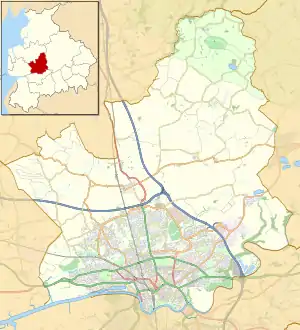 Fulwood Shown within the City of Preston district 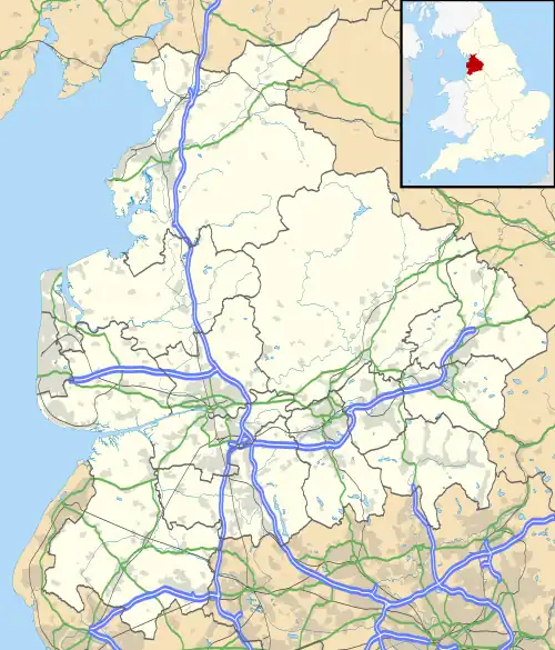 Fulwood Location within Lancashire | |
| Population | 28,353 (2011) |
| OS grid reference | SD5431 |
| District | |
| Shire county | |
| Region | |
| Country | England |
| Sovereign state | United Kingdom |
| Post town | Preston |
| Postcode district | PR2 |
| Dialling code | 01772 |
| Police | Lancashire |
| Fire | Lancashire |
| Ambulance | North West |
| UK Parliament | |
Fulwood is a suburb[1] of Preston, Lancashire, England, to the north of the city centre. It had a population of 28,535 in 2011 and since 2019, is made up of four electoral wards on the City Council.[2]
Fulwood began to develop in the second half of the 19th century and, until 1974, it was governed independently from Preston. It has retained a distinct identity and character, and much of the settlement is in the Fulwood Conservation Area.[1]
History
"Historic Fulwood and Cadley" by Carole Knight and Margaret Burscough, published by Carnegie Press in 1998 provides a comprehensive history of Fulwood.
Fulwood was once part of a large forest which covered much of the North West. It was referred to as Fulewde in 1199; Fulewude in 1228 and Fulwode in 1297. Woods were often named from some natural feature and it is thought that 'Ful' meant 'Foul' which implies it must have been a rather damp and boggy wood.
Although Preston itself was settled in Roman times, there is no evidence of Fulwood ever being occupied at that time although their two main routes passed through Fulwood. The road from Kirkham to Ribchester, following the line of Watling Street Road, was intersected by the route, from Walton-le-Dale to Lancaster, somewhere near Withy Trees and Fulwood Barracks. Traces of the original Walton-le-Dale to Lancaster road were found in 1861, during building work on Lower Bank Road.
Although there was some settlement by Anglo-Saxons and Irish Norsemen, the next major change in Fulwood was when it became a royal forest within the Amounderness Hundred after the Norman invasion of 1066. A royal forest was an area of land where forest law ruled, it belonged to the Crown and there were bans on hunting, cultivation, enclosure, felling of trees, digging of peat etc. King William I gave large areas of land to knights who served him well and he gave all of the land known as Amounderness to the baron Roger de Poitou in 1092 who built Lancaster Castle and the Priory Church of St Mary at Lancaster. William also gave the Priory Church at Lancaster the right to tithes from the Royal Forest of Fulwood and this began Fulwood's long legal attachment to Lancaster.
Roger de Poitou fled England in 1102 after participating in a failed rebellion against the new king, Henry I. As a result, the king confiscated the Honour of Lancaster, which included the castle. The Honour changed hands several times.
The land was developed as a royal forest which provided meat for the monarch and the court and, through the selling of rights, revenue for the monarch but it was also a source of resentment to all sectors of society. The south-western corner of this forest became known as Fillewood Forest enclosed within its own boundaries.
A Norman settlement was made on the western edge of the Royal Forest which became known as Cadley and the enclosed park was granted to the Singleton family, Bailiffs of Amounderness. The Singleton's held the land until 1631 when the plague wiped out all of the family.
In December 1551, a portion of the Forest was granted to Sir Anthony Browne by King Edward VI on the advice of his Regency Council. The land was transferred almost immediately to Thomas Clayton by a deed dated February 1552. On his death, he bequeathed the land to his first born son, William, a Justice of the Peace in Lancashire, who died in 1631. The Clayton family owned the Fulwood Hall estate until 1895 but they did not occupy it for all of that time. In later years, the land was farmed by two tenants Mr Morris from Mason Hill Farm and Mr Hill from Fulwood Hall Farm. The hall had become a simple farmhouse, which was taken over by Preston Golf Club.[3] If you visit the clubhouse today, you will enter through a porch dated 1636 and initialled 'W.C.', which are likely to be the initials of William who died in 1631, although he had a son and grandson also named William.
During the Interregnum, Parliament passed an Act effectively abolishing forest law. Much of the land known as Fulwood Moor though was still held by the Crown and the rest was leased to the Earl of Derby. There were also forest smallholders who had grazing rights on the common land of Fulwood Moor.
The first school in Fulwood known as Cadley School was built in the early 1700s on Cadley brow just behind the site of the Blind Home and remained open until 1863 when it was demolished. The school was taken over by the parish church and re-opened in the building next to Christ Church. The school closed in 1938 but the premises continue to be used as a parochial hall.
In 1811, an Act was passed by Parliament enclosing Fulwood and Cadley Moors, although one twelfth of the land was still retained by the monarch as Duke of Lancaster and that land eventually became the site of Fulwood Barracks. Following enclosure the rest of the Forest land was divided; some was given to those who had a claim and the rest sold to new owners, which included the Rawsthornes at Broughton Tower and the Gerards at Haighton House.
In 1850, a Freehold Society was set up in Preston as a result of the Reform Act 1832 which extended the right to vote to persons who held a 'forty shilling freehold' and the purchase of a suitable site was a priority for the society trustees. When the Fulwood Moor was enclosed in 1817, Samuel Horrocks, the mill owner purchased forty-five acres on the north side of Eaves Brook, just within the township of Fulwood. In 1850, following the death of Mr Horrocks, the land was put up for sale and the trustees of the Preston Freehold Land Society purchased the site for £4,995 and then advertised the plots on the Freedom Park Estate which became known as Fulwood Park . The building work started in May 1851 and the development of the estate continued over the next fifty years. The Fulwood Park Estate was bounded by Garstang Road and Watling Street Road and included Lower Bank Road, Higher Bank Road and Victoria Road.
During the 19th century, the township of Fulwood started to develop into the suburb of Preston it is today. The Christ Church was built for the Church of England on Victoria Road in 1865 and became a district-chapelry. It was during this period of industrial development in Preston with all its wider social consequences that several institutions were built in the healthier environment of Fulwood; the Union Workhouse, the home for the elderly run by the Little Sisters of the Poor, the Derby Home for the Blind, St Vincent's Poor Law School (now demolished) and the Harris Orphanage.
In 1876, the Nook Land Company Ltd was formed and built the small development known as Nooklands today, which is off Garstang Road.
Fulwood was also an area chosen by wealthy Victorian residents for their country houses for the same reason and one of the finest examples still standing is "Greyfriars" on Walker Lane which was commissioned in 1849 for James Clayton, an ironfounder, who resided there until his death in 1885. The house was then sold to Frank Hollins, who enlarged the property and grounds. He became a baronet in 1907 and the Hollins family owned the property until 1963.
In the 20th century, the suburb of Fulwood continued to expand, initially on the north side of Watling Street Road and to the east towards the barracks. Further infilling occurred in the inter-war years but the major expansion of Fulwood occurred post-war.
Fulwood had its own urban district council until May 1974 when such councils were abolished under the Local Government Act 1972 and it became part of the Borough (now City) of Preston. The council offices were at 166 Garstang Road (now a retail store) and the Fulwood Fire Service was housed in a small building at the rear (since demolished). A police station was built in Watling Street Road (now closed) apparently because residents felt unsafe after the opening of the workhouse.
Listed buildings and monuments
Olivers Mound which is associated with the Battle of Preston (1648) is included in the National Heritage List of Scheduled Monuments. The site is next to the "Fulwood Central" shopping centre on Eastway.
The Historic England listed buildings and monuments in Fulwood includes:
- Buildings and landscaped pools at Archbishop Temple School, St Vincent's Road
- Buildings and structures at Fulwood Barracks, Watling Street Road
- Former Fulwood Union Workhouse (and former hospital site), Watling Street Road
- Buildings and War Memorial at the former Harris Orphanage (now Harris Park site), Garstang Road
- Milestone outside the former Harris Orphanage on West side of Garstang Road
- Plastic classroom at Kennington Primary School, Kennington Road
- Wychnor (farmhouse converted to a dwellinghouse), Lightfoot Lane
Carmelite monastery
The former Preston Carmelite Monastery[4] on St Vincent's Road was discalced in 2023. The site was sold and will be converted to a nursing home. The sale ended the Carmelites' association with Preston and the local community which had commenced in 1917.[5]
Governance
From a very early time, Fulwood lay within the Amounderness Hundred of the Historic County of Lancashire.
Prior to any suburban development in Fulwood, the township was governed by the Parish Vestry which consisted mainly of local landowners. The situation changed when the Fulwood Local Board of Health was formed in 1863 under the Public Health Act 1848.
Between 1894 and 1974 Fulwood was governed by Fulwood Urban District Council which was merged with other districts under the Local Government Act 1972 to become the new non-metropolitan district of the Borough (now City) of Preston in the county of Lancashire in a two-tier structure from May 1974. No successor parish was formed and so the area became an unparished area.
Local authority services
Preston City Council and Lancashire County Council provide local authority services for the residents of Fulwood.
Preston City Council
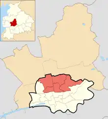
Since the last local government boundary changes in 2019, the four electoral wards which make up the area of Fulwood on Preston City Council are:
- Cadley
- Garrison
- Greyfriars
- Sharoe Green
Each electoral ward has three councillors and you can find your local Councillors on the Preston City Council website.[6]
For Preston City Council elections, see Preston local elections
Lancashire County Council
The three electoral divisions for the area of Fulwood on Lancashire County Council are
- Preston Central East - Garrison ward
- Preston North - Greyfriars and Sharoe Green wards
- Preston West - Cadley ward
The three electoral divisions have one councillor per division and you can find your County Councillors on the Lancashire County Council website.[7]
For Lancashire County Council elections, see Lancashire County Council elections
Current parliamentary constituency
Since 2010, the electoral wards in Fulwood have been in the constituency of Wyre and Preston North and the constituency is represented by The Right Hon. Ben Wallace MP.
Parliamentary constituencies at next General Election
Following the completion of the 2023 Periodic Review of Westminster constituencies, the constituency of Wyre and Preston North will be abolished for the next general election, with the four electoral wards of Fulwood distributed between two neighbouring constituencies:[8]
- Preston - Cadley and Garrison wards.
- Ribble Valley - Greyfriars and Sharoe Green wards.
Other Statutory Services
- Fire and Rescue Service - Lancashire Fire and Rescue Service
- Police Service - Lancashire Constabulary and Lancashire Police and Crime Commissioner
Economy and society
Fulwood has expanded in the 20th and 21st centuries, and has been popular with housing and business developers, with its close links to the M6 and M55 motorways and the A6 (Garstang Road). Since the 1970s when the Central Lancashire New Town was proposed, large sites have been made available for development, such as Longsands, which is a residential area, and Eastway Business Park, where many businesses are currently located, including the Lancashire Evening Post (LEP), Asda supermarket, Royal Mail sorting office, HomeServe, Xchanging, CPC,[9] and EDS.[10]
The B6241 (Eastway) provides a vital route, bypassing much of the residential and central areas of Preston, and it provides access to a Ibis hotel; the Fulwood Central shopping centre with Aldi and B&M stores and the Eastway shopping centre with a Lidl store.
Off Eastway, the B6242 (Andertons Way), connects to the M6 motorway at junction 31A (which was opened in the 1990s) and provides access to a Premier Inn hotel (Preston East) and the Bluebell Way Business Park on the boundary with Brookfield.
A Co-op Food store is based at the junction of Watling Street Road and Garstang Road; a Morrisons Daily store is on Garstang Road and a Sainsbury's supermarket is located on Sir Tom Finney Way (formerly Deepdale Road) on the boundary with Deepdale.
Opposite the Royal Preston Hospital on Sharoe Green Lane is a Booths store and other retail shops.
Fulwood Barracks located on Watling Street Road, has a long military history and is the home of Headquarters North West and the regimental headquarters of the Duke of Lancaster's Regiment. It is also the site of the Lancashire Infantry Museum.
The headquarters of the Lancashire Fire and Rescue Service and the Fulwood station for the service are both located on the A6 (Garstang Road) adjacent to Junction 32 of the M6 motorway.
A four star Delta Hotels by Marriott hotel is located on the old A6 just north of Junction 32 to the M6 motorway in the adjacent village of Broughton, Preston.
Since the mass migration of Indians, Fulwood has been a popular place of residence for well-known, and wealthy families of the Vora Patel community, many of whom have resided here for several generations. Many families of this community amassed great wealths during the economic prosperity of the textiles industry in Northern England and, to this day, retain much of their wealth and have bought many of Lancashire's historic properties.[11]
Architecture

Fulwood is one of the greener parts of the Preston area, however it is nevertheless a fairly built up area, with buildings dating back to the Victorian gentrification of the region, and earlier. Due to large investments during the late Victorian era, Fulwood was an area of much development by wealthy Preston industrialists.
Some of the finest Victorian buildings of Lancashire can be found in Fulwood,[12] such as Christ Church, Fulwood Barracks, the former Fulwood Union Workhouse, on Watling Street Road and the former Harris Orphanage (now Harris Park site) on Garstang Road. Many of the larger houses in Fulwood were also built during the Victorian period, particularly those in Lower Bank Road and the Nooklands cul-de-sac off Garstang Road.
Amenities
Fulwood has a large number of local amenities. The suburb has a large number of local shops, primary and high schools, a college, pubs, restaurants, hotels, libraries, parks and woodlands, a Lloyd's Bank branch, a large Asda supermarket, Booths store, Aldi store, Lidl store, Co-op Food store and Morrisons Daily store, doctors surgeries and health centres, pharmacies, dental surgeries, Preston's main hospital, Royal Preston Hospital, and many other services.
Preston Grasshoppers R.F.C., Fulwood and Broughton Cricket Club, Fulwood Lawn Tennis Club, Fulwood Leisure Centre and Preston Golf Club are also located in Fulwood. (see Sports section below)
Education
State-funded schools
State education is administered by Lancashire County Council.
Primary schools
- Fulwood and Cadley Primary School, Cadley Causeway
- Fulwood St Peter's Church of England Primary School, Meadowfield
- Harris Primary School, Wychnor
- Kennington Primary School, Kennington Road
- Longsands Community Primary School, Longsands Lane
- Our Lady and St Edwards Catholic Primary School, Lightfoot Lane
- Queen's Drive, Primary School, Black Bull Lane
- Sherwood Primary School, Sherwood Way
- St Anthony's Catholic Primary School, St Anthony's Drive
- St Clare's Catholic Primary School, Sharoe Green Lane
Secondary schools
- Archbishop Temple Church of England High School, St Vincent's Road
- Corpus Christi Catholic High School, St Vincent's Road
- Fulwood Academy, Black Bull Lane
- Our Lady's Catholic High School, St Anthony's Drive
Specialist provision school
- Moorbrook School, Ainslie Road
Independent schools
Private junior and prep schools
- Highfield Priory School, Fulwood Row
- St Pius X Catholic Preparatory School, Garstang Road
- The Olive School Preston, Vicarage Lane
Further education
The main campus of Preston College is located in Fulwood on St Vincent's Road.
Cardinal Newman College in the centre of Preston and Runshaw College in Leyland also provide Higher and Further Education provision with bus services available from Fulwood.
Health services
GP surgeries
There are a number of GP surgeries/health centres in Fulwood.[13]
Pharmacy services
There are a number of pharmacies in Fulwood.[14]
Dentists
Hospitals
Fulwood is the home of the Royal Preston Hospital, located on Sharoe Green Lane. It is an acute general hospital managed by the Lancashire Teaching Hospitals NHS Foundation Trust which provides a range of high quality specialist services to patients in Lancashire and South Cumbria and education, training and research.
The former Sharoe Green Hospital was also in Fulwood until its closure in 2004.[16]
Fulwood Hall Hospital located at Midgery Lane is a private hospital operated by Ramsay Health Care UK, providing a wide range of treatments and healthcare services[17]
Specialist care centre
The Sue Ryder Neurological Care Centre Lancashire, located at Teal Avenue, is operated by the Sue Ryder charity and provides specialist neurological rehabilitation care and support.[18]
Libraries
Lancashire County Council provide a library service at two locations in Fulwood:
- Fulwood Library, Garstang Road
- Sharoe Green Library, Sharoe Green Lane
Media
The Lancashire Evening Post newspaper is based in Fulwood.
Television is provided by:
- BBC North West, the regional BBC station for the North West region,
- ITV Granada, the ITV franchise holder for the North West region, and
- a local TV service for Blackpool and Preston, That's Lancashire, from studios at the Northern Lights Business Centre in the University of Central Lancashire's Media Factory building.
The following regional radio stations include Fulwood within their coverage:
- BBC Radio Lancashire - Lancashire wide, news, talk, sport and music. (Broadcast from Blackburn)
- Greatest Hits Radio Lancashire – Lancashire and North West England, classic hits. (Broadcast from Manchester)
- Rock FM – Lancashire and North West England, pop music. (Broadcast from Manchester)
- Heart North West – across the North West, pop music. (Broadcast from Manchester)
- Smooth North West – across the North West, easy-listening music. (Broadcast from Manchester)
- Capital Manchester and Lancashire - across the North West, pop music. (Broadcast from Manchester)
- Central Radio North West - across The Fylde, Preston, Leyland and Chorley areas of Lancashire, news, talk, and music. (Broadcast from Preston) [19]
Blog Preston[20] is a hyperlocal news website which provides community news, views and information about the city.[21][22]
VisitPreston.com is a website that "showcases everything that Preston has to offer to all audiences", providing information on topics such as business investment, education, tourism, etc. It is provided by key local stakeholders including the Preston City Council, Lancashire County Council, University of Central Lancashire, Preston Business Improvement District, and The Chase creative consultants.[23]
Notable people
A notable former resident of Fulwood was Colonel John Rouse Merriott Chard VC, of the Royal Engineers, Officer Commanding at Rorke's Drift in 1879. He was posted to Preston between 1887 and 1892, and is recorded in the 1891 Census living at 80 Victoria Road, Fulwood.
The famous footballer Sir Tom Finney and the former MP and Circuit Judge, Mary Holt were both born in Preston and resided in Fulwood for many years prior to their deaths.
Nick Park, filmmaker and animator, was born in Preston and attended Cuthbert Mayne RC High School, which is now Our Lady's Catholic High School, Fulwood.
Parks and woodlands
Fulwood has several parks and woodlands[24] located adjacent to Andertons Way, Conway Drive, Fairways, Fernyhalgh Lane, Foregate, Levensgarth Avenue, Mill Lane, Sherwood Way, South Drive, and Tower Lane. This makes Fulwood one of the greener suburbs of Preston.
There are allotment sites on Sharoe Green Lane and Blackpool Road.
There are a number of Friends community groups which local residents can join to help maintain and keep tidy the parks and woodlands in their neighbourhood.
Post offices
There are two post offices in Fulwood:
The Preston Mail Centre is located on Pittman Way, were mail is collected outside of office hours and sorted for delivery.
Pubs and restaurants
Pubs
There are seven public houses in Fulwood:
- The Anderton Arms. Longsands Lane
- The Black Bull, Garstang Road
- Crafty Beggars Ale House, Garstang Road
- Phantom Winger, Garstang Road
- The Plungington, Lytham Road
- The Sherwood, Sherwood Way
- The White Hart, Watling Street Road
Three pubs, the Garrison, Sumners and Withy Trees have closed down in recent years.
Restaurants
There are currently three restaurants in Fulwood:
Religion
Church of England
- Christ Church, Victoria Road
- St Cuthbert's Church, Lytham Road[30]
- St Martin's Chapel, Broadway #
- St Peter's Chapel, Meadowfield #
(# united with St John the Baptist's Church, Broughton)
Roman Catholic Church
Methodist Church of Great Britain
- Fulwood Methodist Church, Watling Street Road[34]
Free Methodist Church
- Fulwood Free Methodist Church, Lightfoot Lane[35]
Fellowship of Independent Evangelical Churches
- North Preston Evangelical Church, Sherwood Way[36]
Jehovah's Witnesses
- Witness Hall, Haywood Close[37]
The Church of Jesus Christ of Latter-day Saints
- LDS Church, Longsands Lane[38]
Islam
- Masjid-e-Salaam Mosque, Watling Street Road[39]
- The Sunni Way, Symonds Road[40]
Sport
The following sporting activities are available in Fulwood:
Cricket
Fulwood & Broughton Cricket Club[41] (known as F&B) is based on Garstang Road. The 1st XI plays in the Northern Premier Cricket League, with two other teams playing in the Palace Shield structure. There is also a T20 team.[42] It also has a growing women's section who compete in friendly games, and a junior section with competing teams from Under 10 to Under 17.
There are two social men's cricket teams in Fulwood; a Fulwood & Broughton CC midweek team and Preston Grasshoppers CC, both of whom play in the Boddingtons Village Cricket League.[43]
Cycling
The Preston Guild Wheel cycle route runs through Fulwood. It is also used by walkers and runners
Football
Fulwood's local football team is Fulwood Amateurs F.C.[44] (known as Fulwood Ams) based at Lightfoot Green off Lightfoot Lane. The men's 1st XI play in the West Lancashire League Premier Division (Tier 11 in the English football pyramid).[45][46] In the 2021-22 season, Fulwood Amateurs won the Lancashire FA Amateur Shield.
Golf
Preston Golf Club,[3] is a 18 hole, 6,278 yard, par 71 course affiliated to the England Golf Association which is located on Fulwood Hall Lane.
Leisure centre
Fulwood Leisure Centre[47] is located on Black Bull Lane and provides a 25 metre swimming pool, teaching pool, squash courts, gym, fitness studios, sauna and steam rooms.
Rugby union
Preston's rugby union club, Preston Grasshoppers R.F.C. (known as the Hoppers), is based at Lightfoot Green Lane, Fulwood. The men's 1st XV play in the RFU National League 2 North (Level 4 in the English rugby union pyramid), with 4 other men's senior teams in the North West Leagues, and a women's team in the Women's NC 1 North West.[48] Hoppers are one of the oldest rugby clubs in the north of England, and in the 2021-22 season, they won the John Burgess Lancashire Cup.[49]
The club also has the following sports sections:
- Archery
- Cricket (see above)
- Cycling
- Shooting
- Squash
Sports and social clubs
Fulwood also has three sports and social clubs which have bowling greens and snooker/pool tables with teams competing in local leagues. The clubs are also available for hire for social events:
Tennis
The Fulwood Lawn Tennis Club[53] is affiliated to the Lawn Tennis Association and provides four all-weather carpet courts with floodlights and a clubhouse, which is located at the end of Highgate Avenue. The club offers tennis for all, including adults and juniors who wish to competete in local leagues or just play social fun tennis.
Transport
Junctions 31a and 32 of the M6 motorway and Junction 1 of the M55 motorway can be accessed within Fulwood and the A6 road passes through Fulwood. The Preston Railway Station in the centre of Preston is on the West Coast Main Line which comes through the west of Fulwood. These provide great transport links to all parts of the UK.
The former Fulwood railway station was once in Gamull Lane, on the border between Fulwood and Ribbleton, on the Longridge Branch Line. It was renamed Ribbleton railway station in 1900 and closed in 1930.
Fulwood is served by several bus routes operated by Preston Bus, Stagecoach in Lancashire and Stagecoach in Lancaster. These services include routes (Preston Bus) 19, 23, 43, 45 & 88 and (Stagecoach) 40/41 & 125 services.
There are cycle paths from Fulwood through to Preston and Lancaster[54] as well as the Preston Guild Wheel cycle route.
References
- 1 2 "Fulwood Conservation Area Appraisal". Archived from the original on 29 October 2013. Retrieved 22 October 2016.
- ↑ Office for National Statistics : Census 2001 : Table KS01 : Usual Resident Population Archived 22 April 2015 at the Wayback Machine Brookfield (part); Cadley, College, Garrison; Greyfriars; and Sharoe Green wards. Retrieved 24 May 2010
- 1 2 "Preston Golf Club". Archived from the original on 9 January 2021. Retrieved 9 November 2023.
- ↑ "Preston Carmelite Monastery". Retrieved 10 November 2023.
- ↑ "Sale of Carmelite Monastery". Retrieved 10 November 2023.
- ↑ "Preston Councillors". Retrieved 9 November 2023.
- ↑ "County Councillors Councillors". Retrieved 9 November 2023.
- ↑ "Boundary Commission for England publishes final recommendations for new Parliamentary constituencies | Boundary Commission for England". boundarycommissionforengland.independent.gov.uk. Retrieved 5 July 2023.
- ↑ "Lancashire County Council: Lancashire Profile". Archived from the original on 1 September 2007. Retrieved 7 November 2007.
- ↑ Northern Britain Property Partners NBPP, Valtos, Collective Investment Schemes And Property Asset Management, Northern Britain Property Partners NBPP, Valtos, Collective Investment Schemes And Property Asset Management
- ↑ "Sites for Preston | Preston City Council". Archived from the original on 7 January 2014. Retrieved 7 January 2014.
- ↑ 'The parish of Lancaster: Fulwood', A History of the County of Lancaster: Volume 7 (1912), pp. 137–138.
- ↑ "GP Surgeries". Retrieved 9 November 2023.
- ↑ "Pharmacies". Retrieved 9 November 2023.
- ↑ "Dental Surgeries". Retrieved 9 November 2023.
- ↑ "Sharoe Grren Hospital". Retrieved 9 November 2023.
- ↑ "Fulwood Hall Hospital". Archived from the original on 9 January 2021. Retrieved 10 February 2020.
- ↑ "Sue Ryder Neurological Care Centre". Retrieved 11 November 2023.
- ↑ "About Us - Central Radio". Retrieved 13 November 2023.
- ↑ "Blog Preston". Archived from the original on 9 January 2021. Retrieved 6 June 2021.
- ↑ McAthy, Rachel (17 February 2011). "Preston hyperlocal site wins funding for community project". Journalism.co.uk. Mousetrap Media Ltd. Archived from the original on 9 January 2021. Retrieved 12 December 2011.
- ↑ "Story shorts – 21/02/11". Lancashire Evening Post. 21 February 2011. Archived from the original on 4 April 2012. Retrieved 12 December 2011.
NESTA (National Endowment for Science, Technology and the Arts) has worked alongside the Big Lottery Fund to deliver support to 17 organisations nationwide. They include Prescap, Preston FM, Blog Preston and CSV Preston.
- ↑ "About Visit Preston". VisitPreston.com. Archived from the original on 9 January 2021. Retrieved 15 February 2020.
- ↑ "Preston Parks". Retrieved 9 November 2023.
- ↑ "Fulwood Post Office". Retrieved 10 November 2023.
- ↑ "Sharoe Green Post Office". Retrieved 10 November 2023.
- ↑ "The Ginger Bistro". Retrieved 9 November 2023.
- ↑ "Marino's". Retrieved 9 November 2023.
- ↑ "Sai Surbhi". Retrieved 9 November 2023.
- ↑ "St Cuthbert's Church". Retrieved 10 November 2023.
- ↑ "St Anthony RC Church". Retrieved 10 November 2023.
- ↑ "St Clare's RC Church". Retrieved 10 November 2023.
- ↑ "OLSE Church". Retrieved 10 November 2023.
- ↑ "Fulwood Methodist Church". Retrieved 10 November 2023.
- ↑ "Fulwood Free MethodistChurch". Retrieved 10 November 2023.
- ↑ "North Preston EvangelicalChurch". Retrieved 10 November 2023.
- ↑ "Jehovah's Witness Hall". Retrieved 10 November 2023.
- ↑ "LDS Church". Retrieved 10 November 2023.
- ↑ "Masjid-e-Salaam". Retrieved 10 November 2023.
- ↑ "The Sunni Way". Retrieved 10 November 2023.
- ↑ "Fulwood and Broughton Cricket Club". Retrieved 9 November 2023.
- ↑ "Fulwood and Broughton CC". fbcc.play-cricket.com. Retrieved 23 February 2023.
- ↑ "The Boddingtons Village Cricket League". bvcl.play-cricket.com. Retrieved 23 February 2023.
- ↑ "Fulwood Amateurs F.C." Retrieved 9 November 2023.
- ↑ "Fulwood Amateurs FC - LFA Amateur Shield Winners 2021/22". www.fulwoodams.co.uk. Retrieved 23 February 2023.
- ↑ "Fulwood Amateurs - Premier Division - West Lancashire Football League". www.westlancashireleague.co.uk. Retrieved 23 February 2023.
- ↑ "Fulwood Leisure Centre". Retrieved 9 November 2023.
- ↑ "PGRFC". PGRFC. Retrieved 23 February 2023.
- ↑ "Preston Grasshoppers vs Widnes". PGRFC. Retrieved 23 February 2023.
- ↑ "The Fulwood Club". Retrieved 9 November 2023.
- ↑ "The Lonsdale Club". Retrieved 9 November 2023.
- ↑ "Moor Park Sports and Social Club". Retrieved 9 November 2023.
- ↑ "Fulwood Lawn Tennis Club". Retrieved 9 November 2023.
- ↑ "Cycleways". Retrieved 9 November 2023.
Geography of the City of Preston district | |||||||
|---|---|---|---|---|---|---|---|
| Cities |  | ||||||
| Suburbs | |||||||
| Villages | |||||||
| Parishes | |||||||
| Topography |
| ||||||