| Franklin Tasmania | |||||||||||||||
|---|---|---|---|---|---|---|---|---|---|---|---|---|---|---|---|
 Location in Tasmania | |||||||||||||||
| |||||||||||||||
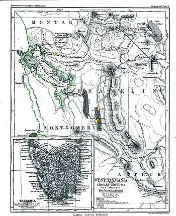
Map of Franklin county and the surrounding area in 1865

Frenchmans Cap, located within the district
Franklin Land District is one of the twenty land districts of Tasmania which are part of the Cadastral divisions of Tasmania.[1] It used to be Franklin County, one of the 18 counties of Tasmania. Frenchmans Cap mountain is located there. It includes most of the Franklin-Gordon Wild Rivers National Park.
See also
References
- ↑ "LISTmap - Land Information System Tasmania". maps.thelist.tas.gov.au. Retrieved 6 June 2023.
This article is issued from Wikipedia. The text is licensed under Creative Commons - Attribution - Sharealike. Additional terms may apply for the media files.