Horton | |
|---|---|
| Township of Horton | |
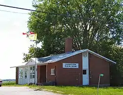
 Municipal building | |
 Horton  Horton | |
| Coordinates: 45°30′N 76°40′W / 45.500°N 76.667°W | |
| Country | |
| Province | |
| County | Renfrew |
| Government | |
| • Mayor | David M. Bennett |
| • Governing body | Horton Council |
| • MP | Cheryl Gallant |
| • MPP | John Yakabuski |
| Area | |
| • Total | 158.51 km2 (61.20 sq mi) |
| Population (2016)[1] | |
| • Total | 2,887 |
| • Density | 18.2/km2 (47/sq mi) |
| Time zone | UTC-5 (EST) |
| • Summer (DST) | UTC-4 (EDT) |
| Area code(s) | 613, 343 |
| Website | www.hortontownship.ca |
Horton is a township in eastern Ontario, Canada, at the confluence of the Bonnechere River and the Ottawa River in Renfrew County. The Town of Renfrew was originally part of Horton Township.
Communities
The township comprises the communities of Castleford, Castleford Station, Cotieville, Fergusons Beach, Goshen, Lochwinnoch (partially), Mayhew and Thompson Hill.
Castleford
In the 1820s, Lt. Christopher James Bell settled his land grant and named the area Castleford after his birthplace in West Yorkshire, England. A post office opened at Castleford in 1832, but the town was renamed Warnock in 1889 when the Castleford designation was given to the CPR station at Castleford Station. In 1891 the community name reverted to Castleford. The town of Castleford is the first of five chutes along the Bonnechere River. The others being Renfrew, Douglas, Fourth Chute and Eganville. The chutes used were for moving timber past rapids and waterfalls.
Castleford Station
In 1889 the Castleford designation was also given to the CPR station at Castleford Station. Both communities were named after Castleford in West Yorkshire, England.
Cotieville
Fergusons Beach
Goshen
Goshen is a former railway stop on a now abandoned line, probably named for the Land of Goshen, the Hebrew name of an area in the Nile delta in Ancient Egypt.
Lochwinnoch
The community of Lochwinnoch was named for the town of Lochwinnoch in Renfrewshire, Scotland.
Mayhew
Thompson Hill
Demographics
In the 2021 Census of Population conducted by Statistics Canada, Horton had a population of 3,182 living in 1,290 of its 1,486 total private dwellings, a change of 10.2% from its 2016 population of 2,887. With a land area of 158.02 km2 (61.01 sq mi), it had a population density of 20.1/km2 (52.2/sq mi) in 2021.[2]
| 2021 | 2016 | 2011 | |
|---|---|---|---|
| Population | 3,182 (+10.2% from 2016) | 2887 (6.2% from 2011) | 2719 (-3.0% from 2006) |
| Land area | 158.02 km2 (61.01 sq mi) | 158.51 km2 (61.20 sq mi) | 158.53 km2 (61.21 sq mi) |
| Population density | 20.1/km2 (52/sq mi) | 18.2/km2 (47/sq mi) | 17.2/km2 (45/sq mi) |
| Median age | 48.8 (M: 50.0, F: 48.4) | 47.1 (M: 46.8, F: 47.5) | |
| Private dwellings | 1,486 (total) 1,290 (occupied) | 1175 (total) | 1234 (total) |
| Median household income | $90,000 |
Former attraction
- Storyland, closed 2011
See also
References
- 1 2 "Horton census profile". 2016 Census of Population. Statistics Canada. 8 February 2017. Retrieved 2017-02-21.
- ↑ "Population and dwelling counts: Canada, provinces and territories, census divisions and census subdivisions (municipalities), Ontario". Statistics Canada. February 9, 2022. Retrieved April 2, 2022.
- ↑ "2021 Community Profiles". 2021 Canadian Census. Statistics Canada. February 4, 2022. Retrieved 2023-10-19.
- ↑ "2016 Community Profiles". 2016 Canadian Census. Statistics Canada. August 12, 2021. Retrieved 2017-02-21.
- ↑ "2011 Community Profiles". 2011 Canadian Census. Statistics Canada. March 21, 2019. Retrieved 2012-02-10.
- ↑ "2006 Community Profiles". 2006 Canadian Census. Statistics Canada. August 20, 2019.
- ↑ "2001 Community Profiles". 2001 Canadian Census. Statistics Canada. July 18, 2021.
External links
