The following list includes all of the Canadian Register of Historic Places listings in Alberni-Clayoquot Regional District, British Columbia.

Name Address Coordinates Government recognition (CRHP №) Wikidata ID Image
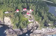
Lighttower Estevan Point
Alberni-Clayoquot B BC
49°22′59″N 126°32′39″W / 49.382955°N 126.544067°W / 49.382955; -126.544067 (Lighttower (Estevan Point)) Federal (2929, (20372)
Lighttower Pachena Point
Alberni-Clayoquot C BC
48°43′20″N 125°05′51″W / 48.7221°N 125.0976°W / 48.7221; -125.0976 (Lighttower (Pachena Point)) Federal (4750)
Cape Beale Lighthouse Cape Beale
Alberni-Clayoquot BC
48°47′11″N 125°12′56″W / 48.7864°N 125.2156°W / 48.7864; -125.2156 (Cape Beale Lighthouse) Federal (20777)
Kiix?in Village and Fortress National Historic Site of Canada
Barkley Sound BC
48°48′24″N 125°10′44″W / 48.8067°N 125.179°W / 48.8067; -125.179 (Kiix?in Village and Fortress National Historic Site of Canada) Federal (16368)
Upload Photo
Alberni Post Office 4888 Johnston Road
Port Alberni BC
49°15′30″N 124°48′36″W / 49.2584°N 124.81°W / 49.2584; -124.81 (Alberni Post Office) Port Alberni municipality (18182)
Upload Photo
Carmoor Block 3074 Kingsway Avenue
Port Alberni BC
49°14′04″N 124°48′43″W / 49.2344°N 124.812°W / 49.2344; -124.812 (Carmoor Block) Port Alberni municipality (18425)
Upload Photo
Federal Building 4877 Argyle Street
Port Alberni BC
49°14′06″N 124°48′18″W / 49.235°N 124.805°W / 49.235; -124.805 (Federal Building) Port Alberni municipality (18743)
Upload Photo
McLean Mill National Historic Site of Canada 5633 Smith Road
Port Alberni BC
49°18′39″N 124°49′37″W / 49.3108°N 124.827°W / 49.3108; -124.827 (McLean Mill National Historic Site of Canada) Federal (12267)
Port Alberni City Hall 4850 Argyle Street
Port Alberni BC
49°14′04″N 124°48′18″W / 49.2344°N 124.805°W / 49.2344; -124.805 (Port Alberni City Hall) Port Alberni municipality (18427)
Upload Photo
Port Alberni Train Station 3100 Kingsway Avenue
Port Alberni BC
49°14′06″N 124°48′43″W / 49.235°N 124.812°W / 49.235; -124.812 (Port Alberni Train Station) Port Alberni municipality (18261)
Rollin Art Centre and Garden 3061 8th Avenue
Port Alberni BC
49°14′03″N 124°48′00″W / 49.2342°N 124.8°W / 49.2342; -124.8 (Rollin Art Centre and Garden) Port Alberni municipality (18426)
Ericsson Shipwreck In Barkely Sound near Folger Island
Bamfield BC
48°49′51″N 125°14′36″W / 48.8307°N 125.2433°W / 48.8307; -125.2433 (Ericsson Shipwreck) British Columbia (19306)
Upload Photo
Lord Western Shipwreck Sidney Inlet
Hot Springs Cove BC
49°26′10″N 126°13′40″W / 49.4361°N 126.2277°W / 49.4361; -126.2277 (Lord Western Shipwreck) British Columbia (19309)
Upload Photo
Hera Shipwreck Dufferin Passage
Tofino BC
49°09′16″N 125°54′57″W / 49.1545°N 125.9157°W / 49.1545; -125.9157 (Hera Shipwreck) British Columbia (19308)
Upload Photo

References

(references appear in the table above as external links)
    This article is issued from Wikipedia. The text is licensed under Creative Commons - Attribution - Sharealike. Additional terms may apply for the media files.