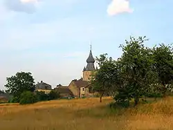
Lierneux
| |
|---|---|
 | |
Location of Lierneux | |
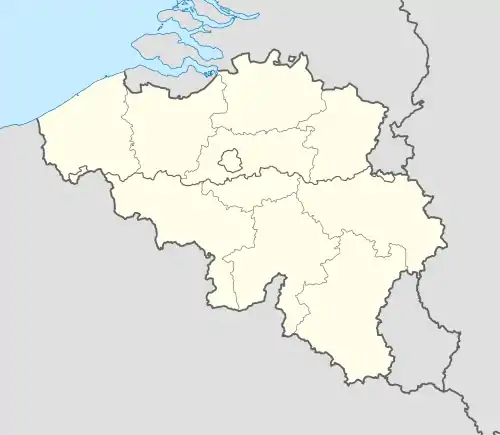 Lierneux Location in Belgium
Location of Lierneux in the province of Liège 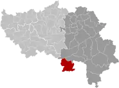 | |
| Coordinates: 50°17′N 05°48′E / 50.283°N 5.800°E | |
| Country | |
| Community | French Community |
| Region | Wallonia |
| Province | Liège |
| Arrondissement | Verviers |
| Government | |
| • Mayor | André Samray |
| • Governing party/ies | Lierneux en Mieux ! |
| Area | |
| • Total | 92.34 km2 (35.65 sq mi) |
| Population (2018-01-01)[1] | |
| • Total | 3,601 |
| • Density | 39/km2 (100/sq mi) |
| Postal codes | 4990 |
| NIS code | 63045 |
| Area codes | 080 |
| Website | www.lierneux.be |
Lierneux (French pronunciation: [ljɛʁnø]; Walloon: Lierneu) is a municipality of Wallonia located in the province of Liège, Belgium.
On January 1, 2006, Lierneux had a total population of 3,367. The total area is 92.08 km2 which gives a population density of 37 inhabitants per km2. Lierneux is known for its psychiatric hospital CHS l'Accueil.
The municipality consists of the following districts: Arbrefontaine, and Bra, and Lierneux.
History
Within the bounds of the municipality a lies a memorial site to the tribute of the 82nd Airborne Division who won the Battle of the Bulge against the German SS division December 22, 1944.
See also
References
- ↑ "Wettelijke Bevolking per gemeente op 1 januari 2018". Statbel. Retrieved 9 March 2019.
Bibliography
- Hendriks, Jan (1995). A Hell in the Snow the Battle Near Grand Sart (Lierneux) on January 7th 1945. Birds Nest Books (Missoula, MT, U.S.A.).
External links
 Media related to Lierneux at Wikimedia Commons
Places adjacent to Lierneux | |
|---|---|
Municipalities in the province of Liège, Wallonia | ||
|---|---|---|
| Huy | 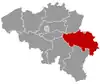 | |
| Liège | ||
| Verviers | ||
| Waremme | ||
| ||
This article is issued from Wikipedia. The text is licensed under Creative Commons - Attribution - Sharealike. Additional terms may apply for the media files.